Home
States
Colorado
Connecticut
Maine
Massachusetts
New Hampshire
New York
Rhode Island
Utah
Vermont
View All
Lists
NE 4,000 Footers
NE 100 Highest
NH 4,000 Footers
NH 100 Highest
NH 52 With A View
NH Belknap Range
NH Ossipee 10
Links
Trail Conditions
Trip Log
Sunrises
Sunsets
About
|
Piper Mountain
Gilford, NH
Trailheads, measurements, times, distances, and maps are all approximate and relative to the hike(s) as shown below.
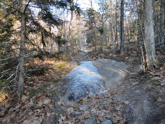
Looking up the Piper Mountain Trail
Route: Piper Mountain Trail, green blazed trail, (Piper Mountain), green blazed trail, bushwhack, (Piper Mountain), green blazed trail, Piper Mountain Trail
With a nice, but brisk, afternoon in store, I took a little time off and headed south to hopefully get up Piper Mountain in time for the sunset. Starting from near the end of the gated Carriage Road, I turned onto the Piper Mountain Trail and was soon faced with a slightly tricky water crossing - most of it had frozen over, but not quite firm enough to easily cross. After crossing, I slowly jogged up the Piper Mountain Trail and then south to the true summit along the green trail.
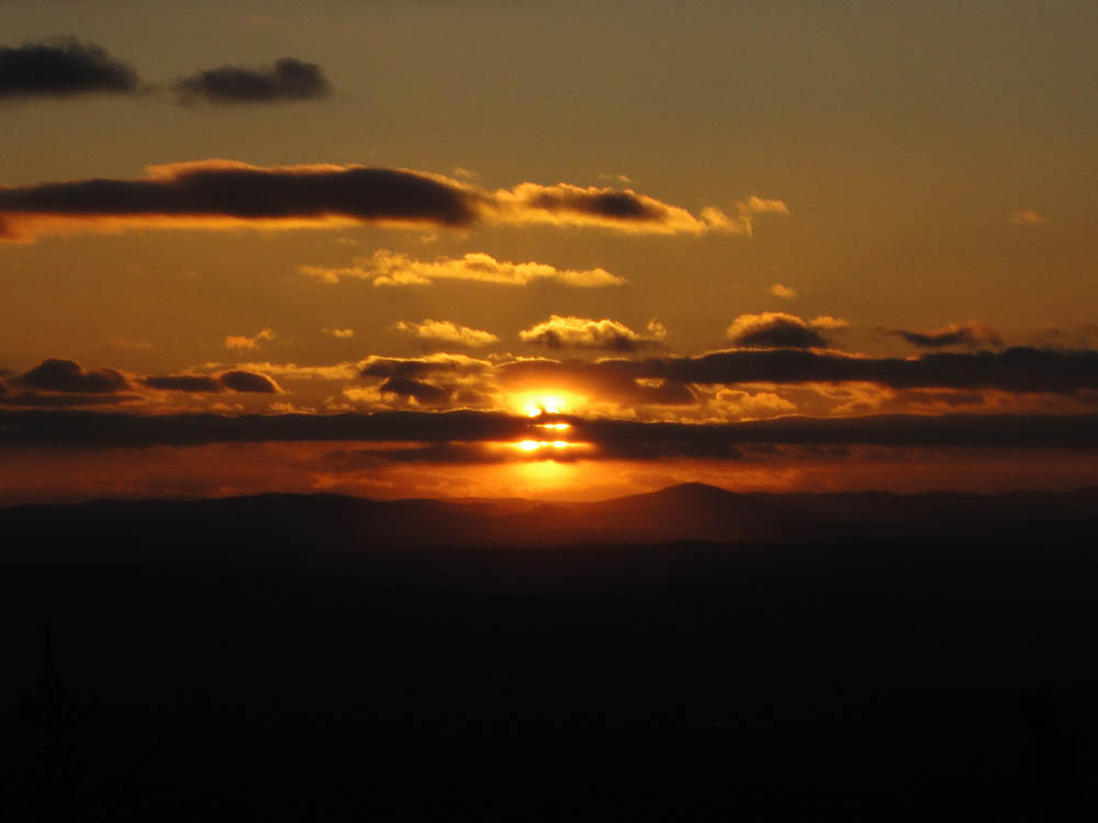
Arriving well ahead of schedule, I almost half an hour to kill prior to sunset. With dropping temperatures and some light, but brisk winds, I wandered around the ridge a bit to stay somewhat warm.
After a nice sunset, I slowly jogged back down the trail, reaching the trailhead without using a headlamp, with the temperature at the base checking in around 20 degrees.
| Hike Ratings |
|
Getting To Trailhead: |
Easy |
| Destination: |
Piper Mountain |
|
Length: |
Moderate |
|
Steepness: |
Moderate |
|
Navigation: |
Easy |
|
Views: |
Excellent |
|
Crowds: |
Minimal |
|
| Hike Stats |
|
Date Hiked: |
Thursday, December 9, 2010 |
| Hike Commenced: |
2:58 PM |
| Parking Elevation: |
1,030' |
| Destination: |
Piper Mountain |
| Ascent Commenced: |
2:59 PM |
| Summit Reached: |
3:25 PM |
| Time Elapsed: |
00:26 |
| Trailhead Elevation: |
1,010' |
| Summit Elevation: |
2,044' |
| Vertical Gain: |
1,064' |
|
|
| Hike Ended: |
4:40 PM |
| Hike Time Elapsed: |
01:42 |
| Hike Vertical Gain: |
1,214' |
|
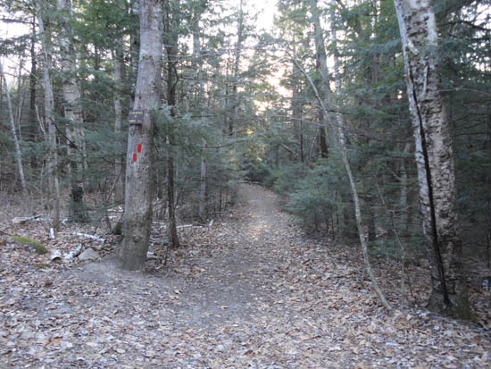
The Piper Mountain Trail trailhead on the Carriage Road
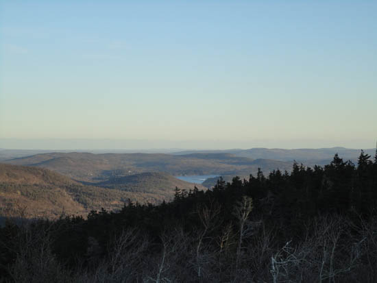
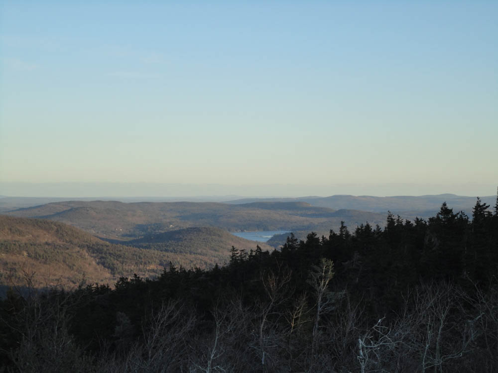
Looking southeast from Piper Mountain
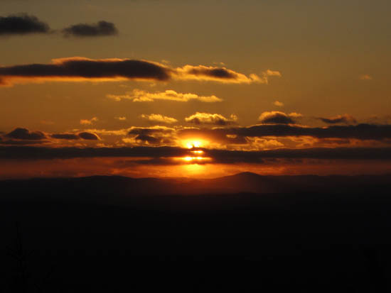
The sunset as seen from near the summit of Piper Mountain
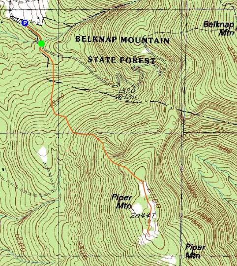

Directions to trailhead: From Route 11A East (from Route 3), take a right on Hoyt Road. Continue down this road as it becomes Belknap Mountain Road. Look for Carriage Road on your left. There is a small parking lot just before the gate. Trailhead is down the road a bit, on the right after a small bridge.
Back to Piper Mountain Profile
|