Home
States
Colorado
Connecticut
Maine
Massachusetts
New Hampshire
New York
Rhode Island
Utah
Vermont
View All
Lists
NE 4,000 Footers
NE 100 Highest
NH 4,000 Footers
NH 100 Highest
NH 52 With A View
NH Belknap Range
NH Ossipee 10
Links
Trail Conditions
Trip Log
Sunrises
Sunsets
About
|
Piper Mountain, Belknap Mountain, Gunstock Mountain
Gilford, NH
Trailheads, measurements, times, distances, and maps are all approximate and relative to the hike(s) as shown below.

Looking up the Piper Mountain Trail
Route: Piper Mountain Trail, green blazed trail, (Piper Mountain), green blazed trail, Old Piper Trail, White Trail, (Belknap Mountain), Blue Trail, Saddle Trail, ski trails, (Gunstock Mountain), Gunstock Mountain Trail
Trails were generally dry and in good shape. If you haven't hiked these trails in the past couple of years, you'll be impressed by all of the work the BRATTS have put in, including rock steps, water bars, blazes, and reroutes. The removal of items off the fire tower and the buildings below it have made it much more scenic as well.
Three reroutes in the past year or so along this route to note: slight reroute on the upper White Trail just before Belknap Mountain, where the trail was moved a little north to avoid the new communication tower; reroute of the White Trail (Belknap Range Trail) between Gunstock and Mt. Rowe (I didn't go on this segment, but I believe it now means you can go between these peaks without stepping onto the ski area); and a reroute (and change in blaze color to orange) of the upper Gunstock Mountain Trail. To find this trail from the top of Gunstock, put your back to the chairlift and go to the left of the left most summit shack. This is also how you pick up the rerouted White Trail to Mt. Rowe.
| Hike Ratings |
|
Getting To Trailhead: |
Easy |
| Destination: |
Piper Mountain |
|
Length: |
Moderate |
|
Steepness: |
Moderate |
|
Navigation: |
Easy |
|
Views: |
Excellent |
|
Crowds: |
Minimal |
| Destination: |
Belknap Mountain |
|
Length: |
Moderate |
|
Steepness: |
Difficult |
|
Navigation: |
Easy |
|
Views: |
Excellent |
|
Crowds: |
Minimal |
| Destination: |
Gunstock Mountain |
|
Length: |
Moderate |
|
Steepness: |
Difficult |
|
Navigation: |
Easy |
|
Views: |
Excellent |
|
Crowds: |
Minimal |
|
| Hike Stats |
|
Date Hiked: |
Wednesday, September 4, 2013 |
| Parking Elevation: |
1,030' |
| Destination: |
Piper Mountain |
| Time Elapsed: |
00:26 |
| Trailhead Elevation: |
1,010' |
| Summit Elevation: |
2,044' |
| Vertical Gain: |
1,064' |
| Destination: |
Belknap Mountain |
| Time Elapsed: |
00:30 |
| Trailhead Elevation: |
2,044' |
| Summit Elevation: |
2,382' |
| Vertical Gain: |
592' |
| Destination: |
Gunstock Mountain |
| Time Elapsed: |
00:22 |
| Trailhead Elevation: |
2,382' |
| Summit Elevation: |
2,245' |
| Vertical Gain: |
270' |
|
|
| Hike Time Elapsed: |
01:58 |
| Hike Vertical Gain: |
1,966' |
|

The Piper Mountain Trail trailhead on the Carriage Road

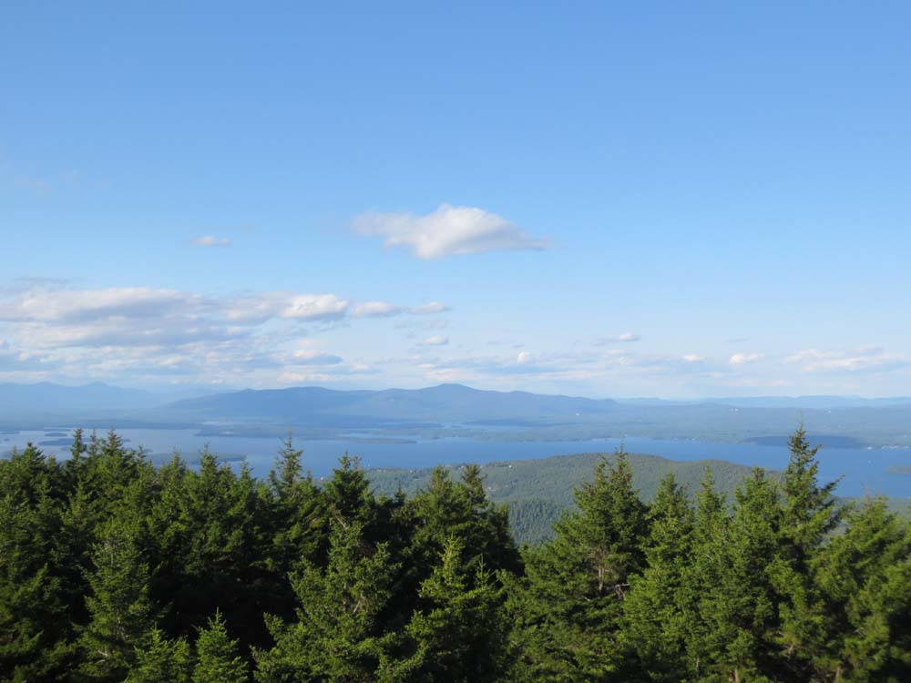
Looking at Mt. Klem and Mt. Mack from near the summit of Piper Mountain

The Old Piper Trail on the way to Belknap Mountain

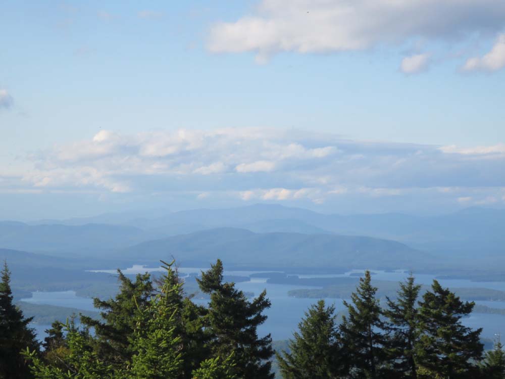
Looking at the Ossipee Range from the Belknap Mountain fire tower

The Blue Trail on the way to Gunstock Mountain

Looking at Red Hill from near the summit of Gunostck Mountain
Directions to trailhead: From Route 11A East (from Route 3), take a right on Hoyt Road. Continue down this road as it becomes Belknap Mountain Road. Look for Carriage Road on your left. There is a small parking lot just before the gate. Trailhead is down the road a bit, on the right after a small bridge.
Back to Piper Mountain Profile
Back to Belknap Mountain Profile
Back to Gunstock Mountain Profile
|