Home
States
Colorado
Connecticut
Maine
Massachusetts
New Hampshire
New York
Rhode Island
Utah
Vermont
View All
Lists
NE 4,000 Footers
NE 100 Highest
NH 4,000 Footers
NH 100 Highest
NH 52 With A View
NH Belknap Range
NH Ossipee 10
Links
Trail Conditions
Trip Log
Sunrises
Sunsets
About
|
Piper Mountain
Gilford, NH, Gilmanton, NH
Trailheads, measurements, times, distances, and maps are all approximate and relative to the hike(s) as shown below.

Looking up the Piper-Whiteface Link
Route: Whiteface Mountain Trail, Piper-Whiteface Link, (Piper Mountain), Piper-Whiteface Link, Vista Trail, Valley View Trail
Trails were dry. Good blueberry crop atop Piper Mountain.
Took Valley View Trail clockwise. Northwestern branch starts off the yellow Vista Trail shortly after Piper-Whiteface Link, marked by cairn atop a ledge on the left (once on said ledge, blazes and sign are visible).
Trail initially descends on ledges that could be dangerous when wet, then slabs across the slope (some portions hard to follow due to faint footbed), soon descending via scrambles to the boulder field. From this boulder field, the trail then climbs to a rock slide, which requires some bouldering/scrambling. Also noted a porcupine hiding in a crevasse. Trail then ascends steeply to the junction of the green Swett Mountain Trail and yellow Vista Trail junction. Tricky to take this trail clockwise or counterclockwise, but I think clockwise is probably the way to go. I found this trail to be more challenging than the Holt Trail, which is considered by some to be the most challenging sanctioned trail in Southern New Hampshire. Easily the most challenging sanctioned trail in the Belknaps. Similar in challenge in places to the Ice Gulch Trail up north in Randolph.
Backtracking up the yellow Vista Trail, the best blueberries of the hike were around the southern Piper Mountain vista (which in my opinion is by far the best viewpoint on the mountain).
| Hike Ratings |
|
Getting To Trailhead: |
Easy |
| Destination: |
Piper Mountain |
|
Length: |
Moderate |
|
Steepness: |
Moderate |
|
Navigation: |
Moderate |
|
Views: |
Excellent |
|
Crowds: |
Minimal |
|
| Hike Stats |
|
Date Hiked: |
Monday, July 13, 2015 |
| Parking Elevation: |
1,050' |
| Destination: |
Piper Mountain |
| Time Elapsed: |
00:24 |
| Trailhead Elevation: |
1,060' |
| Summit Elevation: |
2,044' |
| Vertical Gain: |
1,024' |
|
|
| Hike Time Elapsed: |
01:57 |
| Hike Vertical Gain: |
1,914' |
|

The Whiteface Mountain Trail trailhead

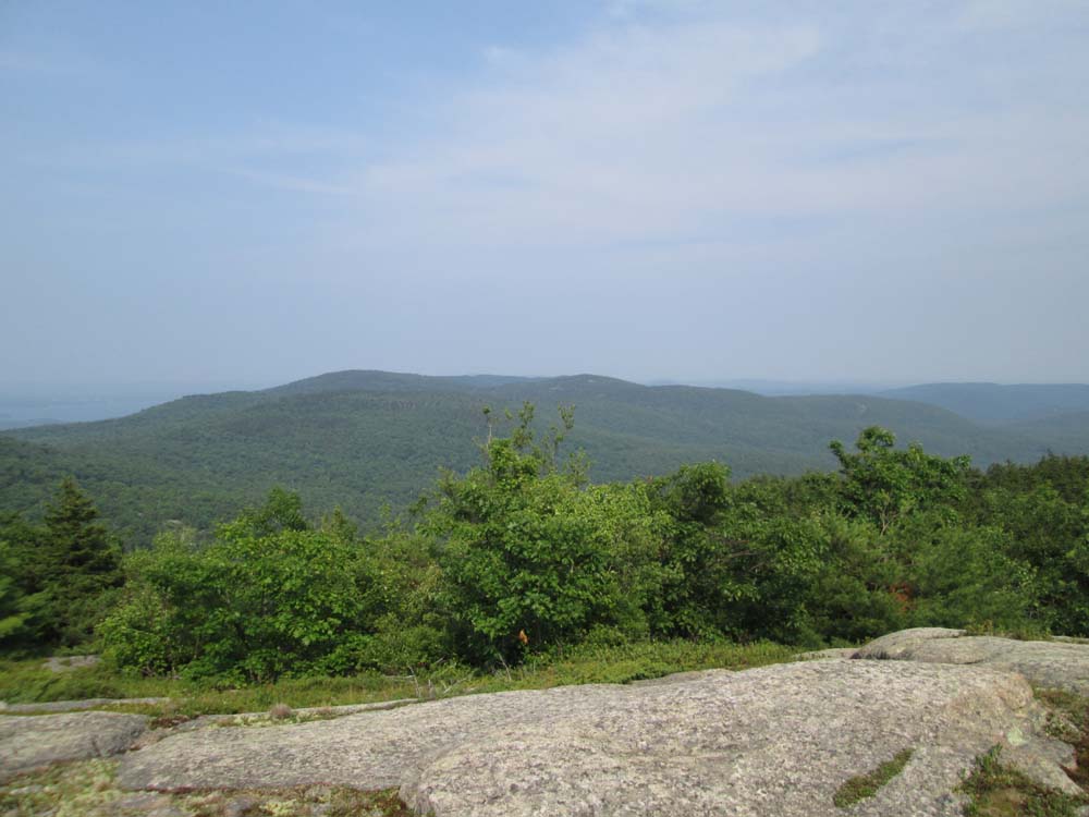
Looking at the central Belknaps near the summit of Piper Mountain

The north side of the Valley View Trail

The north side of the Valley View Trail

The climbing up the south side of the Valley View Trail
Directions to trailhead: From Route 11A East (from Route 3), take a right on Hoyt Road. Continue down this road as it becomes Belknap Mountain Road. At the end of this road, take a left. There will eventually be a turnaround area with a private road sign. Park here, and continue up the road on foot. The Piper Whiteface Trail trailhead will be on the left side of the road.
Back to Piper Mountain Profile
|