Home
States
Colorado
Connecticut
Maine
Massachusetts
New Hampshire
New York
Rhode Island
Utah
Vermont
View All
Lists
NE 4,000 Footers
NE 100 Highest
NH 4,000 Footers
NH 100 Highest
NH 52 With A View
NH Belknap Range
NH Ossipee 10
Links
Trail Conditions
Trip Log
Sunrises
Sunsets
About
|
Red Hill
Moultonborough, NH
Trailheads, measurements, times, distances, and maps are all approximate and relative to the hike(s) as shown below.

Looking down the Red Hill Trail
Route: Red Hill Trail
Wanting to avoid mud and snow again, I decided to hike Red Hill after work. What a difference from two weeks ago! There was basically no snow or mud to be found anywhere!
It was a clear day again, temperatures in the 60s. Unlike the day before, the haze was held back a bit, allowing for blue sky into the late afternoon.
Upon arriving at the summit, I was welcomed into the cab by the ranger - and was the first person this year to sign the log book. The ranger was very friendly and (obviously) knew the surrounding topography quite well. According to him, Winnipesaukee had finally completely thawed the day before.
| Hike Ratings |
|
Getting To Trailhead: |
Easy |
| Destination: |
Red Hill |
|
Length: |
Moderate |
|
Steepness: |
Moderate |
|
Navigation: |
Easy |
|
Views: |
Excellent |
|
Crowds: |
Minimal |
|
| Hike Stats |
|
Date Hiked: |
Tuesday, April 24, 2007 |
| Hike Commenced: |
3:36 PM |
| Parking Elevation: |
635' |
| Destination: |
Red Hill |
| Ascent Commenced: |
3:36 PM |
| Summit Reached: |
4:13 PM |
| Time Elapsed: |
00:37 |
| Trailhead Elevation: |
640' |
| Summit Elevation: |
2,033' |
| Distance: |
1.7 miles |
| Vertical Gain: |
1,398' |
|
|
| Hike Ended: |
4:58 PM |
| Hike Time Elapsed: |
01:22 |
| Hike Distance: |
3.4 miles |
| Hike Vertical Gain: |
1,408' |
|

Red Hill Trail trailhead
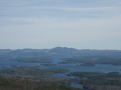
Looking southeast at Mt. Rowe and Belknap Mountain


Directions to trailhead: Take Red Hill Road north from Route 25 near Center Harbor. Parking area and trailhead are on the right shortly after passing Sibley Road on the left.
Back to Red Hill Profile
|

