Home
States
Colorado
Connecticut
Maine
Massachusetts
New Hampshire
New York
Rhode Island
Utah
Vermont
View All
Lists
NE 4,000 Footers
NE 100 Highest
NH 4,000 Footers
NH 100 Highest
NH 52 With A View
NH Belknap Range
NH Ossipee 10
Links
Trail Conditions
Trip Log
Sunrises
Sunsets
About
|
Red Hill
Moultonborough, NH
Trailheads, measurements, times, distances, and maps are all approximate and relative to the hike(s) as shown below.
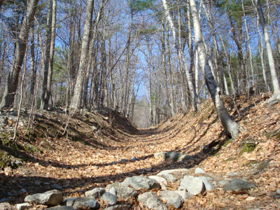
Looking up the Red Hill Trail
Route: Red Hill Trail
An unconscious pattern of hikes brought me to Red Hill on a warm but somewhat windy day. Previously I had hiked the Blue Hills, White Ledge, and Green Mountain. Colorful.
My initial plan was to hike the Champney Falls Trail, however at the last minute I opted for Mt. Whiteface, only to change my mind and consider Mt. Israel. Not wanting to deal with any potential snow, I ended up continuing west to Red Hill.
Though there had been snow on the trail just about two weeks earlier, things had melted and dried nicely on the Red Hill Trail.
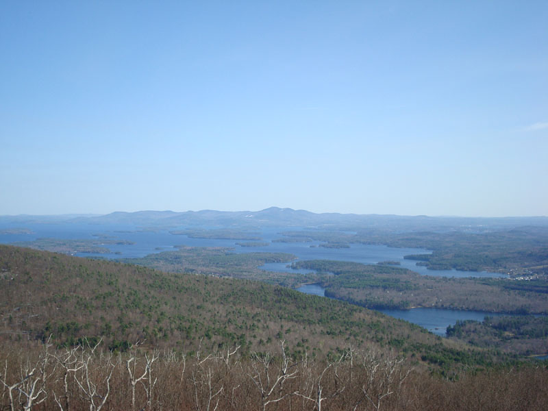
While there was some blue sky to be seen, there was also a lot of haze - especially above Squam Lake. Nonetheless, it was great to see a blue Lake Winnipesaukee for the first time in months! While on the tower, I heard calls about a fire on Mt. Major come in over the radio - though I couldn't make out any smoke, it didn't sound good.
| Hike Ratings |
|
Getting To Trailhead: |
Easy |
| Destination: |
Red Hill |
|
Length: |
Moderate |
|
Steepness: |
Moderate |
|
Navigation: |
Easy |
|
Views: |
Excellent |
|
Crowds: |
Minimal |
|
| Hike Stats |
|
Date Hiked: |
Thursday, April 24, 2008 |
| Hike Commenced: |
4:12 PM |
| Parking Elevation: |
640' |
| Destination: |
Red Hill |
| Ascent Commenced: |
4:12 PM |
| Summit Reached: |
4:55 PM |
| Time Elapsed: |
00:43 |
| Trailhead Elevation: |
640' |
| Summit Elevation: |
2,033' |
| Distance: |
1.7 miles |
| Vertical Gain: |
1,398' |
|
|
| Hike Ended: |
5:46 PM |
| Hike Time Elapsed: |
01:34 |
| Hike Distance: |
3.4 miles |
| Hike Vertical Gain: |
1,403' |
|
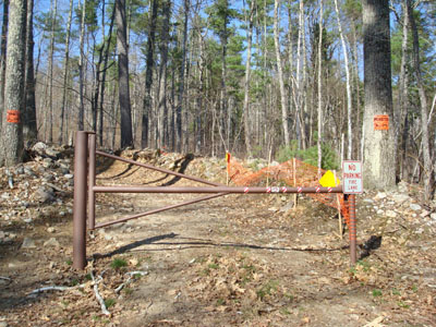
Red Hill Trail trailhead
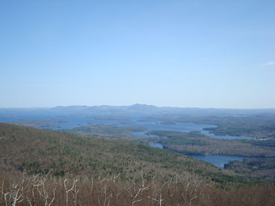
Looking at the Sandwich Range from the Red Hill fire tower
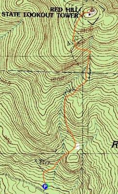

Directions to trailhead: Take Red Hill Road (also signed as Sawmill Road in some places) north from Route 25 near Center Harbor. Parking area and trailhead are on the right shortly after passing Sibley Road on the left.
Back to Red Hill Profile
|