Home
States
Colorado
Connecticut
Maine
Massachusetts
New Hampshire
New York
Rhode Island
Utah
Vermont
View All
Lists
NE 4,000 Footers
NE 100 Highest
NH 4,000 Footers
NH 100 Highest
NH 52 With A View
NH Belknap Range
NH Ossipee 10
Links
Trail Conditions
Trip Log
Sunrises
Sunsets
About
|
Sentinel Mountain, Canaan Mountain
Ossipee, NH, Tuftonboro, NH
Trailheads, measurements, times, distances, and maps are all approximate and relative to the hike(s) as shown below.

Looking up Mountain Trail
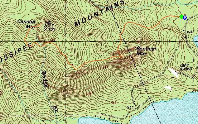
Route: Mountain Trail, (Sentinel Mountain), unknown trail, Dave Green Trail, Canaan Mountain Trail, bushwhack, (Canaan Mountain), bushwhack, Canaan Mountain Trail, Dave Green Trail, unknown trail, (Sentinel Mountain), Mountain Trail
Since the forecast up north wasn't that great and I had just done a somewhat lengthy hike a day earlier, I decided to do something in the southern Ossipees.
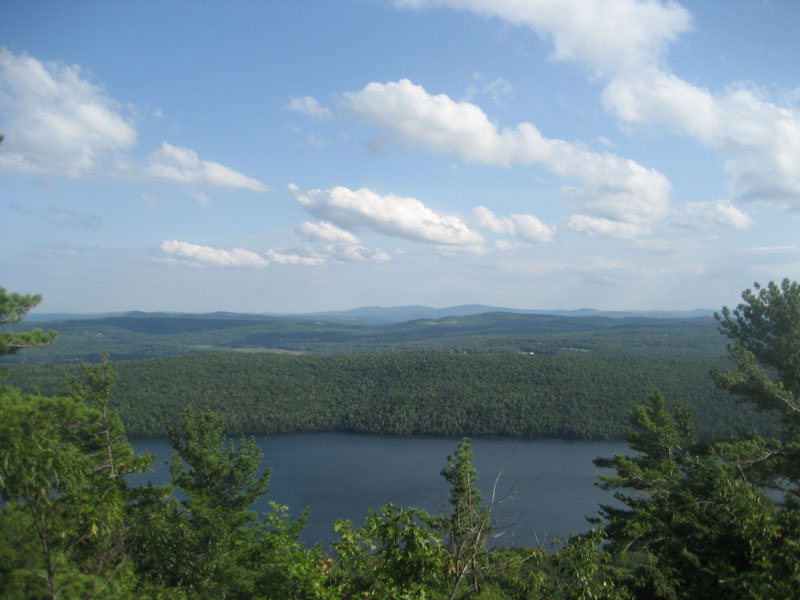
The Sentinel Mountain Trail was in decent shape - mostly dry, only a few blowdowns. The views from the top were great - Copple Crown and the Belknaps both in plain view. From the top of the boulder, I could also see the points up north.
My next stop was a section called the Merrowvista Ledges. The trail over to them from Sentinel is well marked, but apparently not heavily travelled. The views from the ledges were also great.
I decided to keep going to Canaan Mountain after that - a combination of the white blazed trail, red blazed trail, and a bushwhack.
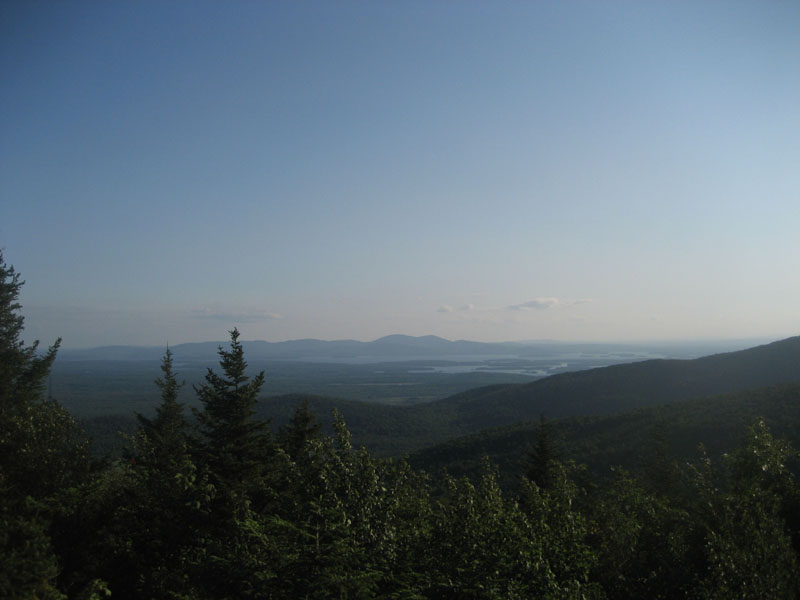
The views from the summit were great - the Belknaps were on full display.
On the way back, I took some time to do some blowdown clearing on the trails, as the August rains had taken their toll on some rotting trees.
| Hike Ratings |
|
Getting To Trailhead: |
Easy |
| Destination: |
Sentinel Mountain |
|
Length: |
Moderate |
|
Steepness: |
Difficult |
|
Navigation: |
Easy |
|
Views: |
Excellent |
|
Crowds: |
Minimal |
| Destination: |
Canaan Mountain |
|
Length: |
Moderate |
|
Steepness: |
Difficult |
|
Navigation: |
Difficult |
|
Views: |
Excellent |
|
Crowds: |
Minimal |
|
| Hike Stats |
|
Date Hiked: |
Monday, August 25, 2008 |
| Hike Commenced: |
3:48 PM |
| Parking Elevation: |
885' |
| Destination: |
Sentinel Mountain |
| Ascent Commenced: |
3:49 PM |
| Summit Reached: |
4:10 PM |
| Time Elapsed: |
00:21 |
| Trailhead Elevation: |
890' |
| Summit Elevation: |
1,680' |
| Vertical Gain: |
805' |
| Destination: |
Canaan Mountain |
| Ascent Commenced: |
4:14 PM |
| Summit Reached: |
4:59 PM |
| Time Elapsed: |
00:45 |
| Trailhead Elevation: |
1,680' |
| Summit Elevation: |
2,072' |
| Vertical Gain: |
612' |
|
|
| Hike Ended: |
7:21 PM |
| Hike Time Elapsed: |
03:33 |
| Hike Vertical Gain: |
1,692' |
|

The Mountain Trail trailhead

Looking at Copple Crown Mountain from the ledges of Sentinel Mountain

Looking down the trail between the Merrowvista Ledges and Sentinel Mountain

Looking southwest at the Belknap Range from Canaan Mountain


Directions to trailhead: From Route 16 South in West Ossipee, take a left onto Old NH 16. After crossing under Route 16, take a right onto Folsom Road. Once in Center Ossipee, take a right onto Moultonville Road. A few minutes later, take a right onto Valley Road. Look for the entrance to Terrace Pines Campground, which will be on the right when Valley Road forks. Shortly down this road, take a right (immediately before a sign for the office). There is limited room for parking in front of the gate - do not block the gate. The Mountain Trail starts a few dozen feet beyond the gate, on the left.
Back to Sentinel Mountain Profile
Back to Canaan Mountain Profile
|