Home
States
Colorado
Connecticut
Maine
Massachusetts
New Hampshire
New York
Rhode Island
Utah
Vermont
View All
Lists
NE 4,000 Footers
NE 100 Highest
NH 4,000 Footers
NH 100 Highest
NH 52 With A View
NH Belknap Range
NH Ossipee 10
Links
Trail Conditions
Trip Log
Sunrises
Sunsets
About
|
South Doublehead, North Doublehead
Jackson, NH
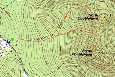
Trailheads, measurements, times, distances, and maps are all approximate and relative to the hike(s) as shown below.
Looking up the Old Path on the way to South Doublehead
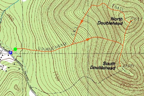
Route: Doublehead Ski Trail, Old Path, New Path, (South Doublehead), New Path, (North Doublehead), Doublehead Ski Trail
Though I never made it to the Doubleheads over the winter, I was still determined to check them out with snow on the ground. Since there are no significant brook crossings, I decided they would be a perfect spring hike.
Arriving at the parking area, I had to get ready while parked on the side of the road, before a parking space in the 3-car parking lot freed up. Fortunately, there was someone departing when I showed up, so I was able to get my space and head out right away.
Since I had to bareboot down the private drive to the trailhead, I decided I'd see how far up the trail I could get before putting on snowshoes. The answer? The beginning of the Old Path. After walking through a muddy, snow free portion of the old path, I postholed pretty deeply, hence the need for my snowshoes. Even with my snowshoes on, I postholed up to my knees a few times on top of the ridge, on the way to South Doublehead.
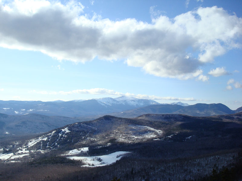
The views from the ledge near the high point were excellent as usual. Not having too much energy or patience, I decided to pass on the other two view points near there and instead head toward North Doublehead.
While the New Path to South Doublehead had been hard to follow (there were a few parts where there was no defined trail due to melting and earlier windblown snow), the portion to North Doublehead was a bit more obvious.
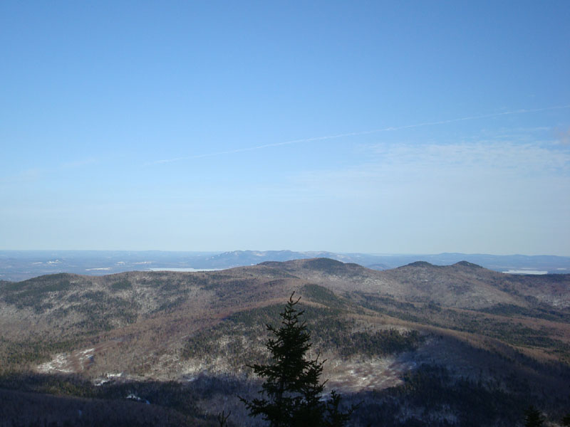
The views of Maine from the back side of North Doublehead were great, though not quite as good as the White Mountain views from South Doublehead. Wanting to head home, I took a few quick photos, and then headed down the ski trail.
While the upper part of the ski trail was covered in spruce needles, the skiing looked pretty good - nice soft spring snow, base depths of 2-3 feet. Wall to wall coverage until the flats, where the water bars had broken through. I may need to bring my skis the next time I hike this one!
| Hike Ratings |
|
Getting To Trailhead: |
Easy |
| Destination: |
South Doublehead |
|
Length: |
Moderate |
|
Steepness: |
Difficult |
|
Navigation: |
Moderate |
|
Views: |
Excellent |
|
Crowds: |
Minimal |
| Destination: |
North Doublehead |
|
Length: |
Moderate |
|
Steepness: |
Difficult |
|
Navigation: |
Moderate |
|
Views: |
Excellent |
|
Crowds: |
Minimal |
|
| Hike Stats |
|
Date Hiked: |
Thursday, April 10, 2008 |
| Hike Commenced: |
4:05 PM |
| Parking Elevation: |
1,480' |
| Destination: |
South Doublehead |
| Ascent Commenced: |
4:06 PM |
| Summit Reached: |
5:04 PM |
| Time Elapsed: |
00:58 |
| Trailhead Elevation: |
1,480' |
| Summit Elevation: |
2,939' |
| Vertical Gain: |
1,459' |
| Destination: |
North Doublehead |
| Ascent Commenced: |
5:09 PM |
| Summit Reached: |
5:31 PM |
| Time Elapsed: |
00:22 |
| Trailhead Elevation: |
2,939' |
| Summit Elevation: |
3,053' |
| Vertical Gain: |
353' |
|
|
| Hike Ended: |
6:31 PM |
| Hike Time Elapsed: |
02:26 |
| Hike Vertical Gain: |
1,842' |
|
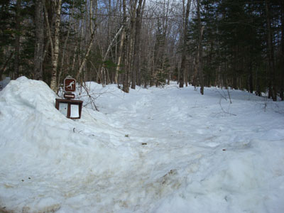
The Doublehead Ski Trail trailhead
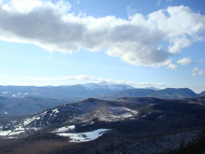
Looking over Black Mountain at Mt. Washington from the ledge near the South Doublehead summit
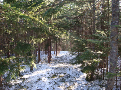
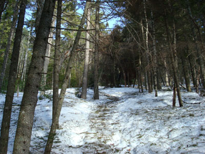
The New Path to North Doublehead
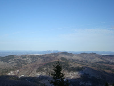
Looking southeast at Pleasant Mountain from the ledge near the North Doublehead summit

Directions to trailhead: Take Route 16 North to Jackson, then take 16A past Black Mountain Ski Area. Just after the ski area, take a right onto Dundee Road. A small parking lot and the trailhead are both located on the left side of the road, on a private drive (the trailhead is a few hundred feet down the private drive on the right).
Back to South Doublehead Profile
Back to North Doublehead Profile
|