Home
States
Colorado
Connecticut
Maine
Massachusetts
New Hampshire
New York
Rhode Island
Utah
Vermont
View All
Lists
NE 4,000 Footers
NE 100 Highest
NH 4,000 Footers
NH 100 Highest
NH 52 With A View
NH Belknap Range
NH Ossipee 10
Links
Trail Conditions
Trip Log
Sunrises
Sunsets
About
|
South Percy Peak, North Percy Peak
Stratford, NH
Trailheads, measurements, times, distances, and maps are all approximate and relative to the hike(s) as shown below.

The Percy Loop Trail
Route: Percy Loop Trail, Percy Peaks Trail, herd path, (South Percy Peak), herd path, Percy Peaks Trail, (North Percy Peak), Percy Peaks Trail, Percy Loop Trail
The first portion of the Percy Loop Trail had smooth footing through nice woods. A bit rougher thereafter, I eventually reached the col. With fog lingering, I headed up the steep herd path to blueberry covered South Percy and waited for the skies to clear.
After seeing the fog move out, I headed back to the col and up the steep, ledgy trail to North Percy, from where there were hazy, but good views and plenty of blueberries.
| Hike Ratings |
|
Getting To Trailhead: |
Easy |
| Destination: |
South Percy Peak |
|
Length: |
Moderate |
|
Steepness: |
Difficult |
|
Navigation: |
Moderate |
|
Views: |
Excellent |
|
Crowds: |
Minimal |
| Destination: |
North Percy Peak |
|
Length: |
Moderate |
|
Steepness: |
Difficult |
|
Navigation: |
Easy |
|
Views: |
Excellent |
|
Crowds: |
Moderate |
|
| Hike Stats |
|
Date Hiked: |
Saturday, July 30, 2011 |
| Parking Elevation: |
1,365' |
| Destination: |
South Percy Peak |
| Time Elapsed: |
01:18 |
| Trailhead Elevation: |
1,365' |
| Summit Elevation: |
3,234' |
| Vertical Gain: |
1,969' |
| Destination: |
North Percy Peak |
| Time Elapsed: |
00:25 |
| Trailhead Elevation: |
3,234' |
| Summit Elevation: |
3,430' |
| Vertical Gain: |
550' |
|
|
| Hike Time Elapsed: |
03:44 |
| Hike Vertical Gain: |
2,569' |
|

Percy Loop Trail trailhead

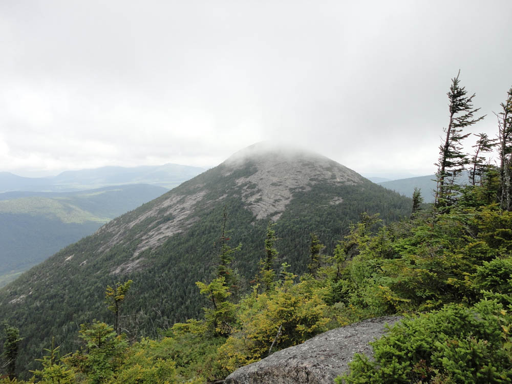
Looking North Percy from South Percy

Looking up the Percy Peaks Trail to North Percy

South Percy as seen from North Percy


Directions to trailhead: Take Route 110 West from Berlin. In Stark, take a right onto Northside Road, crossing a covered bridge. Take a left onto North Road, then eventually take a right onto Nash Stream Road. A few minutes after passing the Percy Peaks Trail, the Percy Loop Trail trailhead will be on the right, just before a bridge.
Back to South Percy Peak Profile
Back to North Percy Peak Profile
|