Home
States
Colorado
Connecticut
Maine
Massachusetts
New Hampshire
New York
Rhode Island
Utah
Vermont
View All
Lists
NE 4,000 Footers
NE 100 Highest
NH 4,000 Footers
NH 100 Highest
NH 52 With A View
NH Belknap Range
NH Ossipee 10
Links
Trail Conditions
Trip Log
Sunrises
Sunsets
About
|
Straightback Mountain
Alton, NH
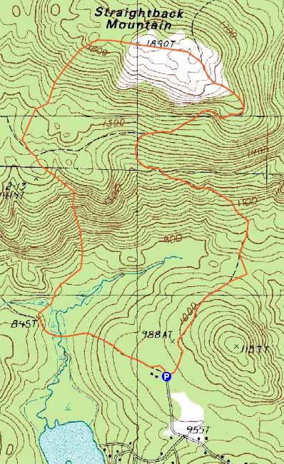
Trailheads, measurements, times, distances, and maps are all approximate and relative to the hike(s) as shown below.
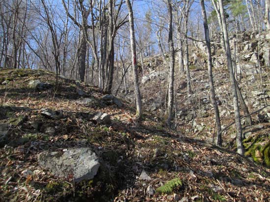
Looking up the Precipice Path
Route: Snowmobile Corridor 22W, herd path, Precipice Path, Belknap Range Trail, Straightback Mountain Trail, Blueberry Pasture Trail
Snowmobile corridor had some areas of mud, as well as some avoidable patches of remaining ice. After crossing the marsh and heading uphill, I beared right onto an unsigned wood road, which faded out at a crossing. I continued on a herd path and soon reached some red blazes. I had intended to head toward Mt. Anna, but think I misinterpreted the west branch of the Precipice Path as a property boundary, ending up instead on the east branch of it.
The Precipice Path was hard to follow in places due to vague footbed and/or faded blazes. Had to turn around multiple times after following old herd paths. The trail was snow free and mostly dry and passed through some neat terrain. The junction where it meets the blue blazed Belknap Ridge Trail was not at all obvious.
The Straightback Mountain Trail was also snow free and mostly dry. The junction with the Blueberry Pasture Trail is also easy to miss, but there are some small signs there. Beyond those signs, the trail (really a wood road) is not marked, including at junctions. Extended portions of rock from erosion. A little wet down low, but avoidable. Emerged on a snowmobile trail, followed it past a field of scarecrows and back to where I parked.
| Hike Ratings |
|
Getting To Trailhead: |
Easy |
| Destination: |
Straightback Mountain |
|
Length: |
Moderate |
|
Steepness: |
Difficult |
|
Navigation: |
Moderate |
|
Views: |
Excellent |
|
Crowds: |
Minimal |
|
| Hike Stats |
|
Date Hiked: |
Thursday, April 24, 2014 |
| Parking Elevation: |
985' |
| Destination: |
Straightback Mountain |
| Time Elapsed: |
01:02 |
| Trailhead Elevation: |
985' |
| Summit Elevation: |
1,890' |
| Vertical Gain: |
1,235' |
|
|
| Hike Time Elapsed: |
01:56 |
| Hike Vertical Gain: |
1,335' |
|
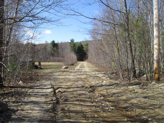
The beginning of the woods road at the end of the maintained portion of Alton Mountain Road

Looking up the Precipice Path
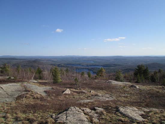
Looking at Sunset Lake from near the summit of Straightback Mountain
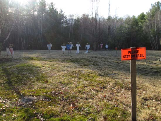
Scarecrows near the bottom of the Blueberry Pasture Trail-Old Stage Road

Directions to trailhead: From the Route 28A - Route 11 junction in Alton Bay, head west, going straight through the next junction, onto Rand Hill Road. Take a left onto Alton Mountain Road. A few minutes later, bear right to stay on Alton Mountain Road (rather than going left onto Avery Hill Road). There is limited room to park near the end of the maintained road and snowmobile trail junction.
Back to Straightback Mountain Profile
|

