Home
States
Colorado
Connecticut
Maine
Massachusetts
New Hampshire
New York
Rhode Island
Utah
Vermont
View All
Lists
NE 4,000 Footers
NE 100 Highest
NH 4,000 Footers
NH 100 Highest
NH 52 With A View
NH Belknap Range
NH Ossipee 10
Links
Trail Conditions
Trip Log
Sunrises
Sunsets
About
|
Stub Hill, North Stub Hill
Pittsburg, NH
Trailheads, measurements, times, distances, and maps are all approximate and relative to the hike(s) as shown below.
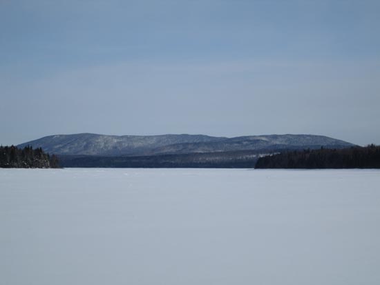
Crossing Second Connecticut Lake
Route: Second Connecticut Lake, bushwhack, Corridor 5, Corridor 20, Corridor 143, snowmobile trails, bushwhacks
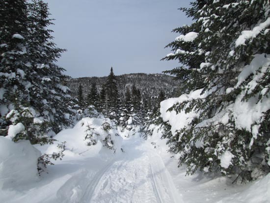
After seeing Magalloway Road was not driveable, we proceeded to what was Plan A anyway - crossing Second Connecticut Lake. After crossing the footbridge and bushwhacking around the outflow, we hugged the southern shore for awhile (but crossed north of the swampy area), then did a short bushwhack (maybe 2 feet of snowpack down low) above the east shore to Corridor 5. We then took this south to Corridor 20 (aka Smith Brook Road), then headed north on it for a little while. We then turned south onto Corridor 143 and followed this to where the road to the Stub Hill col departs left (east). Up to this point, all corridors were groomed and pretty heavily used by snowmobiles.
Luckily for us, there appears to be pretty regular snowombile traffic (though no grooming) up the logging road to the col between Stub Hill and North Stub Hill. In fact, it appears there's regular traffic right over the pond (the trail departs from the logging road at the height of land; multiple snowmobile groups came through here while we were in the vicinity). Quite a gift.
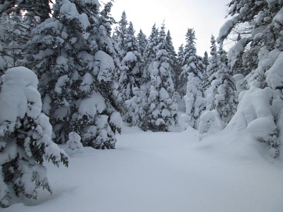
From the pond, we did the short bushwhack in open woods to the summit of Stub Hill, from where we had great views of the Rangeley area, Grafton Notch, and Presidentials. Snow depth up top was probably 3-4 feet.
Returning to the logging road, we descended it on it east briefly (sled traffic here as well), then bushwhacked north (sort of diagonally) on an old skid road to within 100 vertical feet of the summit, then turned and slabbed diagonally sort of west to the highpoint. Maybe 4-5 feet of firm snow on the otherwise blowdown laden ridge, making for quick work of it.
We then retraced our tracks and did the long snowshoe out. Frankly, the only steep part of the day was the last 100 vertical feet up to North Stub Hill. I think pretty much the whole thing could be done via skis.
Below zero (single digits below was much nicer than the readings on teh drive up; -23F!) but sunny to start...snowing with cloud skies and temperatures in the teens at the end. Route including bushwhacks clocked in at about 16.1 miles round trip.
| Hike Ratings |
|
Getting To Trailhead: |
Very Difficult |
| Destination: |
Stub Hill |
|
Length: |
Difficult |
|
Steepness: |
Moderate |
|
Navigation: |
Difficult |
|
Views: |
Excellent |
|
Crowds: |
Minimal |
| Destination: |
North Stub Hill |
|
Length: |
Very Difficult |
|
Steepness: |
Difficult |
|
Navigation: |
Very Difficult |
|
Views: |
Excellent |
|
Crowds: |
Minimal |
|
| Hike Stats |
|
Date Hiked: |
Saturday, February 21, 2015 |
| Parking Elevation: |
1,874' |
| Time To Trailhead: |
02:57 |
| Destination: |
Stub Hill |
| Time Elapsed: |
00:46 |
| Trailhead Elevation: |
3,170' |
| Summit Elevation: |
3,627' |
| Vertical Gain: |
487' |
| Destination: |
North Stub Hill |
| Time Elapsed: |
00:50 |
| Trailhead Elevation: |
3,627' |
| Summit Elevation: |
3,422' |
| Vertical Gain: |
322' |
|
|
| Hike Time Elapsed: |
07:38 |
| Hike Vertical Gain: |
2,505' |
|
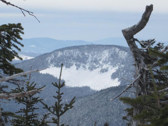
Looking down the snowmobile trail to Stub Hill Pond with North Stub Hill in the background
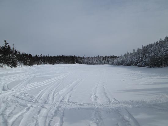
Stub Hill Pond
Bushwhacking to Stub Hill
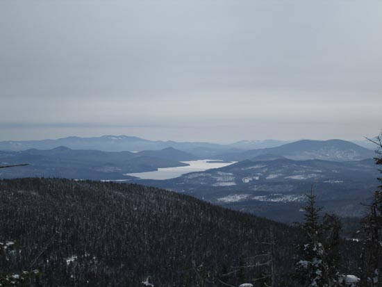
Looking at Aziscohos from near the summit of Stub Hill
Looking at Magalloway from near the summit of Stub Hill
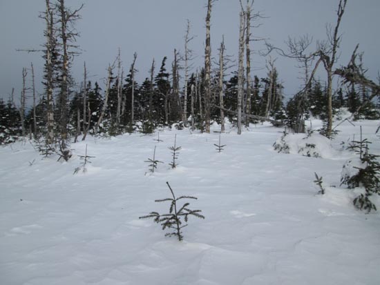
Deep drifts on North Stub Hill
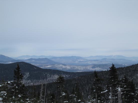
Looking southeast toward the Rangeley high peaks from North Stub Hill
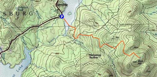

Directions to trailhead: In winter, Magalloway Road is a snowmobile corridor. There may be limited room to park at its start off US 3. In winter 2014-15, there was also plowed parking near the dam at the outflow of Second Connecticut Lake.
Back to Stub Hill Profile
Back to North Stub Hill Profile
|


