Home
States
Colorado
Connecticut
Maine
Massachusetts
New Hampshire
New York
Rhode Island
Utah
Vermont
View All
Lists
NE 4,000 Footers
NE 100 Highest
NH 4,000 Footers
NH 100 Highest
NH 52 With A View
NH Belknap Range
NH Ossipee 10
Links
Trail Conditions
Trip Log
Sunrises
Sunsets
About
|
Thorn Mountain
Jackson, NH
Trailheads, measurements, times, distances, and maps are all approximate and relative to the hike(s) as shown below.
The Thorn Mountain Trail
Route: Davis Path, bushwhack, herd path
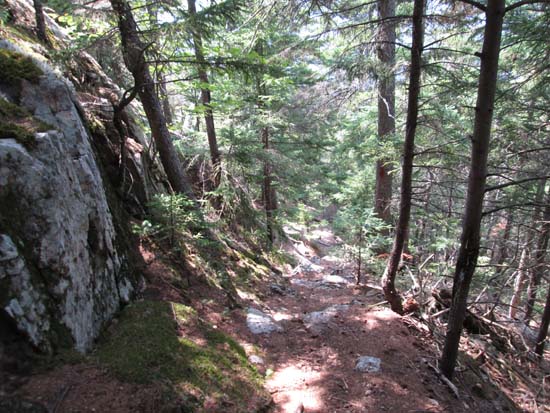
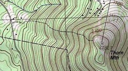
The Thorn Mountain Trail was in the AMC White Mountain Guide for many years, but was removed a few editions back, presumably because it starts on someone's driveway. The USGS map roughly shows its location.
The trail is marked with old blazes and occasional tin can lids. It gets progressively steep as it climbs, making it quite a workout. At perhaps 1,600 in elevation, a trail comes in from the north, perhaps from Tin Mine Road. This may be a better point of access, but I don't know for sure.
The trail was mostly dry. There were multiple ledge views near and at the summit (top of the long defunct Tyrol ski area). Also some blueberries to be found.
| Hike Ratings |
|
Getting To Trailhead: |
Difficult |
| Destination: |
Thorn Mountain |
|
Length: |
Moderate |
|
Steepness: |
Difficult |
|
Navigation: |
Easy |
|
Views: |
Excellent |
|
Crowds: |
Minimal |
|
| Hike Stats |
|
Date Hiked: |
Sunday, August 10, 2014 |
| Parking Elevation: |
1,260' |
| Destination: |
Thorn Mountain |
| Time Elapsed: |
00:35 |
| Trailhead Elevation: |
1,210' |
| Summit Elevation: |
2,282' |
| Vertical Gain: |
1,072' |
|
|
| Hike Time Elapsed: |
01:40 |
| Hike Vertical Gain: |
1,172' |
|
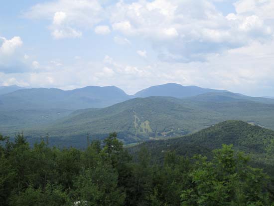
Looking at Carter Notch from Thorn Mountain

Back to Thorn Mountain Profile
|

