Home
States
Colorado
Connecticut
Maine
Massachusetts
New Hampshire
New York
Rhode Island
Utah
Vermont
View All
Lists
NE 4,000 Footers
NE 100 Highest
NH 4,000 Footers
NH 100 Highest
NH 52 With A View
NH Belknap Range
NH Ossipee 10
Links
Trail Conditions
Trip Log
Sunrises
Sunsets
About
|
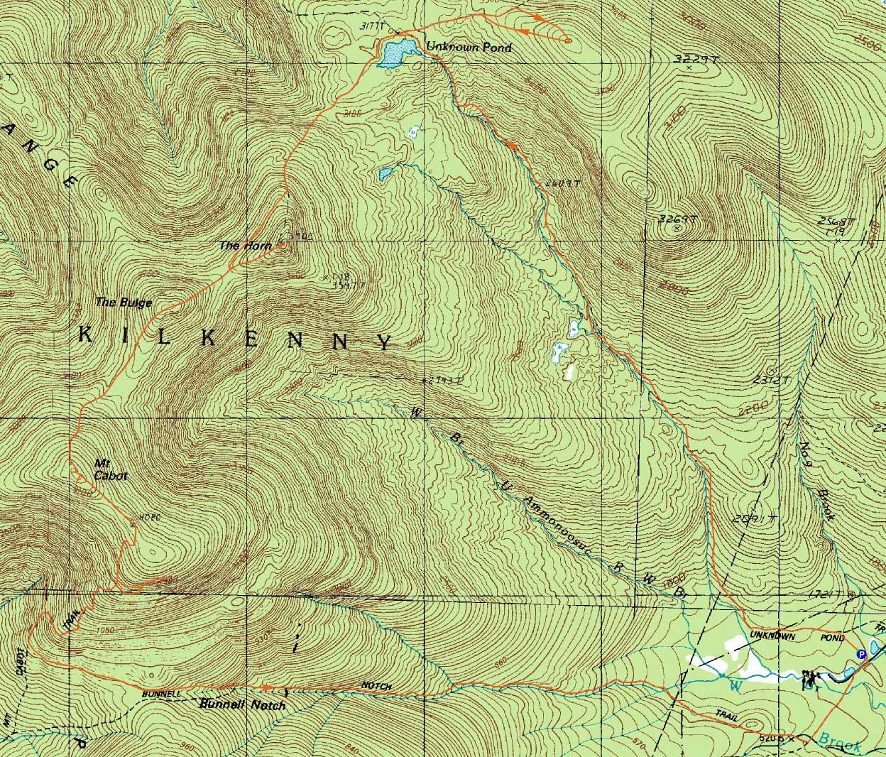
Unknown Pond Peak, The Horn, The Bulge, Mt. Cabot
Berlin, NH, Kilkenny, NH
Trailheads, measurements, times, distances, and maps are all approximate and relative to the hike(s) as shown below.

Looking up the Unknown Pond Trail
Route: Unknown Pond Trail, Kilkenny Ridge Trail, bushwhack, (Unknown Pond Peak), bushwhack, Kilkenny Ridge Trail, The Horn spur trail, (The Horn), The Horn spur trail, Kilkenny Ridge Trail, (The Bulge), Kilkenny Ridge Trail, (Mt. Cabot), Kilkenny Ridge Trail, bushwhack, (Mt. Cabot Talus Field), bushwhack, Bunnell Notch Trail, York Pond Trail
With the fish hatchery gate opening just before 7:30, we soon set foot on the Unknown Pond Trail. Though muddy and grown in in a few areas, the trail was generally in good shape as it gradually worked its way to Unknown Pond.
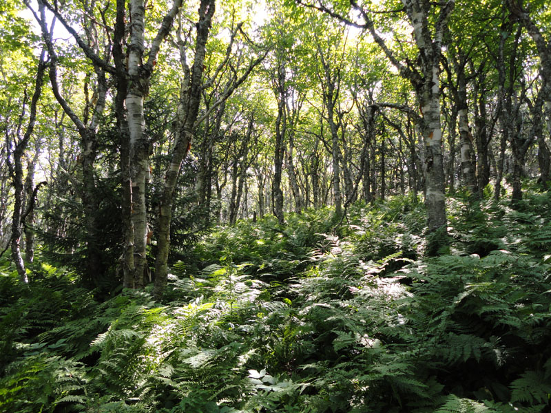
From Unknown Pond, I took the Kilkenny Ridge Trail east just past a height of land, reaching a vast, open birch glade. I was then able to follow the birch glade all the way to the summit of the viewless peak commonly known as Unknown Pond Peak.
For the descent, I attempted to beeline my way back to the pond, but found myself in some moderate spruce - certainly not a time saver vs. the open birch glade.
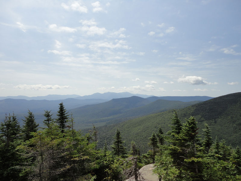
From the pond, I worked my way up to the Horn, where I had excellent (though starting to cloud in) views.
After passing over the the Bulge, I worked my way up the steep climb to Mt. Cabot. After taking the herd path to the true summit, we pushed over to the blowdown view area, then back to the trail and over to the old fire tower viewpoint.
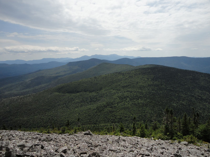
We then continued down the trail past the cabin, eventually turning off at a curve and bushwhacking along the contour to the lower corner of the vast talus fields. From there, I headed up and continued along for some time as the fields opened up dramatically with tremendous views ranging from the Mahoosucs to the Presidentials to Vermont.
We stayed a bit uphill in returning to the trail, resulting in slightly more open woods.
The descent dragged on a bit as we worked our way down the Bunnell Notch Trail and the logging roads back to the parking area.
| Hike Ratings |
|
Getting To Trailhead: |
Easy |
| Destination: |
Unknown Pond Peak |
|
Length: |
Moderate |
|
Steepness: |
Moderate |
|
Navigation: |
Difficult |
|
Views: |
Minimal |
|
Crowds: |
Minimal |
| Destination: |
The Horn |
|
Length: |
Moderate |
|
Steepness: |
Very Difficult |
|
Navigation: |
Difficult |
|
Views: |
Excellent |
|
Crowds: |
Minimal |
| Destination: |
The Bulge |
|
Length: |
Moderate |
|
Steepness: |
Very Difficult |
|
Navigation: |
Easy |
|
Views: |
Minimal |
|
Crowds: |
Minimal |
| Destination: |
Mt. Cabot |
|
Length: |
Difficult |
|
Steepness: |
Difficult |
|
Navigation: |
Easy |
|
Views: |
Excellent |
|
Crowds: |
Minimal |
|
| Hike Stats |
|
Date Hiked: |
Sunday, August 8, 2010 |
| Hike Commenced: |
7:35 AM |
| Parking Elevation: |
1,680' |
| Destination: |
Unknown Pond Peak |
| Ascent Commenced: |
7:35 AM |
| Summit Reached: |
9:42 AM |
| Time Elapsed: |
02:07 |
| Trailhead Elevation: |
1,680' |
| Summit Elevation: |
3,510' |
| Vertical Gain: |
1,900' |
| Destination: |
The Horn |
| Ascent Commenced: |
9:47 AM |
| Summit Reached: |
11:01 AM |
| Time Elapsed: |
01:14 |
| Trailhead Elevation: |
3,510' |
| Summit Elevation: |
3,905' |
| Vertical Gain: |
1,080' |
| Destination: |
The Bulge |
| Ascent Commenced: |
11:03 AM |
| Summit Reached: |
11:19 AM |
| Time Elapsed: |
00:16 |
| Trailhead Elevation: |
3,905' |
| Summit Elevation: |
3,950' |
| Vertical Gain: |
305' |
| Destination: |
Mt. Cabot |
| Ascent Commenced: |
11:20 AM |
| Summit Reached: |
11:43 AM |
| Time Elapsed: |
00:23 |
| Trailhead Elevation: |
3,950' |
| Summit Elevation: |
4,170' |
| Vertical Gain: |
485' |
|
|
| Hike Ended: |
3:38 PM |
| Hike Time Elapsed: |
08:03 |
| Hike Vertical Gain: |
4,095' |
|

The Unknown Pond Trail trailhead near York Pond Road

Looking at the Horn from Unknown Pond

Open glades near the viewless summit of Unknown Pond Peak

The Kilkenny Ridge Trail on the way to the Horn

Looking toward the Presidentials from the Horn

The Kilkenny Ridge Trail to the Bulge

A lack of views from the Bulge

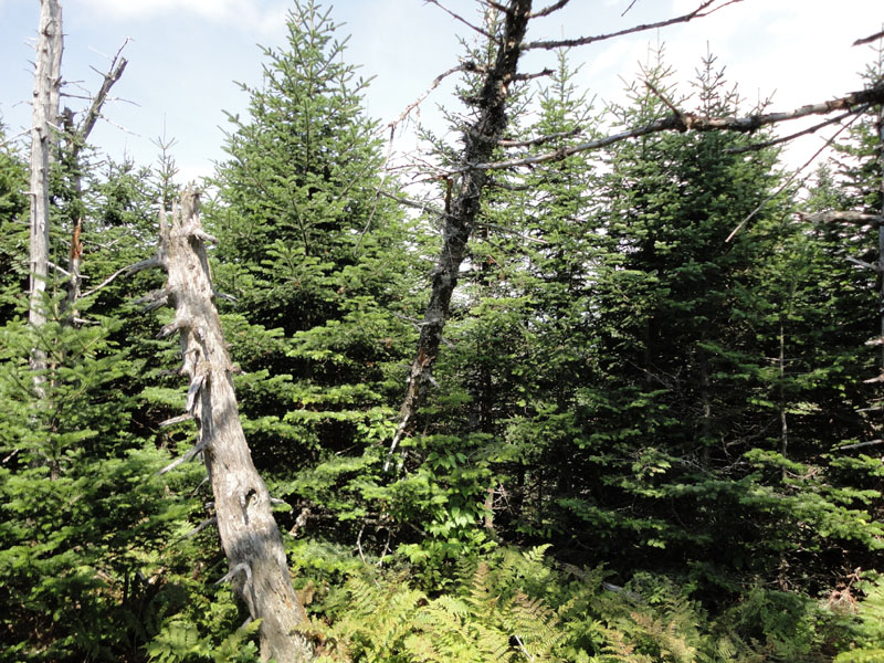
The Kilkenny Ridge Trail to Mt. Cabot

Looking southwest from the blowdown patch near the summit of Mt. Cabot

Looking south from the talus field on Mt. Cabot


Directions to trailhead: Take Route 16 to Berlin, then take Route 110 northwest. York Pond Road will eventually be on the left. Continue through the Fish Hatchery (do be aware that the gates are only open during the day, usually 8 AM - 4 PM). The driveway to the Unknown Pond Trail parking area will eventually be on the right. The trailhead is next to the kiosk.
Back to Unknown Pond Peak Profile
Back to The Horn Profile
Back to The Bulge Profile
Back to Mt. Cabot Profile
|