Home
States
Colorado
Connecticut
Maine
Massachusetts
New Hampshire
New York
Rhode Island
Utah
Vermont
View All
Lists
NE 4,000 Footers
NE 100 Highest
NH 4,000 Footers
NH 100 Highest
NH 52 With A View
NH Belknap Range
NH Ossipee 10
Links
Trail Conditions
Trip Log
Sunrises
Sunsets
About
|
Whiteface Mountain
Gilford, NH
Trailheads, measurements, times, distances, and maps are all approximate and relative to the hike(s) as shown below.
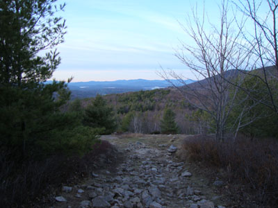
Looking down the Whiteface Trail
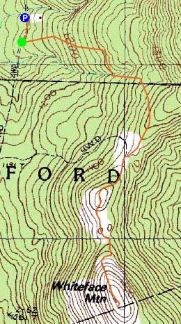
Route: Piper Whiteface Trail, Whiteface Trail, (Whiteface Mountain summit), Whiteface Trail, Piper Whiteface Trail
As I drove to Gilford, I could see clouds increasing - the sunset would either be superb or poor.
I had to be careful as I worked my way up the first portion of the Piper Whiteface Trail, as rocks were hidden by leaves. Climbing up to the Whiteface Trail junction on moderate grades, I walked through the opening in the stonewall and was soon on the dirt road walk to the summit, avoiding a few of the puddles along the way.
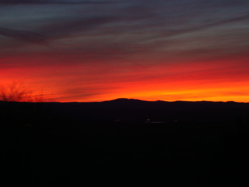
The views from the summit were quite good to the north, east, and northwest, however there were clouds overtaking the south. Though we didn't see the sun actually set due to the clouds, we were soon treated to progressively strong colors - pinks and purples to the north and some oranges to the west.
After about thirty minutes of great colors, we figured we had seen the best of it and started to descend. Reaching the flats, we noticed even stronger colors - deep reds to the west - what a show!
| Hike Ratings |
|
Getting To Trailhead: |
Easy |
| Destination: |
Whiteface Mountain |
|
Length: |
Moderate |
|
Steepness: |
Moderate |
|
Navigation: |
Moderate |
|
Views: |
Excellent |
|
Crowds: |
Minimal |
|
| Hike Stats |
|
Date Hiked: |
Thursday, November 12, 2009 |
| Hike Commenced: |
3:33 PM |
| Parking Elevation: |
1,050' |
| Destination: |
Whiteface Mountain |
| Ascent Commenced: |
3:35 PM |
| Summit Reached: |
4:05 PM |
| Time Elapsed: |
00:30 |
| Trailhead Elevation: |
1,060' |
| Summit Elevation: |
1,664' |
| Vertical Gain: |
739' |
|
|
| Hike Ended: |
5:28 PM |
| Hike Time Elapsed: |
01:55 |
| Hike Vertical Gain: |
794' |
|
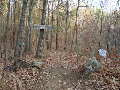
The Piper Whiteface Trail trailhead on Belknap Mountain Road
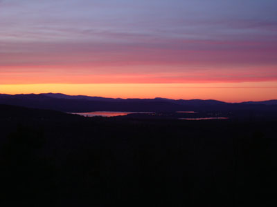
Looking at Lake Winnisquam from near the Whiteface Mountain summit
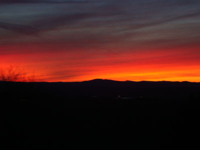
Late sunset colors as seen from Whiteface Mountain
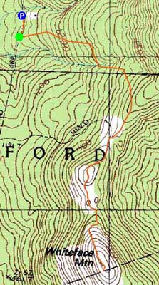

Directions to trailhead: From Route 11A East (from Route 3), take a right on Hoyt Road. Continue down this road as it becomes Belknap Mountain Road. At the end of this road, take a left. There will eventually be a turnaround area with a private road sign. Park here, and continue up the road on foot. The Piper Whiteface Trail trailhead will be on the left side of the road.
Back to Whiteface Mountain Profile
|