Home
States
Colorado
Connecticut
Maine
Massachusetts
New Hampshire
New York
Rhode Island
Utah
Vermont
View All
Lists
NE 4,000 Footers
NE 100 Highest
NH 4,000 Footers
NH 100 Highest
NH 52 With A View
NH Belknap Range
NH Ossipee 10
Links
Trail Conditions
Trip Log
Sunrises
Sunsets
About
|
Whitton Ledge
Albany, NH, Madison, NH
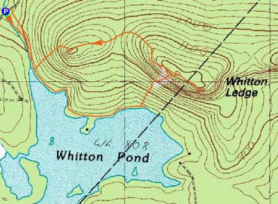
Trailheads, measurements, times, distances, and maps are all approximate and relative to the hike(s) as shown below.
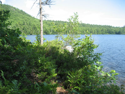
The herd path along the north shore of Whitten Pond
Route: Bushwhack, orange blazed trail, bushwhack
Though the forecast a day earlier had been calling for heavy rains, the weather was much more pleasant. As the afternoon neared, the clouds were giving way to blue sky.
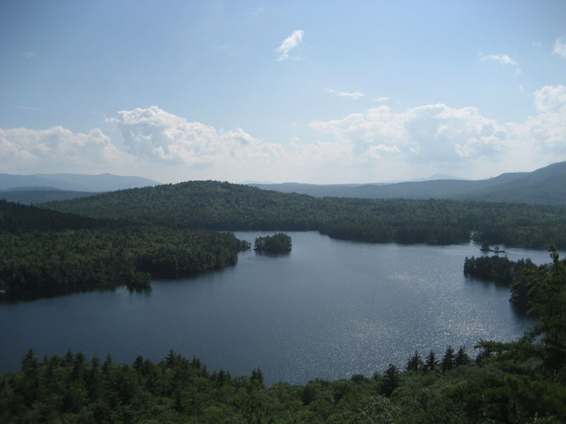
Having seen Whitton Ledge from Mt. Chocorua and taking an interest in it, I decided today would be the perfect day to give it a shot. After circling around Whitton Pond (no roads actually reach the pond, so it was a blind maze trying to find a way in), I decided to follow a brook up to the water. Reaching the pond, I was shocked at how nice it was - quiet and generally undisturbed by development. Following a herdpath along the northern shore, I soon bushwhacked up toward the ridge, reaching a large rock slab.
While I was tempted to try to scale the slab, the bottom was too slippery to grip on (and the major for error was very very slim). Thus, I headed up through the woods and worked my way back over to the slab, heading up the top third. Above the slab, I soon reached a wall of cliffs and a bunch of old cable - a granite quarry perhaps? Finding a way up over the cliff, I reached an orange blazed trail near the highpoint of the peak. Following the trail east, I reached some nice ledge vistas with views ranging from peaks in Maine to Chocorua.
Ready to finish this hike, I followed the orange blazed trail northwest to a smaller subpeak, which offered some additional views. At this point, the trail ended - from here, I bushwhacked back down to the pond and then followed an old woods road back to Drake Hill Road.
A nice hike, though the deer flies were extremely vexing!
| Hike Ratings |
|
Getting To Trailhead: |
Moderate |
| Destination: |
Whitton Ledge |
|
Length: |
Moderate |
|
Steepness: |
Very Difficult |
|
Navigation: |
Difficult |
|
Views: |
Excellent |
|
Crowds: |
Minimal |
|
| Hike Stats |
|
Date Hiked: |
Saturday, July 18, 2009 |
| Hike Commenced: |
2:40 PM |
| Parking Elevation: |
740' |
| Destination: |
Whitton Ledge |
| Ascent Commenced: |
2:40 PM |
| Summit Reached: |
3:38 PM |
| Time Elapsed: |
00:58 |
| Trailhead Elevation: |
560' |
| Summit Elevation: |
740' |
| Vertical Gain: |
560' |
|
|
| Hike Ended: |
4:29 PM |
| Hike Time Elapsed: |
01:49 |
| Hike Vertical Gain: |
720' |
|

The brook coming from Whitten Pond as seen from Drake Hill Road
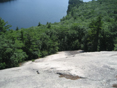
Looking down one of the scramble ledges
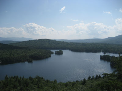
Looking over Whitten Pond at the Ossipees (left) and Mt. Israel (right) from one of the Whitten Ledge vistas

Directions to trailhead: Drake Hill Road is located east of Route 16 near Albany, NH
Back to Whitton Ledge Profile
|