Home
States
Colorado
Connecticut
Maine
Massachusetts
New Hampshire
New York
Rhode Island
Utah
Vermont
View All
Lists
NE 4,000 Footers
NE 100 Highest
NH 4,000 Footers
NH 100 Highest
NH 52 With A View
NH Belknap Range
NH Ossipee 10
Links
Trail Conditions
Trip Log
Sunrises
Sunsets
About
|
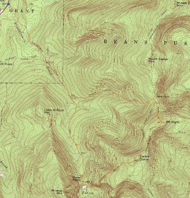
Wildcat A, Carter Dome, Mt. Hight
Green's Grant, NH, Bean's Purchase, NH
Trailheads, measurements, times, distances, and maps are all approximate and relative to the hike(s) as shown below.
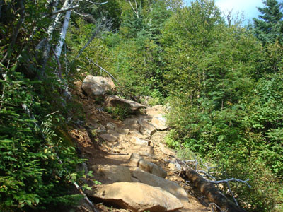
Looking up the Wildcat Ridge Trail as it crosses the slide on the way to Wildcat A
Route: Nineteen Mile Brook Trail, Wildcat Ridge Trail, (Wildcat A), Wildcat Ridge Trail, Nineteen Mile Brook Trail, (Carter Notch Hut), Nineteen Mile Brook Trail, Carter Moriah Trail, (Carter Dome), Carter Moriah Trail, (Mt. Hight), Carter Moriah Trail, Carter Dome Trail, Nineteen Mile Brook Trail
My plan for many days had been to hike Mt. Washington, as the Sunday forecast was looking (and holding!) great! That is, until I woke up Sunday morning and discovered a severe weather advisory and a mostly cloudy with thunderstorms forecast. Give me a break.
I decided Plan B would be a hike up to the Carter Dome. Starting early to beat the weather and parking lot congestion, I was on my way before 7. While the trail was a little bit wet from the previous night's rain, it was still fairly easily hiked. The section after the Carter Dome Trail junction was a bit more wet, but still passable. The trail itself was pretty gradual, other than the last quarter of a mile or so (still pretty easy grades then).
Arriving at the height of land and having blue skies, I decided to do a detour and head up to Wildcat A. While I had heard this section of trail was really steep, I found that, other than the beginning of it and a section up high, that it was fairly moderate. The trail was quite muddy near the summit.
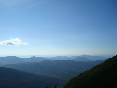
While the views from the ledge near the summit were great, they were a bit hazy.
After taking a few photos, I headed back down, past the beautiful lakes, and over to the Carter Notch Hut. I wasn't hungry, so I turned back around and headed up the Carter Moriah Trail up to the Carter Dome, taking a brief spur path to a great Carter Notch ledge view along the way. While I had also heard this stretch of trail was tough, I didn't find it overly challenging - other than a sustained steep part, it was mostly easy/moderate going.
The views from the summit clearing were a bit better than those at Wildcat A, as the haze was starting to clear out a bit. The Northern Presidentials were in and out of the clouds, while Mt. Washington itself stayed completely covered.
My next stop was Mt. Hight - in my opinion the best summit in the range. While the trail was a bit wet in the col, it was still passable and soon I was at the rocky summit. The views were excellent as usual, though again points to the south were a bit hazy. I took an extended break, then made my way back to the parking lot, stopping about halfway down to cut up and remove a blowdown on the Carter Dome Trail.
Not bad for 'mostly cloudy' and rain in the forecast.
| Hike Ratings |
|
Getting To Trailhead: |
Easy |
| Destination: |
Wildcat A |
|
Length: |
Moderate |
|
Steepness: |
Difficult |
|
Navigation: |
Easy |
|
Views: |
Excellent |
|
Crowds: |
Moderate |
| Destination: |
Carter Dome |
|
Length: |
Difficult |
|
Steepness: |
Difficult |
|
Navigation: |
Easy |
|
Views: |
Excellent |
|
Crowds: |
Moderate |
| Destination: |
Mt. Hight |
|
Length: |
Difficult |
|
Steepness: |
Moderate |
|
Navigation: |
Easy |
|
Views: |
Excellent |
|
Crowds: |
Moderate |
|
| Hike Stats |
|
Date Hiked: |
Sunday, August 17, 2008 |
| Hike Commenced: |
6:33 AM |
| Parking Elevation: |
1,485' |
| Destination: |
Wildcat A |
| Ascent Commenced: |
6:33 AM |
| Summit Reached: |
8:40 AM |
| Time Elapsed: |
02:07 |
| Trailhead Elevation: |
1,485' |
| Summit Elevation: |
4,422' |
| Distance: |
4.3 miles |
| Vertical Gain: |
3,007' |
| Destination: |
Carter Dome |
| Ascent Commenced: |
8:46 AM |
| Summit Reached: |
10:19 AM |
| Time Elapsed: |
01:33 |
| Trailhead Elevation: |
4,422' |
| Summit Elevation: |
4,832' |
| Vertical Gain: |
1,614' |
| Destination: |
Mt. Hight |
| Ascent Commenced: |
10:26 AM |
| Summit Reached: |
10:49 AM |
| Time Elapsed: |
00:23 |
| Trailhead Elevation: |
4,832' |
| Summit Elevation: |
4,675' |
| Vertical Gain: |
165' |
|
|
| Hike Ended: |
1:24 PM |
| Hike Time Elapsed: |
06:51 |
| Hike Vertical Gain: |
4,866' |
|
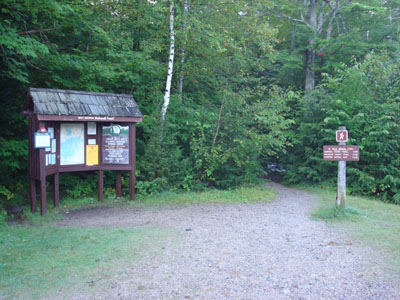
The Nineteen Mile Brook Trail trailhead off Route 16
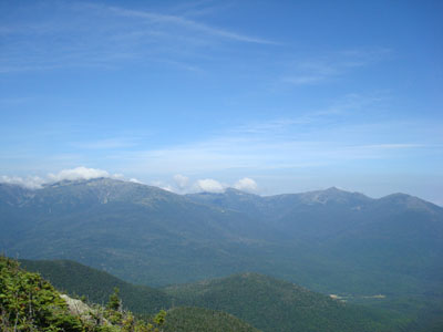
Looking southeast from Wildcat A at the Doubleheads, Kearsarge North, and in the distance, Pleasant Mountain
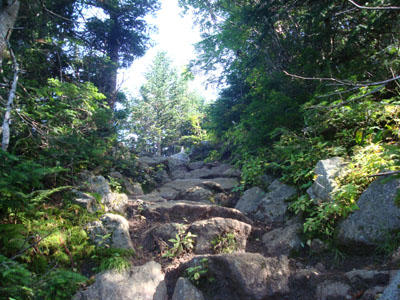
Looking up the Carter Moriah Trail on the way to Carter Dome
Looking at Mt. Washington, Mt. Jefferson, Mt. Adams, and Mt. Madison from the northern Carter Dome viewpoint
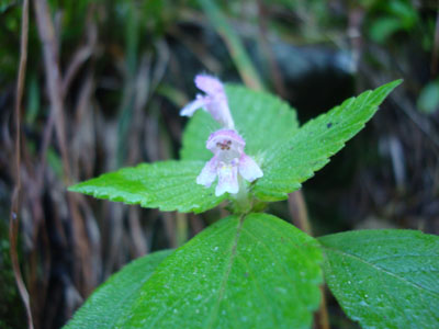
A small wildflower on the side of the Carter Moriah Trail
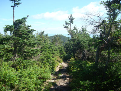
The Carter Moriah Trail to Mt. Hight

Looking at Mt. Washington from Mt. Hight
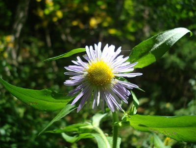
A wildflower on the Carter Dome Trail

Directions to trailhead: Take Route 16 North past the Mt. Washington Auto Road entrance. Shortly thereafter, the Nineteen Mile Brook Trail WMNF fee parking area and trailhead are on the right side of the road, immediately after the brook.
Back to Wildcat A Profile
Back to Carter Dome Profile
Back to Mt. Hight Profile
|


