Home
States
Colorado
Connecticut
Maine
Massachusetts
New Hampshire
New York
Rhode Island
Utah
Vermont
View All
Lists
NE 4,000 Footers
NE 100 Highest
NH 4,000 Footers
NH 100 Highest
NH 52 With A View
NH Belknap Range
NH Ossipee 10
Links
Trail Conditions
Trip Log
Sunrises
Sunsets
About
|
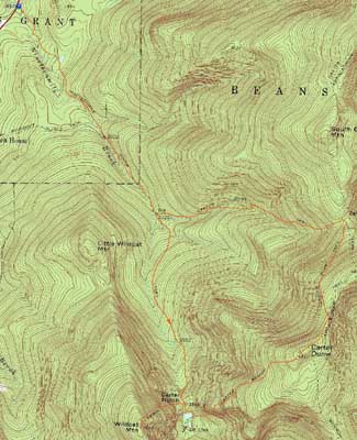
Wildcat A, Carter Dome
Green's Grant, NH, Bean's Purchase, NH
Trailheads, measurements, times, distances, and maps are all approximate and relative to the hike(s) as shown below.

Looking up the monorail on the Wildcat Ridge Trail
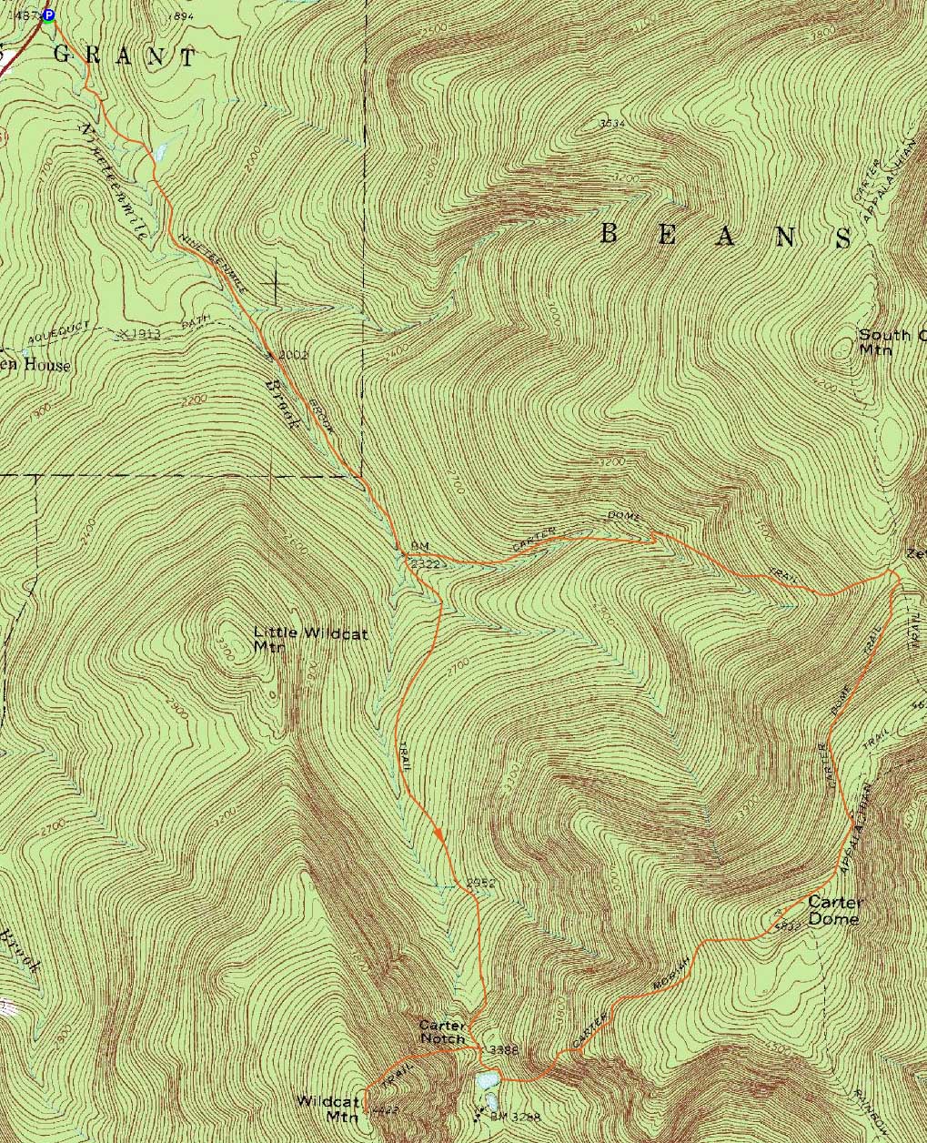
Route: Nineteen Mile Brook Trail, Wildcat Ridge Trail, (Wildcat A), Wildcat Ridge Trail, Nineteen Mile Brook Trail, Carter Moriah Trail, (Carter Dome), Carter Moriah Trail, Carter Dome Trail, Nineteen Mile Brook Trail
My intent was to head up to Wildcat A, then go as far north as I could. Things started off decently - the Nineteen Mile Brook Trail was mostly bare, with the exception of the last half mile or so leading to the height of land.
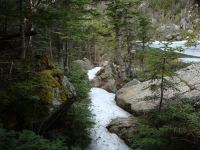
Once at the height of land, I put on my crampons and started the ascent up the Wildcat Ridge Trail. While the trail was fairly firm less than two weeks earlier, the monorail was an absolute mess on this day - very narrow and not at all strong. Thus, lots of slipping and postholing. The slide, fortunately, was much easier to cross than the last few times - a third of the crossing was bare in fact.
The views from the near-summit ledge were good, though hazy and cloudy. Nonetheless, a lot better than my recent trip into a snowstorm.
After a slow descent, I made my way down to the Carter-Moriah Trail junction. Expecting to be dealing with ice, I kept my crampons on. Other than a short stretch down low, the steeps ended up being completely bare and dry - thus the crampons were slightly excessive.
Above the steeps, the monorail made its return. Though not quite as bad as the Wildcat Ridge Trail monorail, it was still pretty poor.
Finally arriving at the summit of Carter Dome (unfortunately, the massive snowdrift that had allowed tremendous views had melted significantly, thus resulting in the peak only having normal views), I decided to visit with some folks who had just climbed it via the north. After having some lunch, I decided to call it a day - I couldn't imagine the trek over to South Carter being particularly enjoyable in these conditions.
Not too far below Zeta Pass, the Carter Dome Trail was mostly bare - perhaps spring is finally beating winter!
| Hike Ratings |
|
Getting To Trailhead: |
Easy |
| Destination: |
Wildcat A |
|
Length: |
Moderate |
|
Steepness: |
Difficult |
|
Navigation: |
Moderate |
|
Views: |
Excellent |
|
Crowds: |
Minimal |
| Destination: |
Carter Dome |
|
Length: |
Difficult |
|
Steepness: |
Difficult |
|
Navigation: |
Easy |
|
Views: |
Excellent |
|
Crowds: |
Minimal |
|
| Hike Stats |
|
Date Hiked: |
Saturday, May 2, 2009 |
| Hike Commenced: |
8:15 AM |
| Parking Elevation: |
1,485' |
| Destination: |
Wildcat A |
| Ascent Commenced: |
8:15 AM |
| Summit Reached: |
10:55 AM |
| Time Elapsed: |
02:40 |
| Trailhead Elevation: |
1,485' |
| Summit Elevation: |
4,422' |
| Distance: |
4.3 miles |
| Vertical Gain: |
3,007' |
| Destination: |
Carter Dome |
| Ascent Commenced: |
11:11 AM |
| Summit Reached: |
1:09 PM |
| Time Elapsed: |
01:58 |
| Trailhead Elevation: |
4,422' |
| Summit Elevation: |
4,832' |
| Vertical Gain: |
1,574' |
|
|
| Hike Ended: |
5:10 PM |
| Hike Time Elapsed: |
08:55 |
| Hike Vertical Gain: |
4,661' |
|
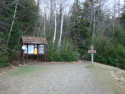
The Nineteen Mile Brook Trail trailhead off Route 16

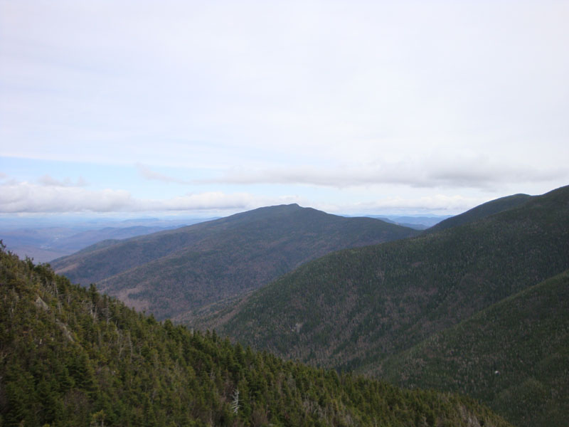
Looking at the Carters from near the Wildcat A summit
The Nineteen Mile Brook Trail on the way to Carter Dome
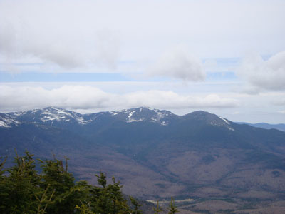
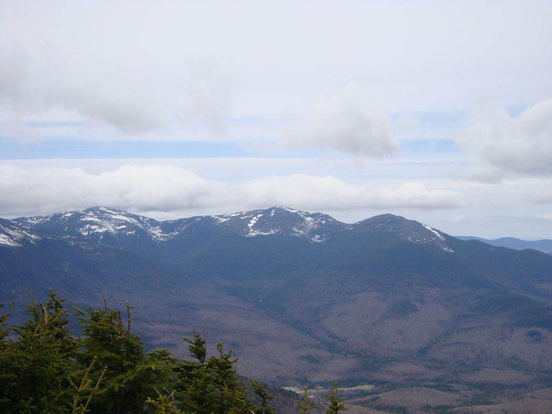
Looking at Mt. Jefferson, Mt. Adams, and Mt. Madison from the Carter Dome viewpoint

Directions to trailhead: Take Route 16 North past the Mt. Washington Auto Road entrance. Shortly thereafter, the Nineteen Mile Brook Trail WMNF fee parking area and trailhead are on the right side of the road, immediately after the brook.
Back to Wildcat A Profile
Back to Carter Dome Profile
|