Home
States
Colorado
Connecticut
Maine
Massachusetts
New Hampshire
New York
Rhode Island
Utah
Vermont
View All
Lists
NE 4,000 Footers
NE 100 Highest
NH 4,000 Footers
NH 100 Highest
NH 52 With A View
NH Belknap Range
NH Ossipee 10
Links
Trail Conditions
Trip Log
Sunrises
Sunsets
About
|
Wildcat D, Wildcat C, Wildcat B, Wildcat A
Pinkham's Grant, NH, Bean's Grant, NH
Trailheads, measurements, times, distances, and maps are all approximate and relative to the hike(s) as shown below.

Looking down one of the ski trails on the way to Wildcat D
Route: Ski trails, Wildcat Ridge Trail, (Wildcat D), Wildcat Ridge Trail, (Wildcat C), Wildcat Ridge Trail, (Wildcat B), Wildcat Ridge Trail, (Wildcat A), Wildcat Ridge Trail, (Wildcat B), Wildcat Ridge Trail, (Wildcat C), Wildcat Ridge Trail, bushwhack, ski trails
Ski area is still in early stages of mowing, so the work road is generally the easiest going. I stayed on Polecat proper, cutting off the work road in a few places on either mowed grass or minimal unmowed stretches. Generally dry with only one minor muddy area.
Wildcat Ridge Trail had some mud, running water, and wet ledge on the rocky portion of the ascent up C. Otherwise, generally dry across the ridge.
On the return, after climbing out of the C-D col, before the sustained steep (with a few random log steps), I did the quick bushwhack over to the ski area (second half was via a herd path) to cut off reclimbing D peak. Easy going once you can see the light of the ski slope as a guide.
Warmer temps than yesterday, but occasional summit fog. Lots of hikers out. Lots of wildflowers and monarch butterflies on the ski slopes. A few trees already turning.
| Hike Ratings |
|
Getting To Trailhead: |
Easy |
| Destination: |
Wildcat D |
|
Length: |
Moderate |
|
Steepness: |
Difficult |
|
Navigation: |
Easy |
|
Views: |
Excellent |
|
Crowds: |
Moderate |
| Destination: |
Wildcat C |
|
Length: |
Moderate |
|
Steepness: |
Difficult |
|
Navigation: |
Easy |
|
Views: |
Minimal |
|
Crowds: |
Moderate |
| Destination: |
Wildcat B |
|
Length: |
Moderate |
|
Steepness: |
Difficult |
|
Navigation: |
Easy |
|
Views: |
Minimal |
|
Crowds: |
Moderate |
| Destination: |
Wildcat A |
|
Length: |
Moderate |
|
Steepness: |
Difficult |
|
Navigation: |
Easy |
|
Views: |
Excellent |
|
Crowds: |
Moderate |
|
| Hike Stats |
|
Date Hiked: |
Sunday, September 2 |
| Parking Elevation: |
1,960' |
| Destination: |
Wildcat D |
| Time Elapsed: |
00:51 |
| Trailhead Elevation: |
1,950' |
| Summit Elevation: |
4,062' |
| Vertical Gain: |
2,112' |
| Destination: |
Wildcat C |
| Time Elapsed: |
01:04 |
| Trailhead Elevation: |
4,070' |
| Summit Elevation: |
4,285' |
| Vertical Gain: |
585' |
| Destination: |
Wildcat B |
| Time Elapsed: |
00:28 |
| Trailhead Elevation: |
4,285' |
| Summit Elevation: |
4,305' |
| Vertical Gain: |
195' |
| Destination: |
Wildcat A |
| Time Elapsed: |
00:13 |
| Trailhead Elevation: |
4,305' |
| Summit Elevation: |
4,422' |
| Vertical Gain: |
182' |
|
|
| Hike Time Elapsed: |
03:21 |
| Hike Vertical Gain: |
3,511' |
|

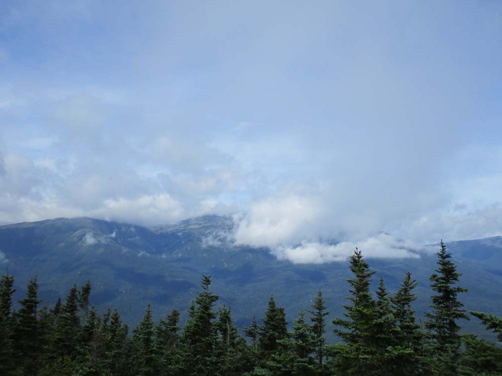
Mt. Washington in the clouds as seen from Wildcat D

The eroded Wildcat Ridge Trail between D and C

Minimal views from the summit of Wildcat C

Wildcat Ridge Trail to Wildcat B

Wildcat A as seen from Wildcat B

Wildcat Ridge Trail to Wildcat A

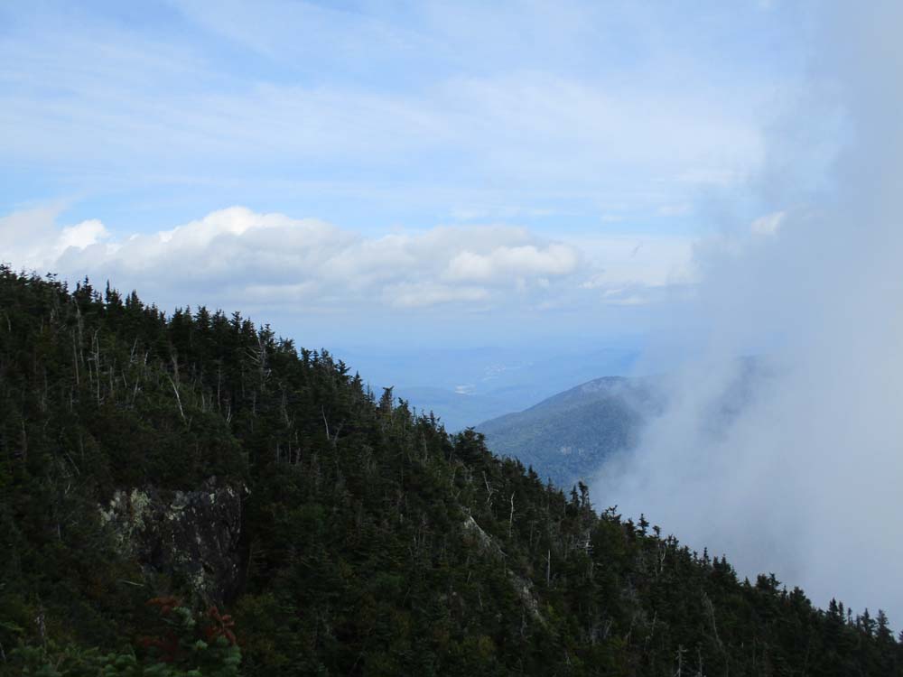
Looking northwest from the Wildcat A vista
Directions to trailhead: Take Route 16 North from Jackson to the Wildcat Ski Area entrance. The Polecat ski trail is located next to the summit quad/gondola base terminal.
Back to Wildcat D Profile
Back to Wildcat C Profile
Back to Wildcat B Profile
Back to Wildcat A Profile
|