Home
States
Colorado
Connecticut
Maine
Massachusetts
New Hampshire
New York
Rhode Island
Utah
Vermont
View All
Lists
NE 4,000 Footers
NE 100 Highest
NH 4,000 Footers
NH 100 Highest
NH 52 With A View
NH Belknap Range
NH Ossipee 10
Links
Trail Conditions
Trip Log
Sunrises
Sunsets
About
|
Wonalancet Hedgehog
Albany, NH, Waterville Valley, NH
Trailheads, measurements, times, distances, and maps are all approximate and relative to the hike(s) as shown below.
The Walden Trail
Route: Old Mast Road, Walden Trail, (Wonalancet Hedgehog), spur path, Walden Trail, Old Mast Road
After doing a bunch of driving on Monday, I wasn't feeling up to doing much more. Thus, I decided to try out a new local peak.
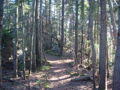
In a previous hike, I had come very close to Wonalancet Hedgehog, but didn't bother to go to the actual summit. This time, I decided to go up the Old Mast Road, a hiking highway of sorts, then head up the Walden Trail. While I had heard this section of trail was rough, I didn't find it to be too too bad - there are a few short scrambles, but its nothing like the nearby Blueberry Ledge Trail.
While the summit of Wonalancet Hedgehog was wooded (well, a big boulder to be precise), there were multiple nearby viewpoints. The one closest to the summit was particularly impressive, with great views to the south, however I found the ledge to be a little bit iffy (angled downhill with a big dropoff and some slippery stuff on it).
Since I'm not a fan of the Wonalancet Range Trail near the lower Short Cut junction, I decided to go back from whence thou came. The steeper sections of the Walden Trail were a bit tricky with loose dirt, however the Old Mast Road proved to be an easy end of the hike.
| Hike Ratings |
|
Getting To Trailhead: |
Easy |
| Destination: |
Wonalancet Hedgehog |
|
Length: |
Moderate |
|
Steepness: |
Very Difficult |
|
Navigation: |
Easy |
|
Views: |
Excellent |
|
Crowds: |
Minimal |
|
| Hike Stats |
|
Date Hiked: |
Wednesday, September 3, 2008 |
| Hike Commenced: |
3:29 PM |
| Parking Elevation: |
1,140' |
| Destination: |
Wonalancet Hedgehog |
| Ascent Commenced: |
3:30 PM |
| Summit Reached: |
4:42 PM |
| Time Elapsed: |
01:12 |
| Trailhead Elevation: |
1,140' |
| Summit Elevation: |
3,140' |
| Distance: |
2.9 miles |
| Vertical Gain: |
2,080' |
|
|
| Hike Ended: |
6:08 PM |
| Hike Time Elapsed: |
02:39 |
| Hike Vertical Gain: |
2,200' |
|
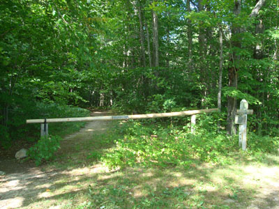
The Old Mast Road trailhead
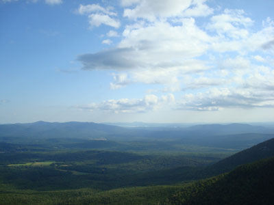
Looking south at the Ossipees, Belknaps, and Red Hill from the vista near the Wonalancet Hedgehog summit.
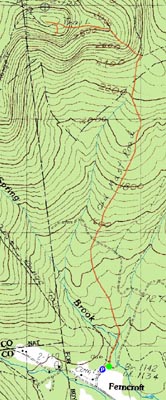

Directions to trailhead: Take Route 113A to Wonalancet, then take Ferncroft Road. The trailhead (the road) and parking lot are both on the right next to the pasture.
Back to Wonalancet Hedgehog Profile
|