Home
States
Colorado
Connecticut
Maine
Massachusetts
New Hampshire
New York
Rhode Island
Utah
Vermont
View All
Lists
NE 4,000 Footers
NE 100 Highest
NH 4,000 Footers
NH 100 Highest
NH 52 With A View
NH Belknap Range
NH Ossipee 10
Links
Trail Conditions
Trip Log
Sunrises
Sunsets
About
|
Malans Peak
Weber County, UT
Trailheads, measurements, times, distances, and maps are all approximate and relative to the hike(s) as shown below.

Looking down Malan's Basin Trail
Route: Herd paths, Bonneville Trail, Taylor Canyon South Trail, Taylor Canyon Trail, Malan's Basin Trail, (Malans Peak), Malan's Basin Trail, Taylor Canyon Trail, herd paths
Wanting to do a lunch time jog, I opted for Malans Peak above Ogden. Starting on 27th Street, I followed a series of herd paths up to Bonneville Trail, then in error continued south to the Taylor Canyon South Trail. I soon corrected this and crossed over to the Taylor Canyon Trail. After following this gradual trail for awhile, I took a right onto Malan's Basin Trail. Though never overly steep, it was certainly steady as it ascended the mountain via switchbacks.
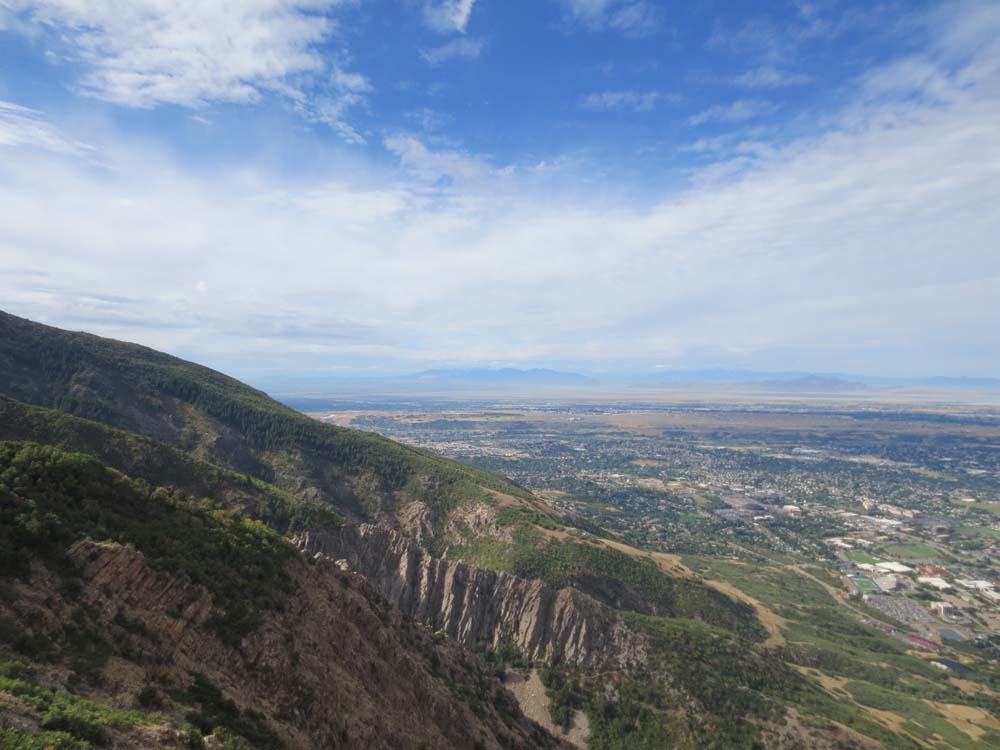
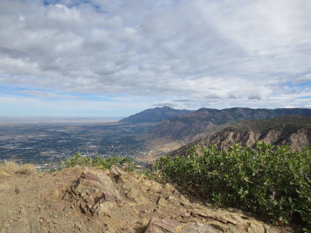
Eventually reaching the summit, I had excellent views in all directions. Had there been time, it would have been fun to continue up to Mt. Ogden, however I had to get back to work.
| Hike Ratings |
|
Getting To Trailhead: |
Easy |
| Destination: |
Malans Peak |
|
Length: |
Moderate |
|
Steepness: |
Moderate |
|
Navigation: |
Moderate |
|
Views: |
Excellent |
|
Crowds: |
Moderate |
|
| Hike Stats |
|
Date Hiked: |
Tuesday, August 27, 2013 |
| Parking Elevation: |
4,840' |
| Destination: |
Malans Peak |
| Time Elapsed: |
00:52 |
| Trailhead Elevation: |
4,840' |
| Summit Elevation: |
6,980' |
| Distance: |
2.5 miles |
| Vertical Gain: |
2,160' |
|
|
| Hike Time Elapsed: |
01:36 |
| Hike Vertical Gain: |
2,180' |
|

The start of a path at the end of 27th Street

Looking down Malan's Basin Trail

Looking southwest from Malans Peak

Looking north from Malans Peak


Directions to trailhead: From Ogden, take 27th Street to its uphill end. There is limited roadside parking. Various paths depart at the gates.
Back to Malans Peak Profile
|