Home
States
Colorado
Connecticut
Maine
Massachusetts
New Hampshire
New York
Rhode Island
Utah
Vermont
View All
Lists
NE 4,000 Footers
NE 100 Highest
NH 4,000 Footers
NH 100 Highest
NH 52 With A View
NH Belknap Range
NH Ossipee 10
Links
Trail Conditions
Trip Log
Sunrises
Sunsets
About
|
East Mountain
East Haven, VT
Trailheads, measurements, times, distances, and maps are all approximate and relative to the hike(s) as shown below.
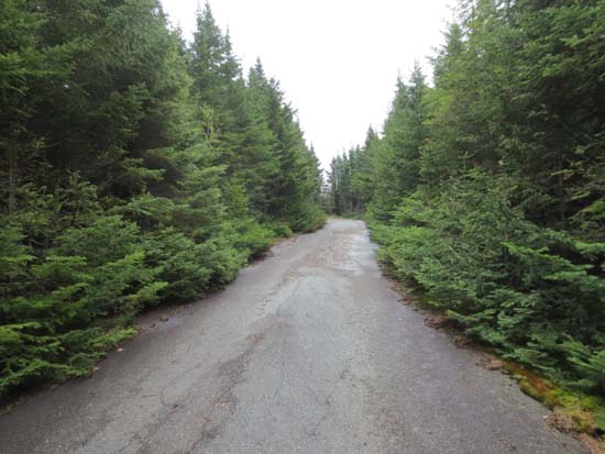
Looking up Radar Road
Route: Radar Road
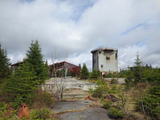
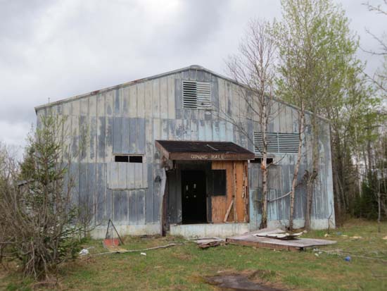
This is not your normal Northeast Kingdom hike. Basically it's a paved road walk. It sort of feels like you woke up 50 years after some sort of cold war nuclear apocalypse. It's quite a sight to see all of these old buildings standing, both at the base camp and the summit. There are no no trespassing signs, however there are a lot of asbestos warning signs.
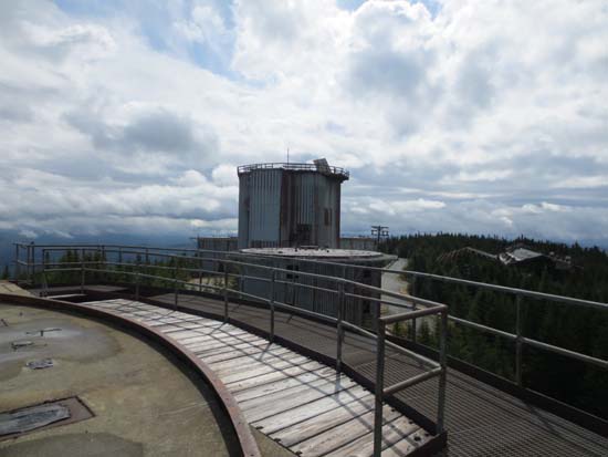
Some of the summit buildings didn't seem safe to poke around. We did find one building, the second one beyond the tallest one, which seemed to be largely made of concrete. We got up to the roof on this one, from where we had good views in most directions (there's not much to see in way of views from the ground). Basically two flights of stairs and then a ladder (either one outside or inside, your choice).
| Hike Ratings |
|
Getting To Trailhead: |
Moderate |
| Destination: |
East Mountain |
|
Length: |
Moderate |
|
Steepness: |
Moderate |
|
Navigation: |
Easy |
|
Views: |
Excellent |
|
Crowds: |
Minimal |
|
| Hike Stats |
|
Date Hiked: |
Sunday, May 12, 2013 |
| Parking Elevation: |
2,394' |
| Destination: |
East Mountain |
| Time Elapsed: |
00:46 |
| Trailhead Elevation: |
2,394' |
| Summit Elevation: |
3,439' |
| Vertical Gain: |
1,065' |
|
|
| Hike Time Elapsed: |
02:12 |
| Hike Vertical Gain: |
1,085' |
|
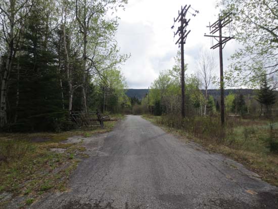
Radar Road at the abandoned base camp
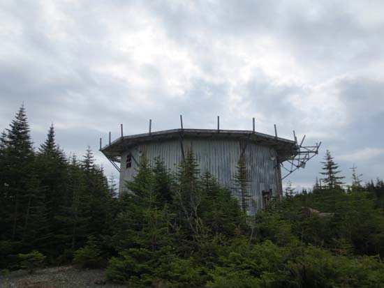
Abandoned radar facility on East Mountain
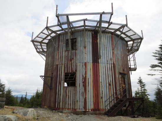
Abandoned radar facility on East Mountain
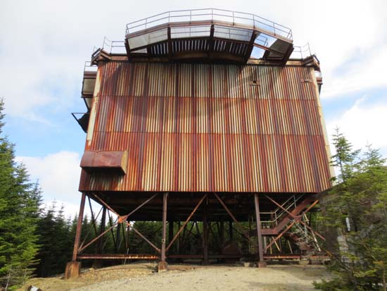
Abandoned radar facility on East Mountain
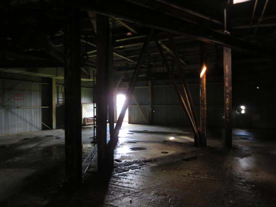
Abandoned radar facility on East Mountain
Abandoned radar facility on East Mountain
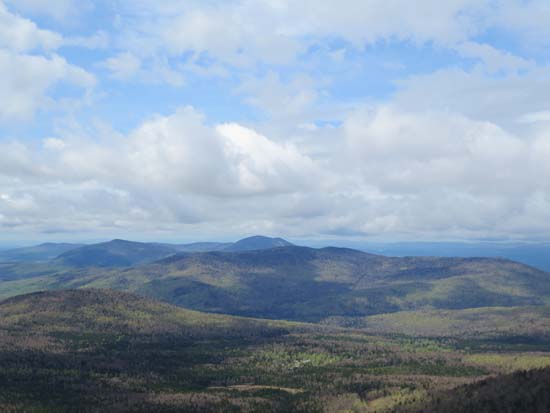
Looking southwest at Burke Mountain from one of the structures on East Mountain
Abandoned radar facility on East Mountain
Time for lunch!
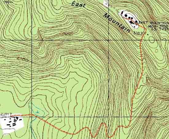

Directions to trailhead: From Exit 1 of Interstate 93 in Vermont, take US 2 East. In North Concord, take a left onto Victory Road. Victory Road eventually becomes River Road and continues to Gallup Mills. At this four way junction, take a left, cross the river, then take a right onto Radar Road. Within a few hundred yards of leaving Victory/River Road, there is a gate (open today). A few miles up the road, there is sort of a three way intersection, where Radar Road is going right (pavement starts - a little bumpy, but not too bad). There is another gate on Radar Road near here, which was also open today. One could have driven to the summit today, or parked at the abandoned base camp and walked to the summit.
Back to East Mountain Profile
|

