Home
States
Colorado
Connecticut
Maine
Massachusetts
New Hampshire
New York
Rhode Island
Utah
Vermont
View All
Lists
NE 4,000 Footers
NE 100 Highest
NH 4,000 Footers
NH 100 Highest
NH 52 With A View
NH Belknap Range
NH Ossipee 10
Links
Trail Conditions
Trip Log
Sunrises
Sunsets
About
|
Elmore Mountain
Elmore, VT
Trailheads, measurements, times, distances, and maps are all approximate and relative to the hike(s) as shown below.

Looking down the Elmore Mountain Trail
Route: Roadwalk, Elmore Mountain Trail
After great weather on Mansfield, I decided to do a second hike on the drive back. Starting at the plowed parking lot off Beach Road, I snowshoed up the access road to the summer hiking trailheads. From there, the Elmore Mountain Trail was a roadwalk for awhile, until finally turning off and heading into the woods.
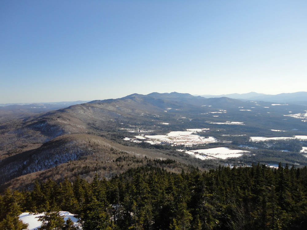
After passing near the old fire warden's cabin clearing (good views), the trail quickly steepened up as it climbed up to the ridge. From there, it was a short walk to the tower. While there were no views from the ground (though it looked like there could be a few ledges nearby), the fire tower offered a 360 degree vista, ranging from the Presidentials to Jay Peak to Mt. Mansfield.
| Hike Ratings |
|
Getting To Trailhead: |
Easy |
| Destination: |
Elmore Mountain |
|
Length: |
Moderate |
|
Steepness: |
Difficult |
|
Navigation: |
Easy |
|
Views: |
Excellent |
|
Crowds: |
Minimal |
|
| Hike Stats |
|
Date Hiked: |
Thursday, April 7, 2011 |
| Parking Elevation: |
1,150' |
| Time to Trailhead: |
00:17 |
| Destination: |
Elmore Mountain |
| Time Elapsed: |
00:42 |
| Trailhead Elevation: |
1,400' |
| Summit Elevation: |
2,608' |
| Vertical Gain: |
1,218' |
|
|
| Hike Time Elapsed: |
02:00 |
| Hike Vertical Gain: |
1,478' |
|

The Elmore Mountain Trail trailhead

Looking south at the Worcestor Range from the Elmore Mountain fire tower


Directions to trailhead: From Morrisville, Vermont, take Route 12 south. In the winter months, the Elmore State Park entrance is closed. Alomst immediately thereafter, Beach Road is on the right. Just down Beach Road on the right, there is a plowed parking area. Continue on foot from this parking area into the park, then take a left and follow the signs up the access road to the summer trailhead.
Back to Elmore Mountain Profile
|