Home
States
Colorado
Connecticut
Maine
Massachusetts
New Hampshire
New York
Rhode Island
Utah
Vermont
View All
Lists
NE 4,000 Footers
NE 100 Highest
NH 4,000 Footers
NH 100 Highest
NH 52 With A View
NH Belknap Range
NH Ossipee 10
Links
Trail Conditions
Trip Log
Sunrises
Sunsets
About
|
Haystack Mountain
Wilmington, VT
Trailheads, measurements, times, distances, and maps are all approximate and relative to the hike(s) as shown below. "Summit" photos may in fact not be at the actual summit - but instead at the best nearby vista.
Haystack Mountain Trail
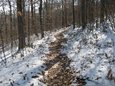
I started this hike relatively late in the day considering the time of the year (because I was busy watching the Three Stooges that morning). Though the trailhead was bare, there was snow at probably 2,500' in elevation and 2-3" on the summit of Haystack Mountain. The trail is easy to follow if you look for the blue markers and the occasional "top" arrow, however I missed one when going around a blowdown near the summit - the footprints in the snow eventually disappeared and I turned around a few hundred feet later after hitting some big mud pits.
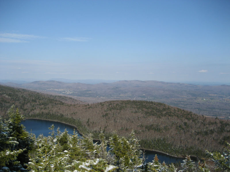
The view from the summit is good, but not as good as nearby Mt. Snow.
| Hike Ratings |
|
Getting To Trailhead: |
Moderate |
| Destination: |
Haystack Mountain |
|
Length: |
Moderate |
|
Steepness: |
Moderate |
|
Navigation: |
Moderate |
|
Views: |
Excellent |
|
Crowds: |
Moderate |
|
| Hike Stats |
|
Date Hiked: |
November 5, 2006 |
| Hike Commenced: |
12:00 PM |
| Parking Elevation: |
2,416' |
| Destination: |
Haystack |
| Ascent Commenced: |
12:00 PM |
| Summit Reached: |
1:06 PM |
| Trailhead Elevation: |
2,414' |
| Summit Elevation: |
3,445' |
| Vertical Gain: |
1,181' |
| Hike Ended: |
2:13 PM |
| Hike Vertical Gain: |
1,233' |
|

Trailhead on Upper Dam Road

Looking northeast over Haystack Pond


Directions to trailhead: Find Upper Dam Road in the Chimney Hill development (it's a maze). The Haystack Mountain Trail sign is toward the top of that road.
Back to Haystack Mountain Profile
|