Home
States
Colorado
Connecticut
Maine
Massachusetts
New Hampshire
New York
Rhode Island
Utah
Vermont
View All
Lists
NE 4,000 Footers
NE 100 Highest
NH 4,000 Footers
NH 100 Highest
NH 52 With A View
NH Belknap Range
NH Ossipee 10
Links
Trail Conditions
Trip Log
Sunrises
Sunsets
About
|
Haystack Mountain
Wilmington, VT
Trailheads, measurements, times, distances, and maps are all approximate and relative to the hike(s) as shown below.

The Haystack Mountain Trail
Route: Haystack Mountain Trail
The trail starts off as a crushed rock covered road, before splitting off to the left onto a proper foot trail. As it reaches the ridge, the corridor widens up into a more winter-friendly route. The last section is a foot path winding up to the summit (the highpoint appears to be one of the knobs to the left of the trail just before the view ledge).
The main view is a little more grown in than I remember, but still good. I also found a few directional views nearby, looking south and west.
| Hike Ratings |
|
Getting To Trailhead: |
Easy |
| Destination: |
Haystack Mountain |
|
Length: |
Moderate |
|
Steepness: |
Moderate |
|
Navigation: |
Easy |
|
Views: |
Excellent |
|
Crowds: |
Moderate |
|
| Hike Stats |
| Date Hiked: |
Saturday, September 7, 2013 |
| Parking Elevation: |
2,414' |
| Destination: |
Haystack Mountain |
| Time Elapsed: |
00:33 |
| Trailhead Elevation: |
2,414' |
| Summit Elevation: |
3,445' |
| Distance: |
2.2 miles |
| Vertical Gain: |
1,081' |
|
|
| Hike Time Elapsed: |
01:15 |
| Hike Vertical Gain: |
1,131' |
|

The Haystack Mountain Trail trailhead

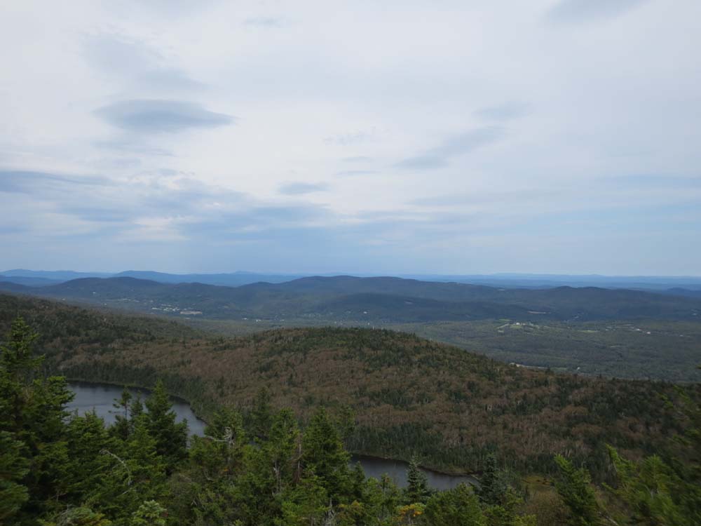
Looking northeast over Haystack Pond


Directions to trailhead: Find Upper Dam Road in the Chimney Hill development (it's a maze). The Haystack Mountain Trail sign is toward the top of that road.
Back to Haystack Mountain Profile
|