Home
States
Colorado
Connecticut
Maine
Massachusetts
New Hampshire
New York
Rhode Island
Utah
Vermont
View All
Lists
NE 4,000 Footers
NE 100 Highest
NH 4,000 Footers
NH 100 Highest
NH 52 With A View
NH Belknap Range
NH Ossipee 10
Links
Trail Conditions
Trip Log
Sunrises
Sunsets
About
|
Killington Peak
Rutland, VT, Killington, VT
Trailheads, measurements, times, distances, and maps are all approximate and relative to the hike(s) as shown below.

Looking down the peak staircase
Route: Warbler Trail, Summit Trail
In the non ski season, the Warbler Trail (C signs) follows gravel access roads from between the Snowdon Triple and Snowdon Quad to just prior to the Canyon Quad, then bee lines up to the Peak Stairway. Trail was generally dry with good footing. One has to be aware of downhill mountain bikers on multi use portions, but not an issue tonight after hours. This route is on par with the Saddleback ski trail route for being perhaps the easiest NE4K approach.
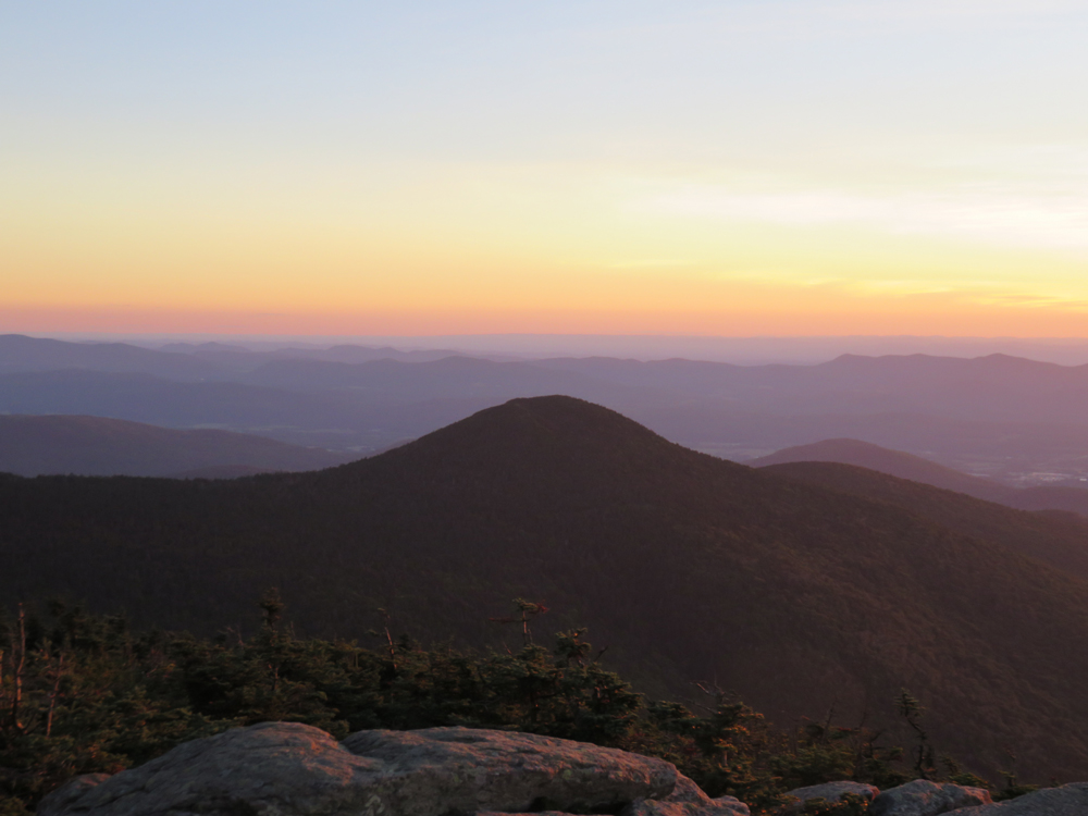
Nice sunset from the summit.
| Hike Ratings |
|
Getting To Trailhead: |
Easy |
| Destination: |
Killington Peak |
|
Length: |
Moderate |
|
Steepness: |
Moderate |
|
Navigation: |
Moderate |
|
Views: |
Excellent |
|
Crowds: |
Moderate |
|
| Hike Stats |
|
Date Hiked: |
Monday, August 29, 2016 |
| Parking Elevation: |
2,500' |
| Destination: |
Killington Peak |
| Time Elapsed: |
00:39 |
| Trailhead Elevation: |
2,500' |
| Summit Elevation: |
4,235' |
| Vertical Gain: |
1,735' |
|
|
| Hike Time Elapsed: |
01:36 |
| Hike Vertical Gain: |
1,735' |
|

The Warbler Trail trailhead

Looking at Mendon Peak from Killington Peak

The sunset from Killington Peak
Directions to trailhead: From the Killington K1 base area, walk northwest past the Snowdon Triple chairlift. The gated access road/Warbler Trail starts thereafter.
Back to Killington Peak Profile
|