Home
States
Colorado
Connecticut
Maine
Massachusetts
New Hampshire
New York
Rhode Island
Utah
Vermont
View All
Lists
NE 4,000 Footers
NE 100 Highest
NH 4,000 Footers
NH 100 Highest
NH 52 With A View
NH Belknap Range
NH Ossipee 10
Links
Trail Conditions
Trip Log
Sunrises
Sunsets
About
|
Mt. Mansfield - The Chin, Mt. Mansfield - The Nose
Stowe, VT, Underhill, VT
Trailheads, measurements, times, distances, and maps are all approximate and relative to the hike(s) as shown below.

Looking up the Profanity Trail
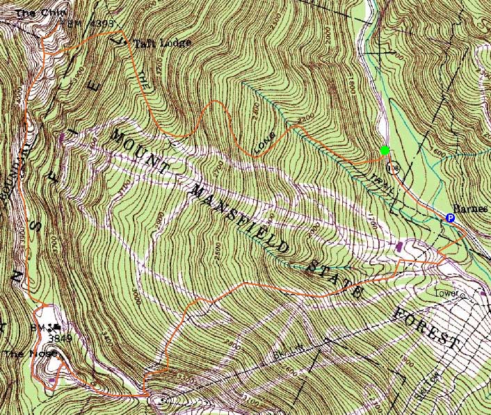
Route: Route 108, Long Trail, Profanity Trail, Long Trail, (The Chin), Long Trail, auto road, unknown trail, (The Nose), unknown trail, Nose Dive, ski trails
With a nice forecast, I headed west to hike Mt. Mansfield. The Long Trail was in decent shape up to the Taft Lodge, though a bit confusing with the ski tracks throughout the glades. Above the cabin, light trailbreaking began. Not wanting to deal with the steep Long Trail out of Eagle Pass, we headed up the Profanity Trail.
The upper portion of the Profanity Trail was a bit dicey, as the gully had a pretty decent, unconsolidated snowfield built up. Reaching the summit of The Chin, we had superb views of both the Whites and Adirondacks.
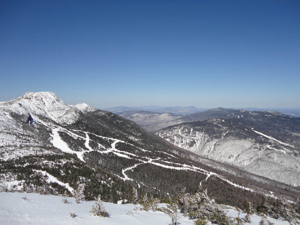
Next, we headed across the ridge to The Nose, alternating between bare ledge and deep snow. From the top of The Nose, we once again had superb views in all directions.
For the descent, we bushwhacked over to the old Nose Dive Trail, then descended via the ski trails.
| Hike Ratings |
|
Getting To Trailhead: |
Easy |
| Destination: |
Mt. Mansfield - The Chin |
|
Length: |
Moderate |
|
Steepness: |
Very Difficult |
|
Navigation: |
Difficult |
|
Views: |
Excellent |
|
Crowds: |
Moderate |
| Destination: |
Mt. Mansfield - The Nose |
|
Length: |
Moderate |
|
Steepness: |
Difficult |
|
Navigation: |
Difficult |
|
Views: |
Excellent |
|
Crowds: |
Moderate |
|
| Hike Stats |
|
Date Hiked: |
Thursday, April 7, 2011 |
| Parking Elevation: |
1,540' |
| Time to Trailhead: |
00:06 |
| Destination: |
Mt. Mansfield - The Chin |
| Time Elapsed: |
01:55 |
| Trailhead Elevation: |
1,620' |
| Summit Elevation: |
4,393' |
| Vertical Gain: |
2,793' |
| Destination: |
Mt. Mansfield - The Nose |
| Time Elapsed: |
00:55 |
| Trailhead Elevation: |
4,393' |
| Summit Elevation: |
4,060' |
| Vertical Gain: |
410' |
|
|
| Hike Time Elapsed: |
04:21 |
| Hike Vertical Gain: |
3,263' |
|

The Long Trail trailhead off Route 108

Looking down the Profanity Trail

Looking at Whiteface from near the Mt. Mansfield summit

The Long Trail on the way to the Nose

Looking up toward Smugglers Notch from the Nose


Directions to trailhead: Take Route 108 North from Stowe. In winter, the road is gated just past the ski area gondola parking lot entrance. There is plowed parking just past that entrance, on the right. The Long Trail will eventually be on the left.
Back to Mt. Mansfield - The Chin Profile
Back to Mt. Mansfield - The Nose Profile
|