Home
States
Colorado
Connecticut
Maine
Massachusetts
New Hampshire
New York
Rhode Island
Utah
Vermont
View All
Lists
NE 4,000 Footers
NE 100 Highest
NH 4,000 Footers
NH 100 Highest
NH 52 With A View
NH Belknap Range
NH Ossipee 10
Links
Trail Conditions
Trip Log
Sunrises
Sunsets
About
|
Mt. Ellen, Cutt's Peak, Nancy Hanks Peak, Lincoln Peak, Mt. Abraham
Starksboro, VT, Buels Gore, VT, Fayston, VT, Warren, VT, Lincoln, VT
Trailheads, measurements, times, distances, and maps are all approximate and relative to the hike(s) as shown below.

Looking up the Jerusalem Trail
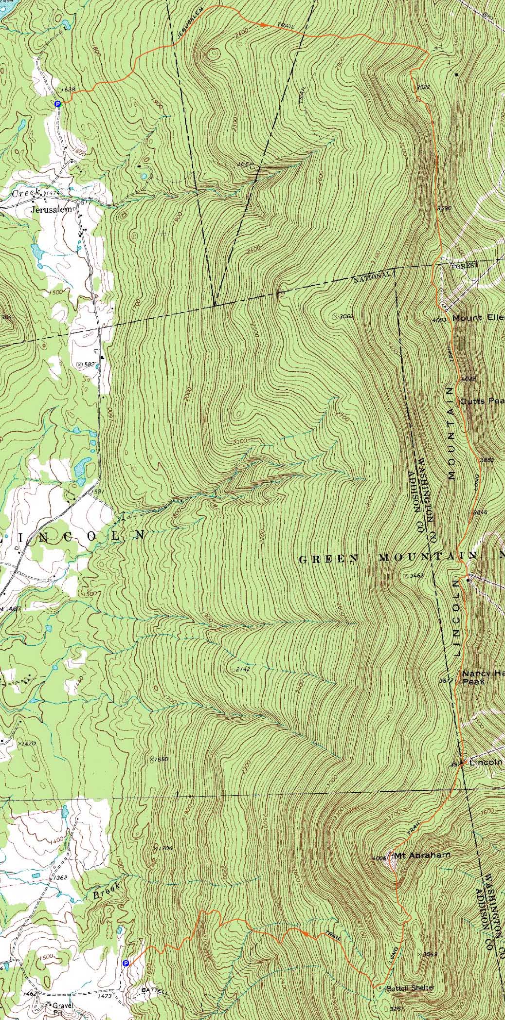
Route: Jerusalem Trail, Long Trail, (Mt. Ellen), Long Trail, (Cutt's Peak), Long Trail, (Nancy Hanks Peak), Long Trail, (Lincoln Peak), Long Trail, (Mt. Abraham), Long Trail, Battell Trail
With some junk moving its way out of New England, we opted to head west and perhaps get a few more hours of clear weather than in New Hampshire and Maine. After spotting a vehicle at the Battell Trail trailhead, we headed over to the Jerusalem Trail.
The Jerusalem Trail started out quite gradually as it worked its way through some nice hardwood forests. Eventually starting to climb, it never became overly steep. While we had fog and clouds overhead, we had a few views through the trees of the valley.
The Long Trail to Mt. Ellen was a bit muddy and had a few minor scrambles. After touching the highpoint on Mt. Ellen, we returned to the top of the chairlift and waited for views as we ate lunch. Unfortunately, the fog never rolled out, so we rolled onward, over Cutts Peak and Castlerock and finally to Nancy Hanks Peak, where we had decent views to the east.
From there, it was a brief walk to the top of Lincoln Peak, where we briefly had excellent views from the observation deck. Once the clouds re-swallowed the summit, we continued onward, over the wooded subpeak called Little Abe and up to Mt. Abraham.
Maybe two minutes below the summit of Mt. Abraham, we followed an obvious herd path to the right to a 1973 Cessna plane crash site. Much of the plane is still there - had they only been a few dozen feet higher, they would have never hit the mountain.
Back on the trail, we reached Mt. Abraham, once again engulfed in clouds. There were some clearing periods, however, which allowed us to see the Breadloaf area to the south, Mt. Ellen to the north, and most impressively, Lake Champlain and the Adirondacks to the northwest.
After an extended break waiting for full cleary and blue sky (which wasn't to be), we continued down the Long Trail, taking our time on some steep, slippery scrambles.
From the shelter area, we headed down the Battell Trail, which was generally smooth sailing with a moderate pitch and decent footing.
| Hike Ratings |
|
Getting To Trailhead: |
Easy |
| Destination: |
Mt. Ellen |
|
Length: |
Moderate |
|
Steepness: |
Difficult |
|
Navigation: |
Easy |
|
Views: |
Minimal (due to weather) |
|
Crowds: |
Moderate |
| Destination: |
Cutt's Peak |
|
Length: |
Moderate |
|
Steepness: |
Moderate |
|
Navigation: |
Easy |
|
Views: |
Minimal (due to weather) |
|
Crowds: |
Minimal |
| Destination: |
Nancy Hanks Peak |
|
Length: |
Moderate |
|
Steepness: |
Moderate |
|
Navigation: |
Easy |
|
Views: |
Excellent |
|
Crowds: |
Minimal |
| Destination: |
Lincoln Peak |
|
Length: |
Moderate |
|
Steepness: |
Difficult |
|
Navigation: |
Easy |
|
Views: |
Excellent |
|
Crowds: |
Minimal |
| Destination: |
Mt. Abraham |
|
Length: |
Moderate |
|
Steepness: |
Difficult |
|
Navigation: |
Easy |
|
Views: |
Excellent |
|
Crowds: |
Minimal |
|
| Hike Stats |
|
Date Hiked: |
Sunday, July 25, 2010 |
| Hike Commenced: |
9:26 AM |
| Parking Elevation: |
1,628' |
| Destination: |
Mt. Ellen |
| Ascent Commenced: |
9:26 AM |
| Summit Reached: |
12:07 PM |
| Time Elapsed: |
02:41 |
| Trailhead Elevation: |
1,628' |
| Summit Elevation: |
4,083' |
| Distance: |
4.2 miles |
| Vertical Gain: |
2,575' |
| Destination: |
Nancy Hanks Peak |
| Ascent Commenced: |
12:30 PM |
| Summit Reached: |
1:52 PM |
| Time Elapsed: |
01:22 |
| Trailhead Elevation: |
4,083' |
| Summit Elevation: |
3,812' |
| Distance: |
2.3 miles |
| Vertical Gain: |
524' |
| Destination: |
Lincoln Peak |
| Ascent Commenced: |
1:52 PM |
| Summit Reached: |
2:13 PM |
| Time Elapsed: |
00:21 |
| Trailhead Elevation: |
3,812' |
| Summit Elevation: |
3,975' |
| Distance: |
0.6 miles |
| Vertical Gain: |
235' |
| Destination: |
Mt. Abraham |
| Ascent Commenced: |
2:31 PM |
| Summit Reached: |
3:04 PM |
| Time Elapsed: |
00:33 |
| Trailhead Elevation: |
3,975' |
| Summit Elevation: |
4,006' |
| Distance: |
0.8 miles |
| Vertical Gain: |
226' |
|
|
| Hike Ended: |
5:23 PM |
| Hike Time Elapsed: |
07:57 |
| Hike Distance: |
10.8 miles |
| Hike Vertical Gain: |
3,570' |
|

The Jerusalem Trail trailhead on Jim Dwire Road

The chairlift terminal near the foggy summit of Mt. Ellen

The Long Trail between Mt. Ellen and Nancy Hanks Peak

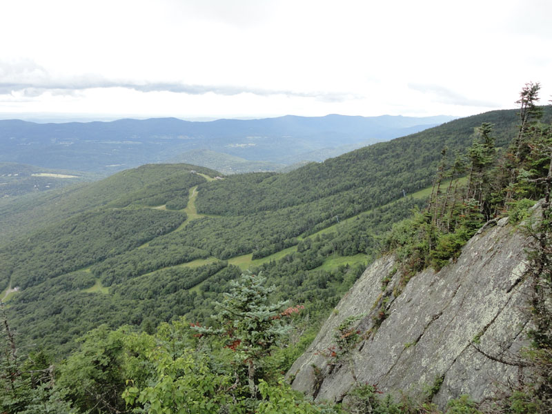
Looking at Sugarbush South from a vista near the summit of Nancy Hanks Peak

The Long Trail between Nancy Hanks Peak and Lincoln Peak

Mt. Abraham as seen from the Lincoln Peak summit deck

The Long Trail between Lincoln Peak and Mt. Abraham

The 1973 Cessna plane wreck near the summit of Mt. Abraham

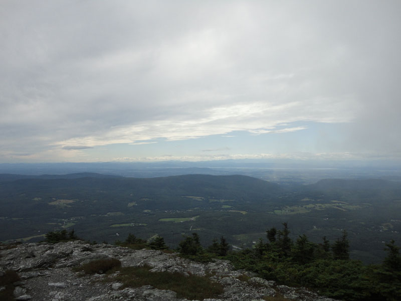
Looking over Lake Champlain toward the Adirondacks from Mt. Abraham

The Battell Trail


Directions to trailhead: From Route 100 in Warren, take Lincoln Gap Road (seasonal) west over Lincoln Gap. Lincoln Gap Road will become East River Road. Bear right onto Quaker Street, passing through Lincoln. Shortly thereafter, take a right onto Elder Hill Road. The Battell Trail trailhead and parking area will eventually be at the end of this road (multiple side roads leave it prior). To get to the Jerusalem Trail trailhead, return to Quaker Street, taking a right onto it. Shortly thereafter, take a right onto Downingsville Road. Awhile after the road turns to dirt, it bears left. Shortly thereafter, take a right onto Jim Dwire Road. The Jerusalem Trail trailhead will be on the right shortly thereafter. There is limited room to park on the side of the road.
Back to Mt. Ellen Profile
Back to Nancy Hanks Peak Profile
Back to Lincoln Peak Profile
Back to Mt. Abraham Profile
|