Home
States
Colorado
Connecticut
Maine
Massachusetts
New Hampshire
New York
Rhode Island
Utah
Vermont
View All
Lists
NE 4,000 Footers
NE 100 Highest
NH 4,000 Footers
NH 100 Highest
NH 52 With A View
NH Belknap Range
NH Ossipee 10
Links
Trail Conditions
Trip Log
Sunrises
Sunsets
About
|
Mt. Ellen, Nancy Hanks Peak, Lincoln Peak, Mt. Abraham
Warren, VT, Lincoln, VT
Trailheads, measurements, times, distances, and maps are all approximate and relative to the hike(s) as shown below.

Looking up the access road to Castlerock
Route: Access road, Long Trail, (Mt. Ellen), Long Trail, (Cutt's Peak), Long Trail, (Nancy Hanks Peak), Long Trail, ski trail, (Lincoln Peak), Long Trail, (Mt. Abraham), Long Trail, (Lincoln Peak), Organ Grinder
Hiked up access road from Super Bravo Quad to top of Castlerock (as to avoid wet grass). Ski trails on this side snow free.
Long Trail snow free as well. Long Trail had slippery rock, minor mud, and some pooled water areas. Otherwise, generally dry (until a powerful downpour this afternoon). Beelined it down the old gondola lift line, reaching the bottom just as the downpour started.
| Hike Ratings |
|
Getting To Trailhead: |
Easy |
| Destination: |
Mt. Ellen |
|
Length: |
Moderate |
|
Steepness: |
Very Difficult |
|
Navigation: |
Moderate |
|
Views: |
Excellent |
|
Crowds: |
Minimal |
| Destination: |
Nancy Hanks Peak |
|
Length: |
Moderate |
|
Steepness: |
Moderate |
|
Navigation: |
Easy |
|
Views: |
Excellent |
|
Crowds: |
Minimal |
| Destination: |
Lincoln Peak |
|
Length: |
Moderate |
|
Steepness: |
Difficult |
|
Navigation: |
Moderate |
|
Views: |
Excellent |
|
Crowds: |
Minimal |
| Destination: |
Mt. Abraham |
|
Length: |
Moderate |
|
Steepness: |
Difficult |
|
Navigation: |
Moderate |
|
Views: |
Excellent |
|
Crowds: |
Heavy |
|
| Hike Stats |
|
Date Hiked: |
Saturday, May 28, 2011 |
| Parking Elevation: |
1,585' |
| Destination: |
Mt. Ellen |
| Time Elapsed: |
01:53 |
| Trailhead Elevation: |
1,620' |
| Summit Elevation: |
4,083' |
| Vertical Gain: |
2,773' |
| Destination: |
Nancy Hanks Peak |
| Time Elapsed: |
01:08 |
| Trailhead Elevation: |
4,083' |
| Summit Elevation: |
3,812' |
| Distance: |
2.3 miles |
| Vertical Gain: |
524' |
| Destination: |
Lincoln Peak |
| Time Elapsed: |
00:15 |
| Trailhead Elevation: |
3,812' |
| Summit Elevation: |
3,975' |
| Vertical Gain: |
235' |
| Destination: |
Mt. Abraham |
| Time Elapsed: |
00:27 |
| Trailhead Elevation: |
3,975' |
| Summit Elevation: |
4,006' |
| Distance: |
0.8 miles |
| Vertical Gain: |
226' |
|
|
| Hike Time Elapsed: |
05:30 |
| Hike Vertical Gain: |
3,988' |
|

The beginning of the access road next to the Super Bravo lift at Sugarbush

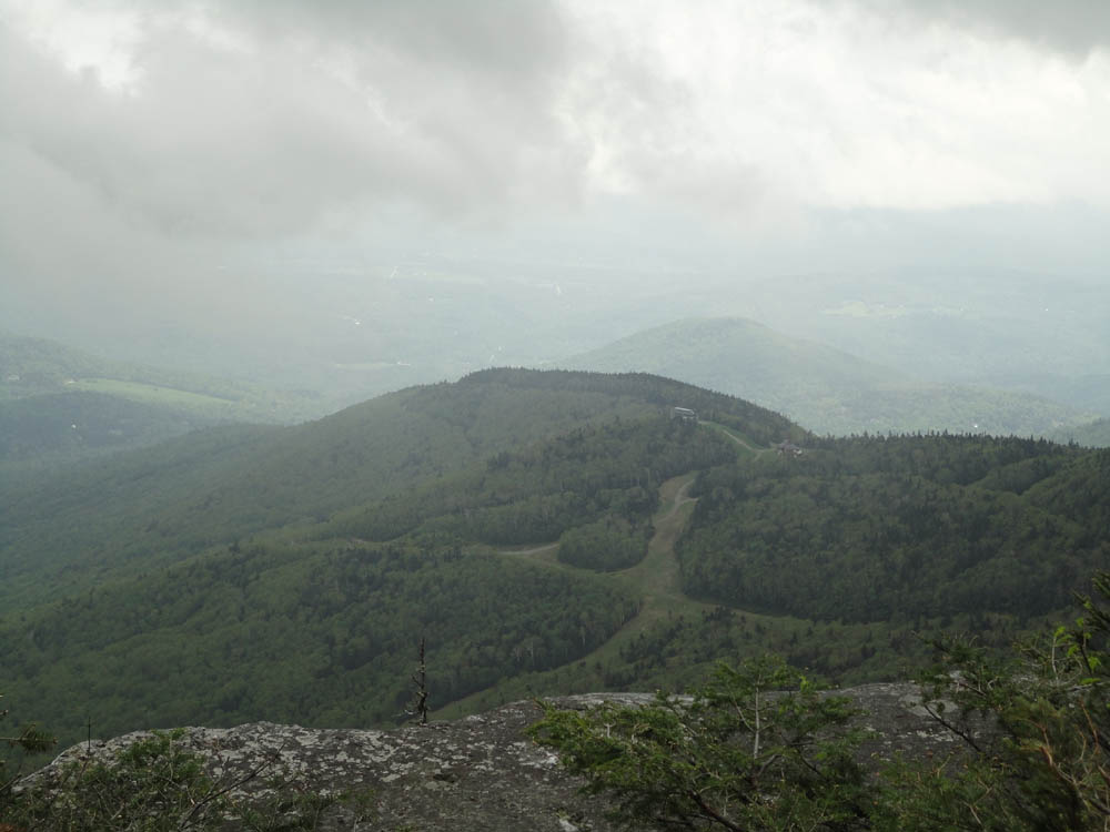
Looking north from near the summit of Mt. Ellen

The Long Trail between Mt. Ellen and Nancy Hanks Peak

Looking at Sugarbush south from the viewpoint on Nancy Hanks Peak

The Long Trail between Nancy Hanks Peak and Lincoln Peak

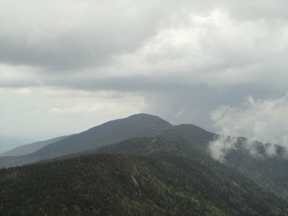
Looking at Mt. Ellen from the Lincoln Peak summit deck

The Long Trail between Lincoln Peak and Mt. Abraham

The plane crash near the summit of Mt. Abraham

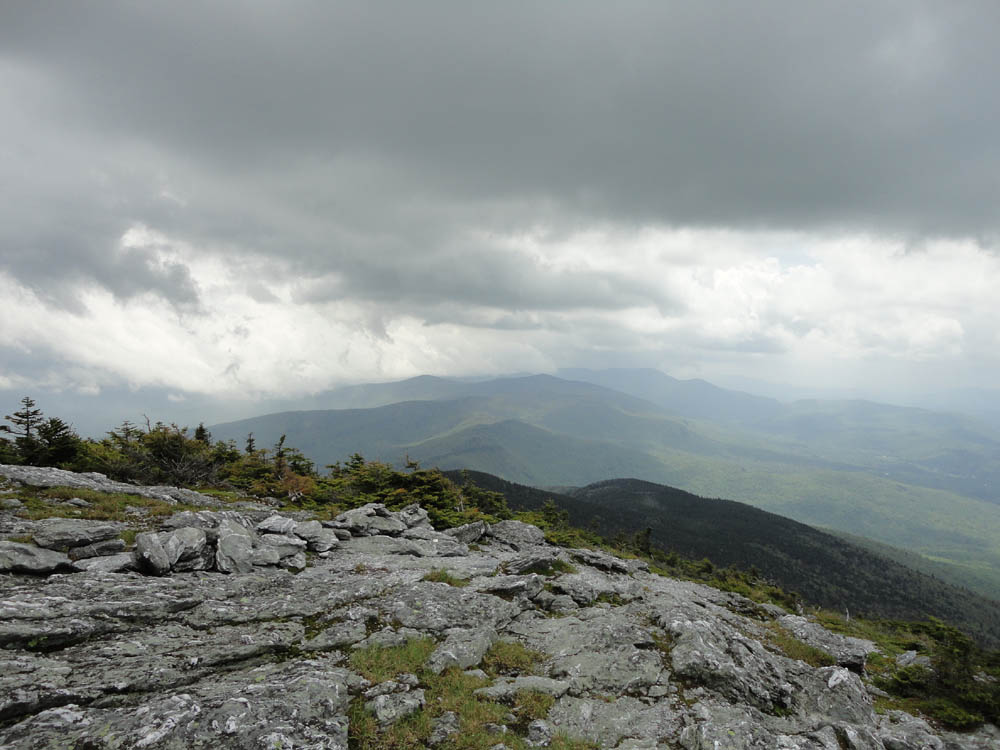
Looking south from Mt. Abraham


Directions to trailhead: From Warren, VT, take Route 100 North to the Sugarbush Access Road (Sugarbush South-Lincoln Peak). There is parking at the end of the road at the ski area.
Back to Mt. Ellen Profile
Back to Nancy Hanks Peak Profile
Back to Lincoln Peak Profile
Back to Mt. Abraham Profile
|