Home
States
Colorado
Connecticut
Maine
Massachusetts
New Hampshire
New York
Rhode Island
Utah
Vermont
View All
Lists
NE 4,000 Footers
NE 100 Highest
NH 4,000 Footers
NH 100 Highest
NH 52 With A View
NH Belknap Range
NH Ossipee 10
Links
Trail Conditions
Trip Log
Sunrises
Sunsets
About
|
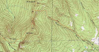
Mt. Wilson, Breadloaf Mountain, Mt. Roosevelt
Granville, VT, Ripton, VT
Trailheads, measurements, times, distances, and maps are all approximate and relative to the hike(s) as shown below.
The Clark Brook Trail
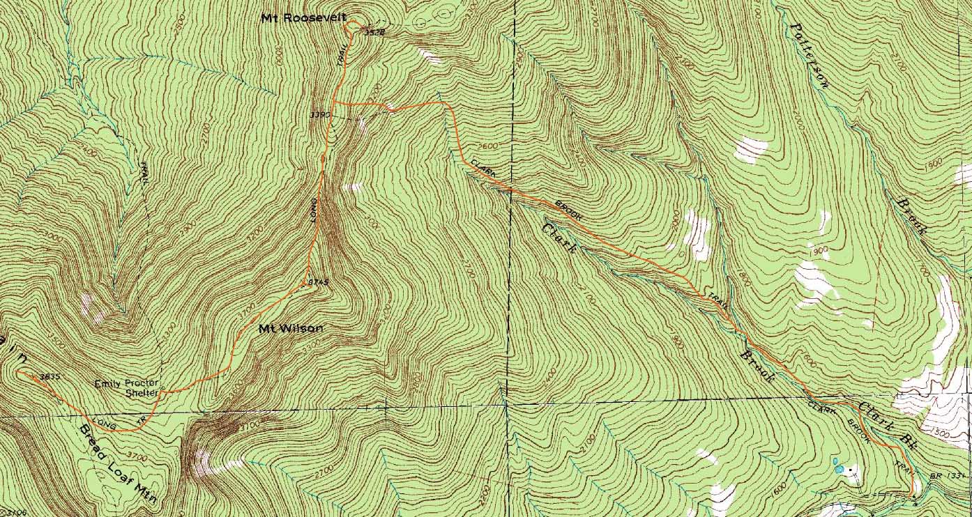
Route: Clark Brook Trail, Long Trail, (Mt. Wilson), Long Trail, herd path, (Breadloaf Mountain), herd path, Long Trail, (Mt. Wilson), Long Trail, (Mt. Roosevelt), Long Trail, Clark Brook Trail
With a sunny day forecasted, I headed west to the Green Mountains.
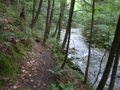
Starting under cloudy skies, I headed up the Clark Brook Trail. Though it was a bit grown in, the footbed was pretty good, allowing for smooth sailing. With the exception of a few short steep pitches, it was pretty easy going.
Reaching the Long Trail, the skies were still cloudy - as a result, the overnight rain wasn't evaporating, leaving plenty of puddles and mudpits. Eventually reaching the Mt. Wilson outlook, I had slight views to the south. Back on trail, about 5 minutes later I reached two bumps, about 2-3 minutes apart, that appeared to be the highpoint of the peak - neither had views.
Nearing the southern knob, the trail quickly dropped down to the Emily Proctor Shelter. With a sharp left turn at the shelter, the Long Trail climbed somewhat roughly and steeply in places back up the ridge, eventually reaching a sharp left turn. From that sharp turn, I followed a blue blazed trail, stepping a few feet of the trail to touch the obvious highpoint of Breadloaf Mountain. Continuing down the spur path, I reached a small outlook which offered hazy views.
Once back at the shelter, I took a snack break and hoped for sun. Other than a few very brief peaks, it wasn't to be.
After crossing back over Mt. Wilson (slightly better views from the northern viewpoint at this point), I continued past the Clark Brook Trail to Mt. Roosevelt. Just past the highpoint, I reached a really nice view ledge - the views were decent, even with the clouds and haze.
Back on the Clark Brook Trail, I took my time descending to the trailhead, as the trail was still a bit wet and slippery.
| Hike Ratings |
|
Getting To Trailhead: |
Easy |
| Destination: |
Mt. Wilson |
|
Length: |
Moderate |
|
Steepness: |
Difficult |
|
Navigation: |
Easy |
|
Views: |
Moderate (due to weather) |
|
Crowds: |
Moderate |
| Destination: |
Breadloaf Mountain |
|
Length: |
Moderate |
|
Steepness: |
Difficult |
|
Navigation: |
Easy |
|
Views: |
Moderate (due to weather) |
|
Crowds: |
Minimal |
| Destination: |
Mt. Wilson |
|
Length: |
Moderate |
|
Steepness: |
Moderate |
|
Navigation: |
Easy |
|
Views: |
Excellent |
|
Crowds: |
Minimal |
| Destination: |
Mt. Roosevelt |
|
Length: |
Moderate |
|
Steepness: |
Difficult |
|
Navigation: |
Easy |
|
Views: |
Excellent |
|
Crowds: |
Minimal |
|
| Hike Stats |
|
Date Hiked: |
Sunday, June 27, 2010 |
| Hike Commenced: |
8:19 AM |
| Parking Elevation: |
1,360' |
| Destination: |
Mt. Wilson |
| Ascent Commenced: |
8:19 AM |
| Summit Reached: |
10:25 AM |
| Time Elapsed: |
02:06 |
| Trailhead Elevation: |
1,360' |
| Summit Elevation: |
3,790' |
| Vertical Gain: |
2,600' |
| Destination: |
Breadloaf Mountain |
| Ascent Commenced: |
10:25 AM |
| Summit Reached: |
11:05 AM |
| Time Elapsed: |
00:40 |
| Trailhead Elevation: |
3,790' |
| Summit Elevation: |
3,835' |
| Vertical Gain: |
360' |
| Destination: |
Mt. Wilson |
| Ascent Commenced: |
11:14 AM |
| Summit Reached: |
11:56 AM |
| Time Elapsed: |
00:42 |
| Trailhead Elevation: |
3,835' |
| Summit Elevation: |
3,790' |
| Vertical Gain: |
315' |
| Destination: |
Mt. Roosevelt |
| Ascent Commenced: |
11:56 AM |
| Summit Reached: |
12:48 PM |
| Time Elapsed: |
00:52 |
| Trailhead Elevation: |
3,790' |
| Summit Elevation: |
3,528' |
| Vertical Gain: |
408' |
|
|
| Hike Ended: |
2:29 PM |
| Hike Time Elapsed: |
06:10 |
| Hike Vertical Gain: |
3,773' |
|
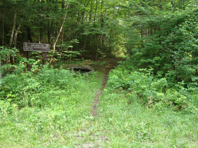
The Clark Brook Trail trailhead off Forest Road 55
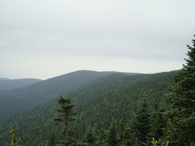
Looking toward Breadloaf Mountain from the northern vista on Mt. Wilson
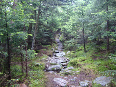
The Long Trail between Mt. Wilson and Breadloaf Mountain
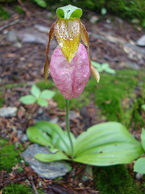
A lady slipper along the Long Trail

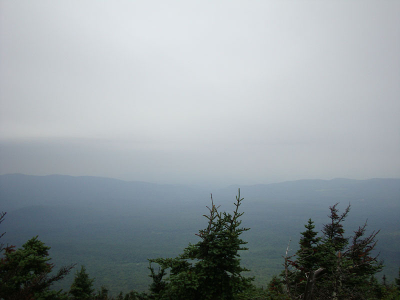
Hazy views from the vista near Breadloaf Mountain

The Long Trail between Mt. Wilson and Mt. Roosevelt
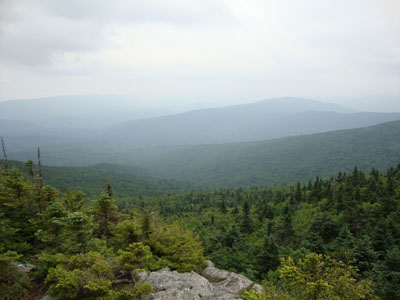
Hazy views from the Mt. Roosevelt view ledges

Directions to trailhead: Take Route 100 North to Granville. Take a left onto West Hill Road. Continue on this road, avoiding right hand turns, as it becomes Forest Road 55. The Clark Brook Trail trailhead is located just after some cabins and a sharp turn, on the right. There is limited room for parking alongside the road before and after the cabins.
Back to Mt. Wilson Profile
Back to Breadloaf Mountain Profile
Back to Mt. Roosevelt Profile
|