Home
States
Colorado
Connecticut
Maine
Massachusetts
New Hampshire
New York
Rhode Island
Utah
Vermont
View All
Lists
NE 4,000 Footers
NE 100 Highest
NH 4,000 Footers
NH 100 Highest
NH 52 With A View
NH Belknap Range
NH Ossipee 10
Links
Trail Conditions
Trip Log
Sunrises
Sunsets
About
|
Ricker Mountain, Vista Peak, Woodward Mountain, Bone Mountain
Bolton, VT, Waterbury, VT
Trailheads, measurements, times, distances, and maps are all approximate and relative to the hike(s) as shown below.

The access road up the ski trails
Route: Ski trails, access road, bushwhack, (Ricker Mountain), bushwhack, access road, ski trails, Woodward Mountain Trail, (Vista Peak), Woodward Mountain Trail, bushwhack, (Woodward Mountain), bushwhack, (Bone Mountain), bushwhack, woods road, ski glades, ski trails
Started from near the main base area (the start of the access road up the ski trails had a gate and sign on it, which I assume was there to prevent folks from driving up...we steered clear of this area and climbed up near the condos), eventually getting onto the gravel work roads up to the top of the Vista Quad. From there, we dropped north on the Vista Glades ski trail, then took a right onto the access road to the communication towers on Ricker Mountain. The access road had some areas of mud and standing water.
While there is a small bump above the tower on Ricker Mountain (some views), the recognized high point is to the east (there's also a false summit with cliffs prior to reaching it). From the west and south sides, the short bushwhack had some steep and scrappy parts. There are some ski glades that ascend to the col between the false (some views if you push around) and true summits from the north that could be a little easier.
We then doubled back to the top of the Vista Quad and hopped onto the Woodward Mountain Trail (ski area boundary above the chairlift), which led to a sketchy wooden observation tower atop 'Vista Peak' shortly thereafter. If you don't like shaky ladders/observation towers, this one isn't for you. Great views if you climb it though, even with the heavy haze today.
The Woodward Mountain Trail appears to be maintained for nordic skiing/snowshoeing with a wide corridor. Slow going due to being overgrown with ferns/grass and hidden mud. While the USGS shows two similar 3,100 contours, we found the recognized highpoint on the southern of the two, a short but scrappy bushwhack east of the trail.
From there, we dropped off the side of Woodward Mountain, in generally decent mixed woods, aiming for the col on Bone Mountain. We fortunately did not try to beeline, as there are major cliffs on that side of the mountain. In addition, the col has some cliffs, so we had to approach from the northeast. The recognized highpoint is wooded, but if you push around to the south side of the contour, there are excellent southern views from the scrub atop the cliffs.
For the descent, we dropped off the northside of the mountain from the false peak, initially in thick woods that soon gave way to quasi gladed spots. A few hundred vertical feet down, we hit a woods road which we followed for awhile, then dropped down to another one which led to the brook (draining from Goose Pond). On the other side of the brook, the main woods road apparently leads to the Timberline condos (lower base area on the access road). We turned and went uphill instead, occasionally following old woods roads, bootleg ski trails, open glades, and occasional cliffbands. We eventually popped out atop the Timberline Quad chairlift, then followed a work road back down to the main base area.
| Hike Ratings |
|
Getting To Trailhead: |
Easy |
| Destination: |
Ricker Mountain |
|
Length: |
Moderate |
|
Steepness: |
Difficult |
|
Navigation: |
Difficult |
|
Views: |
Excellent |
|
Crowds: |
Minimal |
| Destination: |
Vista Peak |
|
Length: |
Moderate |
|
Steepness: |
Moderate |
|
Navigation: |
Easy |
|
Views: |
Excellent |
|
Crowds: |
Minimal |
| Destination: |
Woodward Mountain |
|
Length: |
Moderate |
|
Steepness: |
Moderate |
|
Navigation: |
Difficult |
|
Views: |
Minimal |
|
Crowds: |
Minimal |
| Destination: |
Bone Mountain |
|
Length: |
Moderate |
|
Steepness: |
Difficult |
|
Navigation: |
Difficult |
|
Views: |
Excellent |
|
Crowds: |
Minimal |
|
| Hike Stats |
|
Date Hiked: |
Sunday, July 13, 2014 |
| Parking Elevation: |
2,140' |
| Destination: |
Ricker Mountain |
| Time Elapsed: |
01:28 |
| Trailhead Elevation: |
2,140' |
| Summit Elevation: |
3,410' |
| Vertical Gain: |
1,440' |
| Destination: |
Vista Peak |
| Time Elapsed: |
00:42 |
| Trailhead Elevation: |
3,410' |
| Summit Elevation: |
3,150' |
| Vertical Gain: |
130' |
| Destination: |
Woodward Mountain |
| Time Elapsed: |
00:41 |
| Trailhead Elevation: |
3,150' |
| Summit Elevation: |
3,110' |
| Vertical Gain: |
250' |
| Destination: |
Bone Mountain |
| Time Elapsed: |
01:07 |
| Trailhead Elevation: |
3,110' |
| Summit Elevation: |
2,910' |
| Vertical Gain: |
230' |
|
|
| Hike Time Elapsed: |
05:55 |
| Hike Vertical Gain: |
2,850' |
|

Looking southwest at Camel's Hump from near the summit of Ricker Mountain

The access road between Ricker Mountain and Vista Peak

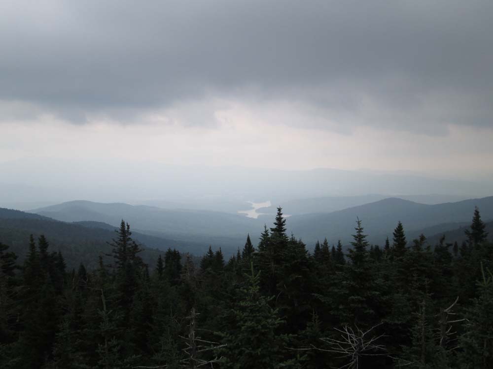
Looking southeast at the Waterbury Reservoir from the Vista Peak observation tower

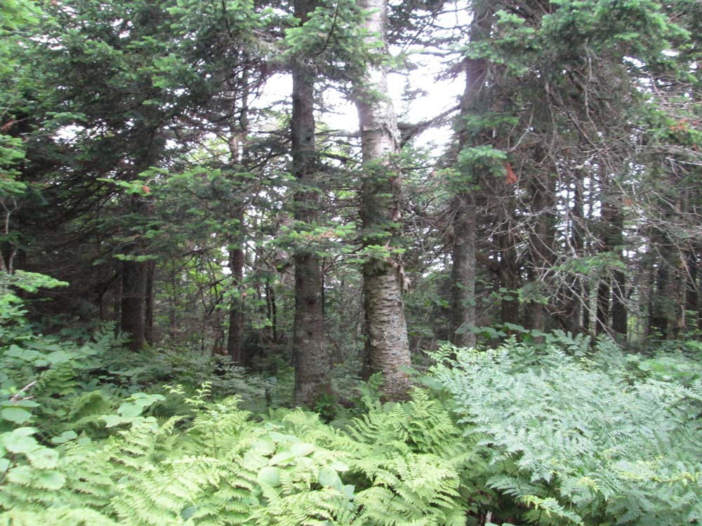
The Woodward Mountain Trail

A lack of views near the highpoint of Woodward Mountain

Bushwhacking to Bone Mountain

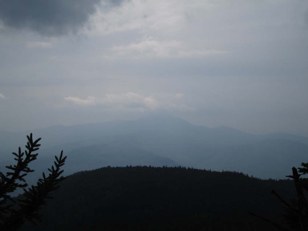
Looking south toward Camel's Hump from the Bone Mountain cliffs


Directions to trailhead: To get to the Worcester Mountain Trail trailhead from Route 12 in Worcester, take Minister Brook Road to Hampshire Hill Road, then take a left onto Mountain Road. There is a grassy parking area at the end of this road. To get to the Middlesex Trail trailhead from Route 12 north of Montpelier, take a left onto Shady Hill Road, then eventually take a right onto Story Road, then bear left onto Chase Road, then take a left onto North Bear Swamp Road. The Middlesex Trail trailhead and parking lot will eventually be the right.
Back to Ricker Mountain Profile
Back to Vista Peak Profile
Back to Woodward Mountain Profile
Back to Bone Mountain Profile
|