Home
States
Colorado
Connecticut
Maine
Massachusetts
New Hampshire
New York
Rhode Island
Utah
Vermont
View All
Lists
NE 4,000 Footers
NE 100 Highest
NH 4,000 Footers
NH 100 Highest
NH 52 With A View
NH Belknap Range
NH Ossipee 10
Links
Trail Conditions
Trip Log
Sunrises
Sunsets
About
|
White Rock Mountain, Mt. Hunger, Mt. Putnam, Mt. Worcester (South Peak), Mt. Worcester
Middlesex, VT, Worcester, VT
Trailheads, measurements, times, distances, and maps are all approximate and relative to the hike(s) as shown below.

The White Rock Trail
Route: Middlesex Trail, Bob Kemp Trail, White Rock Trail, (White Rock Mountain), White Rock Trail, Skyline Trail, (Mt. Hunger), Skyline Trail, (Mt. Putnam), Skyline Trail, (Mt. Worcester South Peak), Skyline Trail, (Mt. Worcester), Worcester Mountain Trail
Hodgepodge of conditions, but generally wet from the continued monsoon.
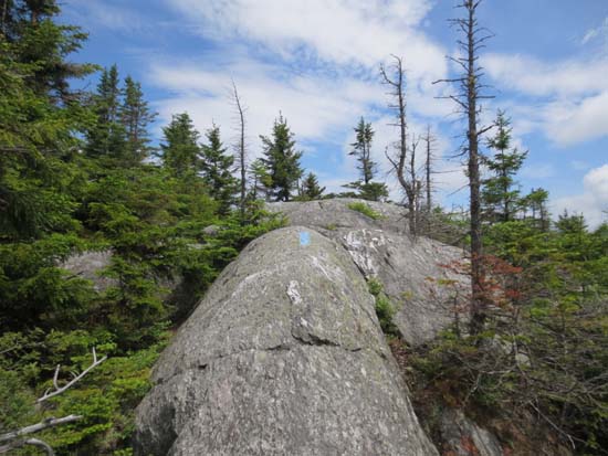
Lower portion of Middlesex Trail alternated between wet and dry with some minor mud and some water running on the trail. The ledges around White Rock Mountain were dry. Similar conditions between there and Mt. Hunger.
Heading north from Mt. Hunger, the ledges were extremely slippery due to the humidity. There were also quite a few mud pits from this ridiculous rain.
The ledges weren't quite as treacherous by the time we made it to Worcester, but they still needed to be passed with care. The ridge as a whole was a lot rougher than the GMC 80 foot contour map looks. Lots of ups and downs, some deep cols, and a minor segment disagreement (between GMC map, Map Adventures map, and trail signs).
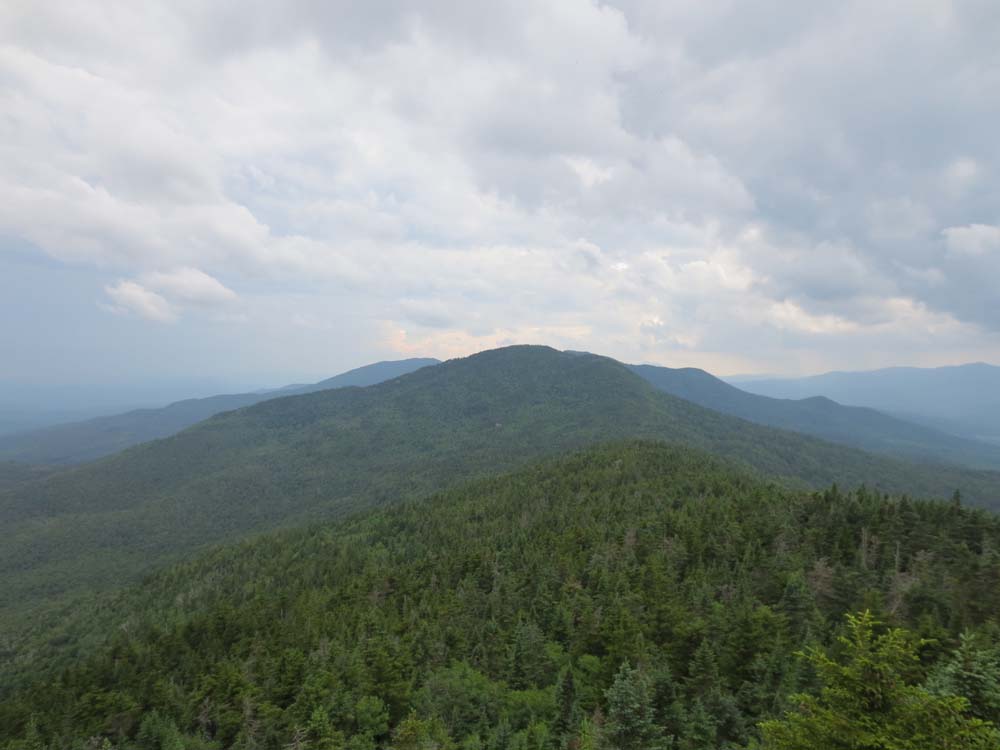
Nice ledge views from White Rock, Hunger, and Worcester.
The skies opened up as we descended Worcester, resulting in an intense downpour for a good half hour. Streams swelled, waterbars were jumped by runoff, trails flooded, etc. Yikes!
If you remove the railgrade portions (of the about to be mentioned comparison hike), this Worcester Range hike is easily more strenuous than a Bonds traverse in New Hampshire. Especially on a hot, humid day.
| Hike Ratings |
|
Getting To Trailhead: |
Easy |
| Destination: |
White Rock Mountain |
|
Length: |
Moderate |
|
Steepness: |
Difficult |
|
Navigation: |
Easy |
|
Views: |
Excellent |
|
Crowds: |
Minimal |
| Destination: |
Mt. Hunger |
|
Length: |
Moderate |
|
Steepness: |
Difficult |
|
Navigation: |
Easy |
|
Views: |
Excellent |
|
Crowds: |
Heavy |
| Destination: |
Mt. Putnam |
|
Length: |
Difficult |
|
Steepness: |
Difficult |
|
Navigation: |
Easy |
|
Views: |
Excellent |
|
Crowds: |
Minimal |
| Destination: |
Mt. Worcester (South Peak) |
|
Length: |
Difficult |
|
Steepness: |
Difficult |
|
Navigation: |
Easy |
|
Views: |
Minimal |
|
Crowds: |
Minimal |
| Destination: |
Mt. Worcester |
|
Length: |
Difficult |
|
Steepness: |
Difficult |
|
Navigation: |
Easy |
|
Views: |
Excellent |
|
Crowds: |
Minimal |
|
| Hike Stats |
|
Date Hiked: |
Friday, July 5, 2013 |
| Parking Elevation: |
1,580' |
| Destination: |
White Rock Mountain |
| Time Elapsed: |
01:12 |
| Trailhead Elevation: |
1,580' |
| Summit Elevation: |
3,194' |
| Vertical Gain: |
1,634' |
| Destination: |
Mt. Hunger |
| Time Elapsed: |
00:39 |
| Trailhead Elevation: |
3,194' |
| Summit Elevation: |
3,539' |
| Vertical Gain: |
539' |
| Destination: |
Mt. Putnam |
| Time Elapsed: |
00:38 |
| Trailhead Elevation: |
3,539' |
| Summit Elevation: |
3,642' |
| Vertical Gain: |
682' |
| Destination: |
Mt. Worcester (South Peak) |
| Time Elapsed: |
01:12 |
| Trailhead Elevation: |
3,642' |
| Summit Elevation: |
3,477' |
| Vertical Gain: |
647' |
| Destination: |
Mt. Worcester |
| Time Elapsed: |
01:15 |
| Trailhead Elevation: |
3,477' |
| Summit Elevation: |
3,293' |
| Vertical Gain: |
573' |
|
|
| Hike Time Elapsed: |
07:53 |
| Hike Vertical Gain: |
4,095' |
|

The Middlesex Trail trailhead

Looking at Camel's Hump from White Rock Mountain

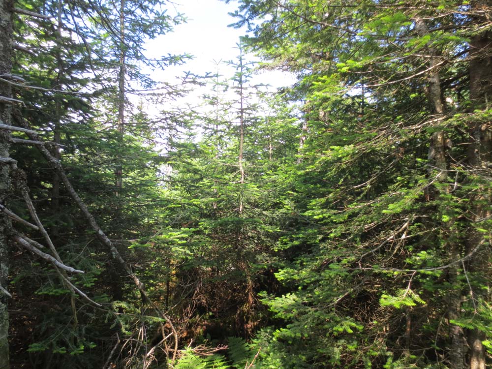
The Skyline Trail

Looking at Mt. Mansfield from Mt. Hunger
The Skyline Trail

Looking north from Mt. Putnam

The Skyline Trail

A lack of views from South Worcester

The Skyline Trail

Looking south from Mt. Worcester


Directions to trailhead: To get to the Worcester Mountain Trail trailhead from Route 12 in Worcester, take Minister Brook Road to Hampshire Hill Road, then take a left onto Mountain Road. There is a grassy parking area at the end of this road. To get to the Middlesex Trail trailhead from Route 12 north of Montpelier, take a left onto Shady Hill Road, then eventually take a right onto Story Road, then bear left onto Chase Road, then take a left onto North Bear Swamp Road. The Middlesex Trail trailhead and parking lot will eventually be the right.
Back to White Rock Mountain Profile
Back to Mt. Hunger Profile
Back to Mt. Putnam Profile
Back to Mt. Worcester (South Peak) Profile
Back to Mt. Worcester Profile
|