Birch Hill Trail
State: NH |
|
|
| Birch Hill Trail Details |
|
| Also Known As: |
|
|
| Location: |
White Mountains |
|
| Peak: |
Birch Hill |
|
| Opened: |
|
|
| Closed: |
1947 |
|
| Reason Closed: |
|
|
| Guidebook Descriptions: |
|
1931 AMC White Mountain Guide
Birch Hill. (P.M.C. Trail)
This hill (1,865 ft.), N. of Swift River and W. of Bear Mountain, is reached by a trail on its W side, leaving the Sawyer Pond Trail 2 m. N. of Albany Intervale highway, and climbing gently ½ m. to the summit (1 ½ hrs.).
1934 AMC White Mountain Guide
Birch Hill. (P.M.C.)
This hill (1,865 ft.), N. of Swift River and W. of Bear Mountain, is reached by a trail on its W. side, leaving the Sawyer Pond Trail 1 ¾ m. N. of Albany Intervale highway, and climbing gently ½ m. to the summit (1 ½ hrs.). Another trail branches N. from the Brunel Trail about midway between the Sawyer Pond Trail and Rob Brook.
1940 AMC White Mountain Guide
Birch Hill (1,865 ft.) PMC Trail
This hill N of Swift River and W of Bear Mountain is reached by a trail on its W side, leaving the Sawyer Pond Trail 1 ¾ m. N of Swift River Road, climbing gently ½ m. to the summit (1 ½ hrs.). Another trail branches N from the Brunel Trail about midway between Sawyer Pond Trail and Rob Brook.
|
|
| Images: |
|
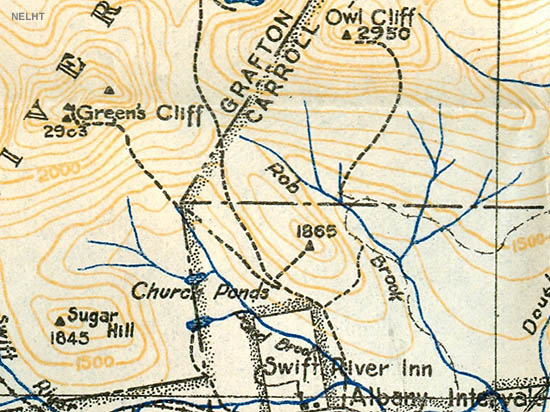
1931 AMC maps of Birch Hill
|
|
| Links: |
|
|
|
| Last updated 2011-08-19 |
| Disclaimer: Data provided for academic and historical purposes only. Respect all signs. |
|
|
