South Baldface Trail
State: NH |
The South Baldface Trail connected the East Branch Trail to South Baldface
|
|
| South Baldface Trail Details |
|
| Also Known As: |
|
|
| Location: |
White Mountains - East |
|
| Peak: |
South Baldface |
|
| Opened: |
|
|
| Closed: |
1940s |
|
| Reason Closed: |
|
|
| Guidebook Descriptions: |
|
1940 AMC White Mountain Guide
South Baldface Trail (WMNF)
In conjunction with the Baldface Circle Trail, the East Branch Trail, and the Bald Land Trail, this trail provides an almost straight-line route from the vicinity of Cold River Camp to Jackson. From the summit of South Baldface it bears SW down the ledges and through a burned-over district to the E fork of the East Branch.
Just below (S) of the junction of the E fork with the East Branch the trail crosses the East Branch, R, and enters the East Branch Trail. Distance from road to road 11 m. (7 hrs. 30 min.).
|
|
| Images: |
|
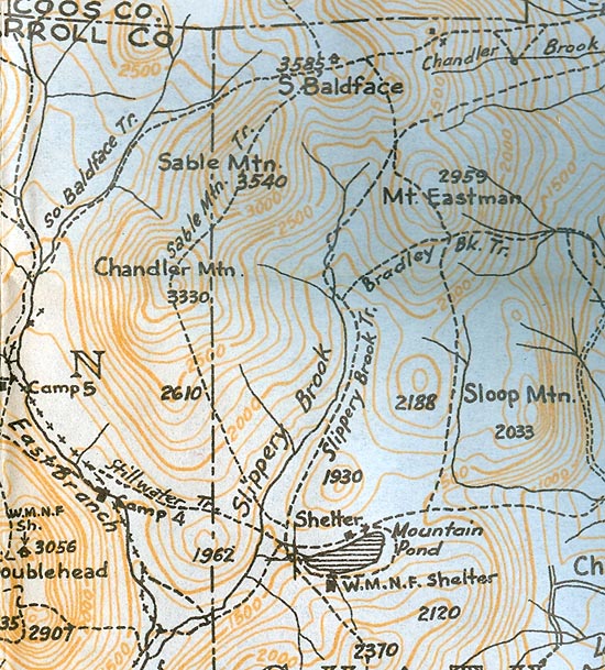
1940 AMC map of the South Baldface Trail
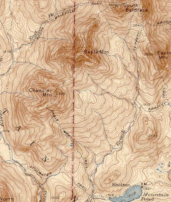
1945 USGS map of the South Baldface Trail
|
|
| Links: |
|
|
|
| Last updated 2012-12-18 |
| Disclaimer: Data provided for academic and historical purposes only. Respect all signs. |
