Fire Warden Trail
State: NH |
Located on the northeast side of Mt. Israel, the Fire Warden Trail was once the main route to the scenic, ledgy summit. The Wentworth and Mead Trails are now typically used to climb this mountain.
|
|
| Fire Warden Trail Details |
|
| Also Known As: |
Old Fire Warden Trail |
|
| Location: |
White Mountains - Sandwich |
|
| Peak: |
Mt. Israel |
|
| Opened: |
|
|
| Closed: |
1940s |
|
| Reason Closed: |
Likely due to lack of use after Wentworth Trail opened in 1937. |
|
| Guidebook Descriptions: |
|
1931 AMC White Mountain Guide
Mount Israel
This outlying mountain near the Sandwich Range, though low (2,630 ft.), affords a fine view of mountains and lakes and is well worth the climb to see the shore line of Squam Lake alone. The former fire-warden’s trail up the E. side was obliterated by an ice-storm in 1929. A new trail now leads up the S. side
1934 AMC White Mountain Guide
Mount Israel
This mountain (2,630 ft.), near the Sandwich Range, affords a fine view of the Sandwich Range, Squam Lake, and Lake Winnipesaukee and is well worth climbing.
Take the Sandwich Notch Road W. from Center Sandwich and the first turn to the R. (N.) on the Young Mt. Road. Follow this about 3 m. to an old house on the L., occupied in 1933 by Levi Martin (sign on large maple near highway). Enter between the house and a barn and swing R. across a field to a target: do not take the lumber road swinging L. At the junction of the paths just beyond the target turn L. The trail is well marked with blazes and white paint after it enters the woods. It ascends steeply, with excellent views, passing through the edge of a tract lumbered in 1932. About two-thirds of the way up, the trail joins an abandoned telephone line which it follows to the old fire-warden’s cabin near the top. The summit has open ledges and a wooden tower. A trail leads W. from the summit to a spring where water is usually to be found. Another trail leads S.W. to the W. summit.
Distance. 1 ¾ m. (2 hrs.).
1948 AMC White Mountain Guide
Old Fire-Warden Trail
An old, more or less abandoned trail reached from Center Sandwich by taking the Diamond Ledge road NW from the village. Bear R at the first fork and continue in a general northerly direction for about 3 ½ m. from the village. The trail leaves the road on the L (W) at an old house and passes between the house and barn, thence swings R across the field to a target (avoid the lumber road swinging L). At the junction of the paths just beyond the target, turn L. The trail used to be marked with blazes and white paint after it enters the woods and with red paint on the upper portion. It ascends steeply, passing through the edge of a tract lumbered in 1932. About 2/3rds of the way up, the trail joins an abandoned telephone line which it follows to the site of the old fire-warden’s cabin near the top. The open summit is just beyond. A trail leads W from the summit to a spring. In descending, this trail will be found by red blazes on the ledges heading east.
Distance. Highway to summit 1 ¾ m. (2 hrs.). |
|
| Images: |
|
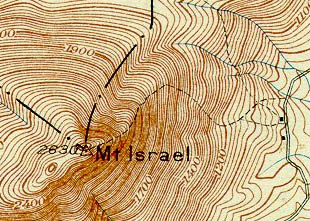
1931 USGS Map of Mt. Israel
|
|
| Links: |
|
|
|
| Last updated 2011-08-16 |
| Disclaimer: Data provided for academic and historical purposes only. Respect all signs. |
|
|
