Welch-Tecumseh Path
State: NH |
A path from Welch Mountain to Mt. Tecumseh was cut by Nathaniel Greeley in the 1850s. The path appears to have generally faded away shortly thereafter.
|
|
| Welch-Tecumseh Path Details |
|
| Also Known As: |
|
|
| Location: |
White Mountains - Waterville |
|
| Peak: |
Mt. Tecumseh |
|
| Opened: |
1850s |
|
| Closed: |
Before 1880 |
|
| Reason Closed: |
Establishment of direct route from Waterville? |
|
| Guidebook Descriptions: |
|
1881 The White Mountains: A Handbook for Travelers
The route from the S. leads up Welch Mt., and thence around a ridge nearly 2 M. long, on which rises the rocky pile of Stone Mt. On the L is a deep semi-circular ravine, over which are Fisher Mt. and Green Mt. Bending around the R side of the latter, a patch of jungle is crossed, and the traveller soon enters the dwarf forests on the slope of Tecumseh. |
|
| Images: |
|
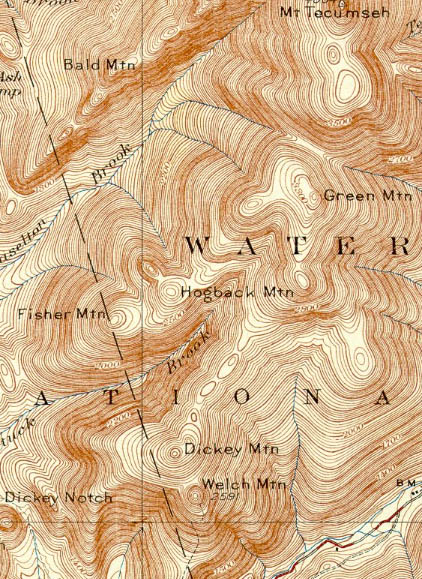
1931 USGS map of Mt. Tecumseh
|
|
| Links: |
|
|
|
| Last updated 2011-08-23 |
| Disclaimer: Data provided for academic and historical purposes only. Respect all signs. |
