Sable Mountain Trail
State: NH |
The Sable Mountain Trail reached the summits of Chandler, Sable, and South Baldface via the western branch of Slippery Brook Trail.
|
|
| Sable Mountain Trail Details |
|
| Also Known As: |
|
|
| Location: |
White Mountains - East |
|
| Peak: |
Sable Mountain |
|
| Opened: |
Late 1930s |
|
| Closed: |
1940s |
|
| Reason Closed: |
|
|
| Guidebook Descriptions: |
|
1934 AMC White Mountain Guide
Mounts Sable and Chandler
Mt. Sable (3,510 ft.) and Mt. Chandler (3,330 ft.) are remote summits on ridge extending S.W. from South Baldface. The bear no trails and are rarely ascended.
1940 AMC White Mountain Guide
Mounts Sable (3,540 ft.) and Chandler (3,330 ft.)
Sable Mountain Trail (WMNF)
From the Slippery Brook Trail 0.2 m. N of its junction with the Mountain Pond Trail, the Sable Mountain Trail begins W. It ascends Mt. Chandler, follows the ridge over Mt. Sable, descends to the col between Mt. Sable and South Baldface, ascends the open SW ledges of South Baldface, ending at the summit of South Baldface (See note under heading “The Baldface Range” for directions from this point). Last sure water is at small brook on SE slope of Mt. Chandler 6.4 m. (4 hrs. 15 min.).
1948 AMC White Mountain Guide
Mounts Sable (3,540 ft.) and Chandler (3,330 ft.)
The trail over these two mountains which diverged from the Slippery Brook Trail and ended at the summit of South Baldface has been abandoned.
|
|
| Images: |
|
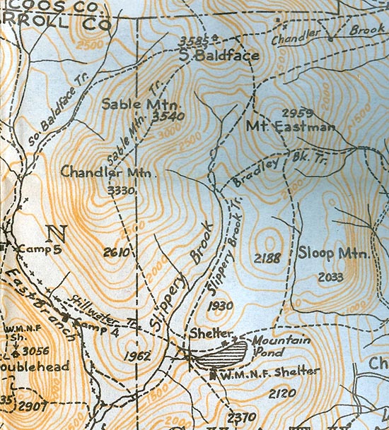
1940 AMC map of the Sable Mountain Trail
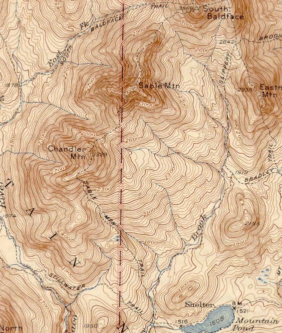
1945 USGS map of the Sable Mountain Trail
|
|
| Links: |
|
|
|
| Last updated 2011-09-22 |
| Disclaimer: Data provided for academic and historical purposes only. Respect all signs. |
|
|
