Home
States
Colorado
Connecticut
Maine
Massachusetts
New Hampshire
New York
Rhode Island
Utah
Vermont
View All
Lists
NE 4,000 Footers
NE 100 Highest
NH 4,000 Footers
NH 100 Highest
NH 52 With A View
NH Belknap Range
NH Ossipee 10
Links
Trail Conditions
Trip Log
Sunrises
Sunsets
About
|
Bald Rock Mountain
Camden, ME
Trailheads, measurements, times, distances, and maps are all approximate and relative to the hike(s) as shown below.
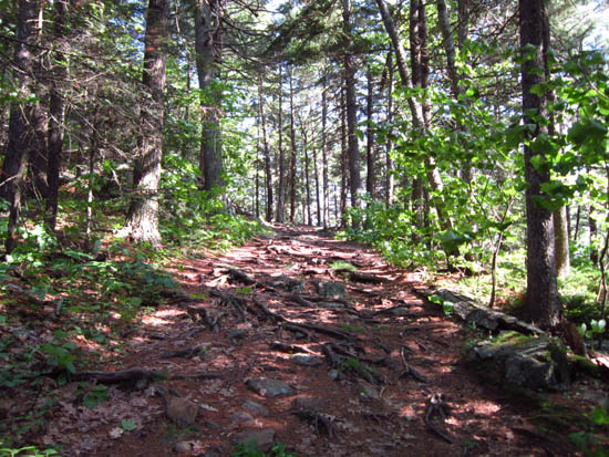
The Bald Rock Mountain Trail
Route: Ski Lodge Trail, Bald Rock Mountain Trail
Ski Lodge Trail was basically a gated dirt road - smooth sailing.
Bald Rock Mountain Trail was basically an old road - a few rooty areas, as well as some rock stairs, but pretty gradual.
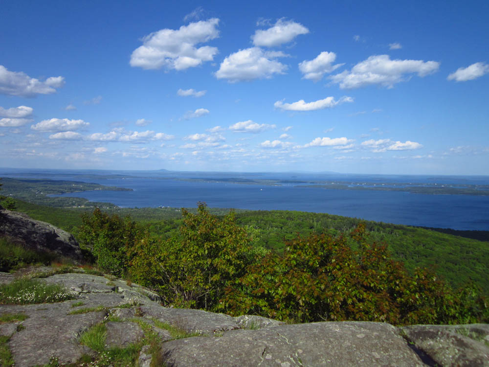
Superb ocean views from the summit ledge. Map Adventures map suggested there were two views from the top, but I didn't find the one that appears to be toward the west.
| Hike Ratings |
|
Getting To Trailhead: |
Easy |
| Destination: |
Bald Rock Mountain |
|
Length: |
Moderate |
|
Steepness: |
Easy |
|
Navigation: |
Easy |
|
Views: |
Excellent |
|
Crowds: |
Minimal |
|
| Hike Stats |
|
Date Hiked: |
Saturday, June 9, 2012 |
| Parking Elevation: |
260' |
| Destination: |
Bald Rock Mountain |
| Time Elapsed: |
00:32 |
| Trailhead Elevation: |
260' |
| Summit Elevation: |
1,100' |
| Distance: |
2 miles |
| Vertical Gain: |
840' |
|
|
| Hike Time Elapsed: |
01:03 |
| Hike Vertical Gain: |
840' |
|
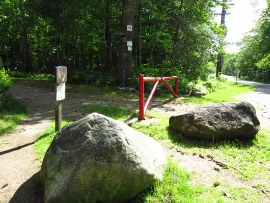
The Ski Lodge Trail trailhead
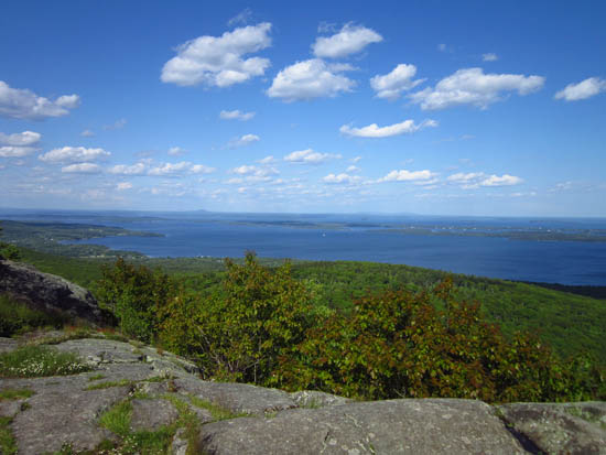
Looking toward Mt. Desert Island from Bald Rock Mountain
Directions to trailhead: From Route 52 in Camden, take Youngtown Road east. The Ski Lodge Trail fee parking area ($3 in 2012) is on the right, just before the Route 173 junction.
Back to Bald Rock Mountain Profile
|