Home
States
Colorado
Connecticut
Maine
Massachusetts
New Hampshire
New York
Rhode Island
Utah
Vermont
View All
Lists
NE 4,000 Footers
NE 100 Highest
NH 4,000 Footers
NH 100 Highest
NH 52 With A View
NH Belknap Range
NH Ossipee 10
Links
Trail Conditions
Trip Log
Sunrises
Sunsets
About
|
The Ossipee 10 (10)
Summary
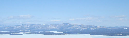
The Ossipee Mountains, located northeast of Lake Winnipesaukee, are the remains of an ancient volcano. The Ossipee 10, also known as the O-10, is a list of notable peaks located in the range. These peaks feature official and unofficial trails and variety of excellent views.
Range High Point
Mt. Shaw in Tuftonboro at 2,990 feet.
Map
View the Google Map of the peaks on this page or download the Trail Bandit Ossipee Mountains Map.
Mountain Profiles
Click on the name of the mountain or peak for maps, photos, and more.
|
| 2,000 Feet (7) |
| Mt. Shaw | Tuftonboro, NH | 2,990' |
| Black Snoot | Tuftonboro, NH | 2,803' |
| Faraway Mountain | Moultonborough, NH | 2,782' |
| Mt. Roberts | Moultonborough, NH | 2,582' |
| Mt. Flagg | Tuftonboro, NH | 2,390' |
| Turtleback Mountain | Moultonborough, NH | 2,203' |
| Big Ball Mountain (Tate Mountain) | Tuftonboro, NH | 2,060' |
|
| 1,000 Feet (3) |
|
|
History
The Ossipee 10 list was created in May of 2008 as a way to help spur interest in some of the more scenic, trail served peaks of the Ossipee Mountains.
On September 22, 2008, Black Snoot was removed from the list and replaced with Larcom Mountain.
On March 12, 2009, Larcom Mountain was removed from the list due to trail access issues and replaced with Black Snoot.
More Information
- Trail Bandit Ossipee Mountains Map - A free map of the hiking trails throughout the Ossipee Mountains.
- Castle In the Clouds - encompasses much of the western Ossipees, offers a laminated trail map of that area.
|
|
