Home
States
Colorado
Connecticut
Maine
Massachusetts
New Hampshire
New York
Rhode Island
Utah
Vermont
View All
Lists
NE 4,000 Footers
NE 100 Highest
NH 4,000 Footers
NH 100 Highest
NH 52 With A View
NH Belknap Range
NH Ossipee 10
Links
Trail Conditions
Trip Log
Sunrises
Sunsets
About
|
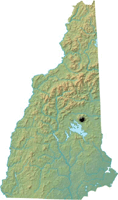
Mt. Shaw
Tuftonboro, NH
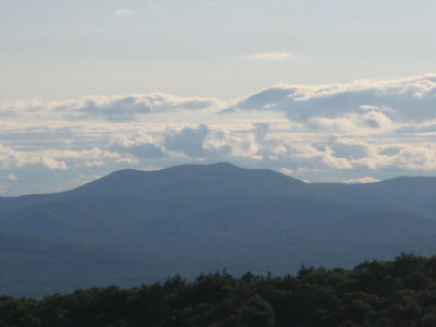
Mt. Shaw as seen from Green Mountain
 Summary Summary
Mt. Shaw is the highest peak in the Ossipee Mountains, as well as one of the fifty most prominent in all of New England. The summit features excellent views of the Sandwich Range, Mt. Washington, and Maine.
Summit Elevation
2,990 feet
Summit Facilities
None.
Trails
While only the Gorilla Trail and Black Snout Trail reach the summit of Mt. Shaw, many others connect to them, including the Mt. Shaw Trail, the High Ridge Trail, the Banana Trail (also known as the Big Ball Mountain Trail), and the Thunderbird Trail.
Trip Reports:
Click on the date for photos, timestamps, and maps.
| Date of Hike |
Trail(s) |
Length |
Steepness |
Vertical |
|
| June 11, 2017 |
Tate Mountain Trail, more |
Moderate |
Difficult |
2,728' |
| May 3, 2015 |
Tate Mountain Trail, more |
Moderate |
Difficult |
2,728' |
| May 18, 2013 |
Tate Mountain Trail, more |
Moderate |
Difficult |
2,728' |
| December 14, 2008 |
Mt. Shaw Trail, more |
Moderate |
Difficult |
2,728' |
| November 16, 2008 |
Mountain Trail, more |
Moderate |
Difficult |
3,183' |
| July 26, 2008 |
Mountain Trail, more |
Moderate |
Difficult |
2,880' |
| May 10, 2008 |
Big Ball Mountain Trail, more |
Moderate |
Difficult |
2,728' |
| January 20, 2008 |
Mt. Shaw Trail, more |
Moderate |
Difficult |
2,593' |
| October 2, 2007 |
Mt. Shaw Trail, more |
Moderate |
Difficult |
2,458' |
|
More Information
- The Ossipee 10 - Hiking list
- Mount Shaw - Wikipedia
- Mt. Shaw - SummitPost
|
