Home
States
Colorado
Connecticut
Maine
Massachusetts
New Hampshire
New York
Rhode Island
Utah
Vermont
View All
Lists
NE 4,000 Footers
NE 100 Highest
NH 4,000 Footers
NH 100 Highest
NH 52 With A View
NH Belknap Range
NH Ossipee 10
Links
Trail Conditions
Trip Log
Sunrises
Sunsets
About
|
Mt. Flagg
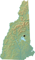
Tuftonboro, NH

Mt. Flagg as seen from Big Ball Mountain
 Summary Summary
Mt. Flagg is a peak located east of Mt. Shaw. There are ledge views in nearly all directions located near the summit.
Summit Elevation
2,390 feet
Summit Facilities
None.
Trip Reports:
Click on the date for photos, timestamps, and maps.
| Date of Hike |
Trail(s) |
Length |
Steepness |
Vertical |
|
| April 16, 2009 |
Mt. Flagg Trail, more |
Moderate |
Difficult |
1,595' |
| November 16, 2008 |
Mountain Trail, more |
Moderate |
Difficult |
3,183' |
| July 26, 2008 |
Mountain Trail, more |
Moderate |
Difficult |
2,880' |
| May 10, 2008 |
Big Ball Mountain Trail, more |
Moderate |
Difficult |
2,728' |
|
More Information
- The Ossipee 10 - Hiking list
|
