Home
States
Colorado
Connecticut
Maine
Massachusetts
New Hampshire
New York
Rhode Island
Utah
Vermont
View All
Lists
NE 4,000 Footers
NE 100 Highest
NH 4,000 Footers
NH 100 Highest
NH 52 With A View
NH Belknap Range
NH Ossipee 10
Links
Trail Conditions
Trip Log
Sunrises
Sunsets
About
|
Bigelow Mountain (Avery Peak), Bigelow Mountain (West Peak)
Wyman, ME, Dead River, ME
Trailheads, measurements, times, distances, and maps are all approximate and relative to the hike(s) as shown below.
Looking up the Fire Warden's Trail on the way to Avery Peak
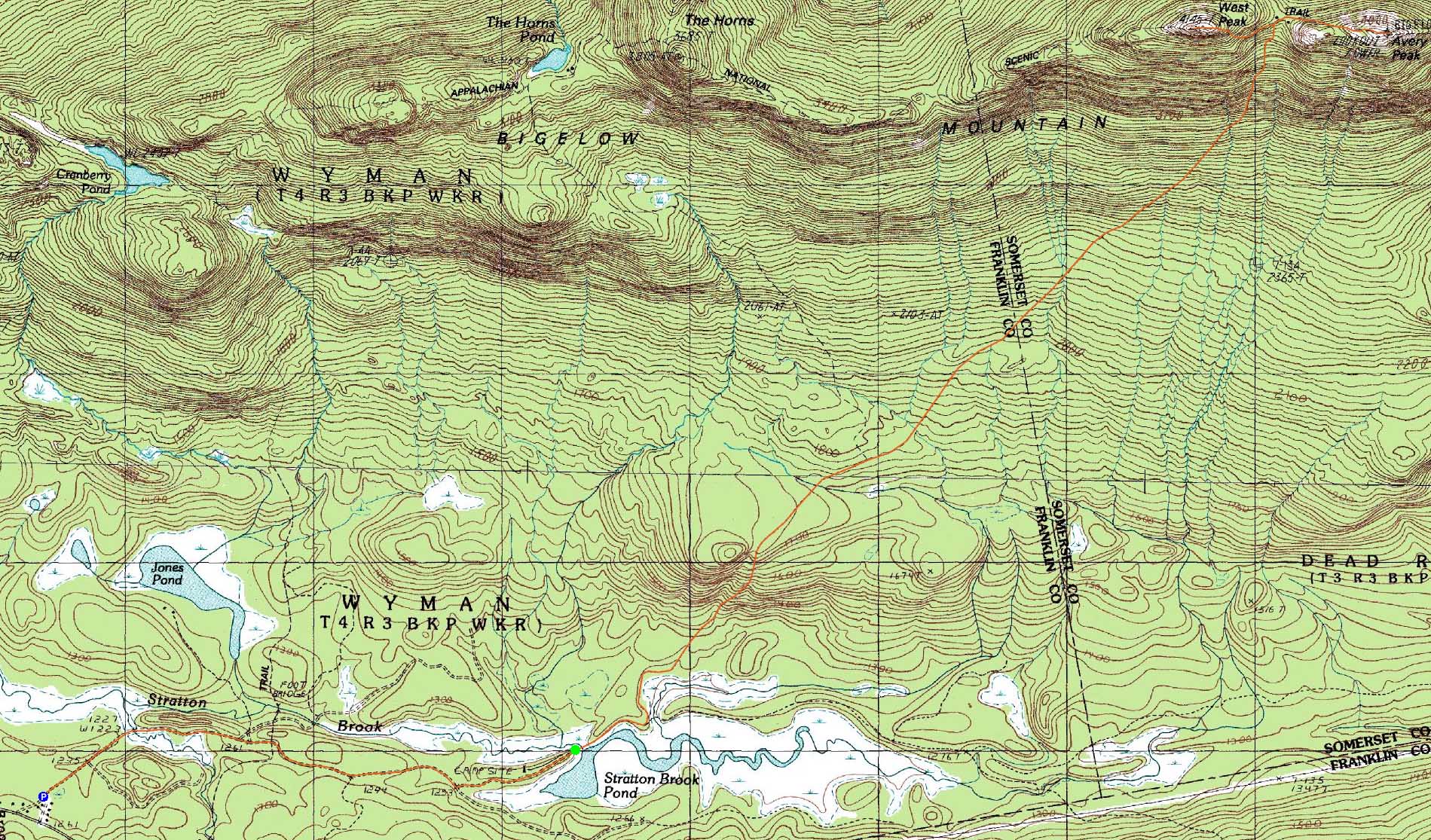
Route: Stratton Brook Pond Road, Fire Warden's Trail, Appalchian Trail, (Bigelow Mountain - Avery Peak), Appalchian Trail, (Bigelow Mountain - West Peak), Appalachian Trail, Fire Warden's Trail, Stratton Brook Pond Road
With a nice day forecasted for the end of winter, we decided to head up to Maine for the Bigelows. Learning from last winter, we opted not to take the Appalachian Trail - rather, we drove in Stratton Brook Pond Road and snowshoed along the snowmobile trail, bringing us to the 2nd summer trailhead faster and with less effort than the AT.
Crossing the outlet of the pond was potentially tricky, as the running water was a little high. Instead, we took a wide route on the ice on the pond - probably one of the last days this would be possible this year.
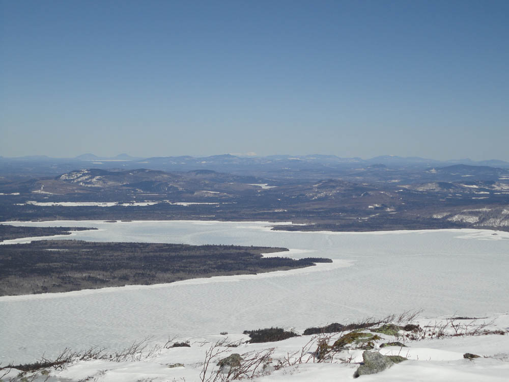
The Fire Warden's Trail had set up overnight, resulting in a firm, but somewhat uneven walk. Eventually reaching the col, we headed up to Avery Peak first. Snowshoes provided adequate traction as we worked our way around the alpine zone to the highpoint. While there were excellent views in all directions, Mt. Katahdin was a stunning image to the northeast.
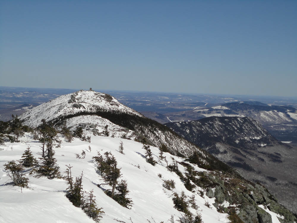
After a lunch break near the summit, we headed back into the col and up to West Peak, climbing over a very impressive snow drift along the way. From the summit of West Peak, we had excellent views of both Mt. Washington and Mt. Katahdin - a very unique vista.
With temperatures climbing, the trail softened considerably for the descent, resulting in a few full-snowshoe postholes. Nonetheless, it was fairly smooth sailing. The ride back to New Hampshire, on the other hand, wasn't - for nearly an hour, we found ourselves stopping for dozens of deer, including one herd that had to have been 50 or more.
| Hike Ratings |
|
Getting To Trailhead: |
Difficult |
| Destination: |
Bigelow Mountain (Avery Peak) |
|
Length: |
Difficult |
|
Steepness: |
Difficult |
|
Navigation: |
Moderate |
|
Views: |
Excellent |
|
Crowds: |
Minimal |
| Destination: |
Bigelow Mountain (West Peak) |
|
Length: |
Difficult |
|
Steepness: |
Difficult |
|
Navigation: |
Moderate |
|
Views: |
Excellent |
|
Crowds: |
Minimal |
|
| Hike Stats |
|
Date Hiked: |
Sunday, March 20, 2011 |
| Hike Commenced: |
9:20 AM |
| Parking Elevation: |
1,250' |
| Destination: |
Bigelow Mountain (Avery Peak) |
| Ascent Commenced: |
10:03 AM |
| Summit Reached: |
1:12 PM |
| Time Elapsed: |
03:09 |
| Trailhead Elevation: |
1,235' |
| Summit Elevation: |
4,088' |
| Vertical Gain: |
2,933' |
| Destination: |
Bigelow Mountain (West Peak) |
| Ascent Commenced: |
1:41 PM |
| Summit Reached: |
2:14 PM |
| Time Elapsed: |
00:33 |
| Trailhead Elevation: |
4,088' |
| Summit Elevation: |
4,145' |
| Distance: |
0.7 mile |
| Vertical Gain: |
370' |
|
|
| Hike Ended: |
5:36 PM |
| Hike Time Elapsed: |
08:16 |
| Hike Vertical Gain: |
3,728' |
|
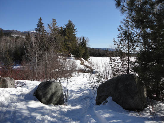
The start of the Firewarden's Trail at Stratton Brook Pond
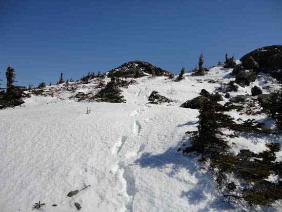
Looking up the Appalachian Trail on the way to Avery Peak
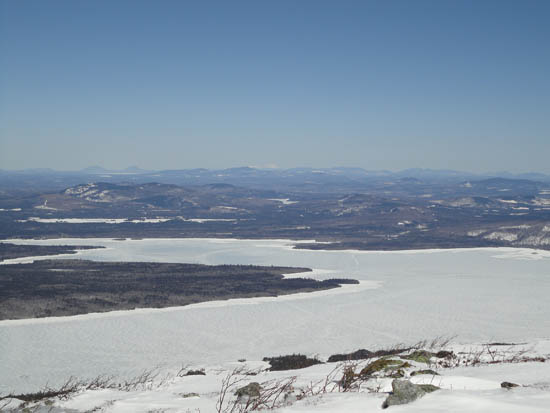
Looking over Flagstaff Lake at Mt. Katahdin from Avery Peak
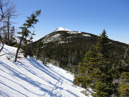
The Appalachian Trail on the way to Bigelow Mountain's West Peak

Looking east from West Peak
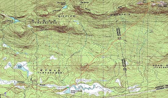

Directions to trailhead: Take Route 27 northwest from the entrance to Sugarloaf USA ski area. Shortly after passing the Appalachian Trail crossing, take a right onto Stratton Brook Pond Road. In winter, only a short portion of this road is plowed, with very limited room for parking. Beyond this, the road tends to be packed by snowmobiles. The Fire Warden's Trail will eventually depart to the left, crossing the outflow of Stratton Brook Pond.
Back to Bigelow Mountain - Avery Peak Profile
Back to Bigelow Mountain - West Peak Profile
|