Home
States
Colorado
Connecticut
Maine
Massachusetts
New Hampshire
New York
Rhode Island
Utah
Vermont
View All
Lists
NE 4,000 Footers
NE 100 Highest
NH 4,000 Footers
NH 100 Highest
NH 52 With A View
NH Belknap Range
NH Ossipee 10
Links
Trail Conditions
Trip Log
Sunrises
Sunsets
About
|
Boundary Bald Mountain
Bald Mountain, ME
Trailheads, measurements, times, distances, and maps are all approximate and relative to the hike(s) as shown below.
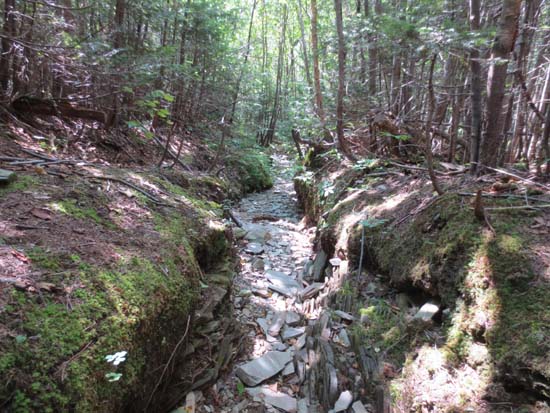
The lower portion of the trail to Boundary Bald Mountain
Route: Trail Road, blue blazed trail
Lower portion of the Blue Trail from Trail Road had some areas of running water (trail is essentially a rocky ditch in this area), as well as some mudbogs. Upper portion had some slippery rock, but was otherwise dry. Also noted another blue blazed trail emerging on the summit ridge, signed for Notch Road.
Excellent views from the summit ridge, even with rain showers passing through.
| Hike Ratings |
|
Getting To Trailhead: |
Difficult |
| Destination: |
Boundary Bald Mountain |
|
Length: |
Moderate |
|
Steepness: |
Difficult |
|
Navigation: |
Moderate |
|
Views: |
Excellent |
|
Crowds: |
Minimal |
|
| Hike Stats |
|
Date Hiked: |
Friday, August 16, 2013 |
| Parking Elevation: |
2,150' |
| Destination: |
Boundary Bald Mountain |
| Time Elapsed: |
00:45 |
| Trailhead Elevation: |
2,550' |
| Summit Elevation: |
3,640' |
| Distance: |
1.2 miles |
| Vertical Gain: |
1,240' |
|
|
| Hike Time Elapsed: |
02:29 |
| Hike Vertical Gain: |
1,790' |
|
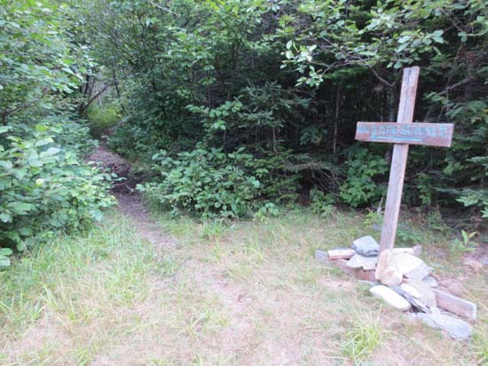
The start of the trail to Boundary Bald Mountain
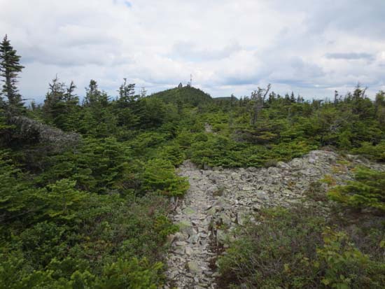
The upper portion of the blue trail on Boundary Bald Mountain

Looking northwest from near the summit of Boundary Bald Mountain


Directions to trailhead: From Jackman, take US 201 North past The Falls picnic area, then take a right onto Bald Mountain Road. Following the hiking trail signs, avoiding Mud Pond Road after a bridge. Around 4.1 miles, take a left onto Notch Road. 0.2 miles up this road, there is a grassy area on the left where one may park. High clearance vehicles may attempt to bear right and continue for part of the eroded next 1.2 miles. The trail to Boundary Bald Mountain will eventually be on the left, marked with a sign and blue blazes.
Back to Boundary Bald Mountain Profile
|


