Home
States
Colorado
Connecticut
Maine
Massachusetts
New Hampshire
New York
Rhode Island
Utah
Vermont
View All
Lists
NE 4,000 Footers
NE 100 Highest
NH 4,000 Footers
NH 100 Highest
NH 52 With A View
NH Belknap Range
NH Ossipee 10
Links
Trail Conditions
Trip Log
Sunrises
Sunsets
About
|
Burnt Meadow Mountain
Brownfield, ME
Trailheads, measurements, times, distances, and maps are all approximate and relative to the hike(s) as shown below.

Looking up the Burnt Meadow Trail
Route: Burnt Meadow Trail
While my recent hikes up and near Burnt Meadow Mountain's north peak had involved the new Twin Brook Trail, I decided to do a fairly quick hike up the traditional Burnt Meadow Trail.
With unseasonably warm temperatures, the sometimes steep trail was a work out. Lots of work has been done in recent years by the Maine AMC, making a once-obscure trail much easier to follow.
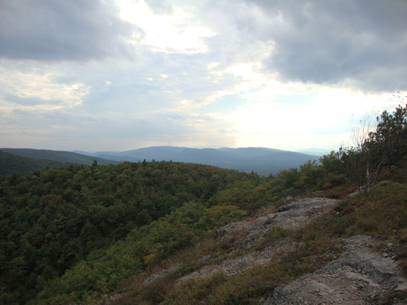
Reaching the summit, there were decent views despite overcast skies.
| Hike Ratings |
|
Getting To Trailhead: |
Moderate |
| Destination: |
Burnt Meadow Mountain |
|
Length: |
Moderate |
|
Steepness: |
Very Difficult |
|
Navigation: |
Easy |
|
Views: |
Excellent |
|
Crowds: |
Minimal |
|
| Hike Stats |
|
Date Hiked: |
Wednesday, September 22, 2010 |
| Hike Commenced: |
4:10 PM |
| Parking Elevation: |
440' |
| Destination: |
Burnt Meadow Mountain |
| Ascent Commenced: |
4:10 PM |
| Summit Reached: |
4:44 PM |
| Time Elapsed: |
00:34 |
| Trailhead Elevation: |
440' |
| Summit Elevation: |
1,575' |
| Vertical Gain: |
1,258' |
|
|
| Hike Ended: |
5:32 PM |
| Hike Time Elapsed: |
01:22 |
| Hike Vertical Gain: |
1,396' |
|

The trailhead to Burnt Meadow Mountain on Route 160

Looking into New Hampshire from the Burnt Meadow Mountain summit


Directions to trailhead: Take 160 South from Brownfield. Shortly after passing the pond, just after a curve, there will be a small dirt parking lot on the right. The trailhead is on the right side of the parking lot.
Back to Burnt Meadow Mountain Profile
|