Home
States
Colorado
Connecticut
Maine
Massachusetts
New Hampshire
New York
Rhode Island
Utah
Vermont
View All
Lists
NE 4,000 Footers
NE 100 Highest
NH 4,000 Footers
NH 100 Highest
NH 52 With A View
NH Belknap Range
NH Ossipee 10
Links
Trail Conditions
Trip Log
Sunrises
Sunsets
About
|
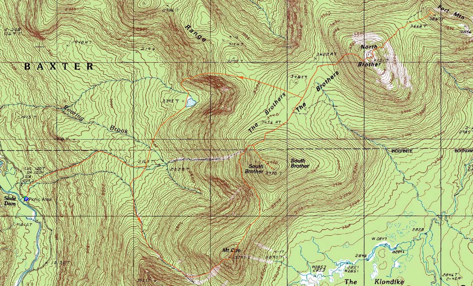
Mt. Coe, South Brother, North Brother, Fort Mountain
T3 R10, ME, T4 R10, ME
Trailheads, measurements, times, distances, and maps are all approximate and relative to the hike(s) as shown below.

Looking down the Mt. Coe Trail
Route: Marston Trail, Mount Coe Trail, (Mt. Coe), Mount Coe Trail, South Brother Trail, (South Brother), South Brother Trail, Mount Coe Trail, Marston Trail, (North Brother), herdpath, (Fort Mountain), herdpath, (North Brother), Marston Trail
Thursday night was my first night at the Bear Brook group campsite in Baxter. After a long hike up Katahdin, it was nice to be able to have a very short drive to 'base camp.' I fortunately set up my new tent prior to heading to Maine, so I didn't have to look like a dumb monkey scratching its head while trying to figure out some complex gadget - rather, I was able to set up the tent in daylight and get a meal in next to the fire. One thing that took adjusting to, though, was not getting a post-hike shower - no running water in Baxter (except streams and rivers, of course).
Wanting to get the 'work' hikes out of the way up front - ie the 4,000 footers - I headed up to do the North Brother loop. Though the trailhead was only a few miles away, it took quite awhile to get over to it with the 20 MPH speed limits and bumpy (and very dusty!) dirt roads.
The Marston Trail started off gradually initially, prior to getting steep as it worked its way alongside a brook. Reaching the Mount Coe Trail junction, we opted to go counterclockwise.
The Mount Coe Trail was quite interesting as it worked its way up to its namesake. For an extended stretch, the trail ran alongside a slide of sorts, that almost seemed to resemble a high-tension-powerline-cut-without-the-high-tension-powerlines. The views from this gravelly area were quite good - up to the shoulder of Mt. OJI, and back toward the western side of the park.
Turning the corner, we soon reached the Coe slide. With dry conditions, this was a joy to ascend - the slabs were fairly grippy and never overly steep, while the views were tremendous.
Not long after reaching the top of the slide, we reached the summit of Mount Coe. Unfortunately we didn't get the full show in terms of views, as there was morning fog blowing through the park. Nonetheless, it seemed like a great peak.
The next stretch of trail, on the way to the South Brother Trail junction, seemed to drag on - a 'Maine Mile' perhaps. Not only did it drag, but the trail itself was heavily grown in - seemingly a bushwhack in places! The flat, open summit of South Brother provided great views in all directions.
The section of trail from the South Brother Trail to the Marston Trail seemed to have the best footing of the day - some nice, extended sections of flat, smooth trail.
The Marston Trail to North Brother was pretty eroded - but fortunately, the footing wasn't as bad as I had expected. Steep, however.
The views from North Brother were superb - a nice, rocky summit. After a quick lunch, it was time for the final new peak of the day - Fort Mountain.
Just beyond the summit sign of North Brother, we looked to our left and saw some cairns, denoting a safe way to descend into the trees without trampling alpine vegetation. Once in the trees, we kept our eyes on the ground, following a fairly well defined herd path footbed (the airway of the path was filled with sharp spruce branches). While there were a few turns along the way, I found the herd path easy to follow. While there were some navigational aides in place, we disregarded them and kept looking at our feet, as a few of the ribbons seemed to lead to less-than-optimal routes.
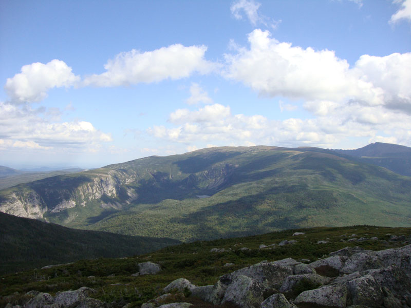
Reaching the ridge of Fort Mountain, we went to both cairns on the northwest side. The views were tremendous. While it was tempting to continue along the ridge and check out the plane wreck, we descended to head back to North Brother and save energy for the rest of the long weekend.
The Marston Trail dragged on as we descended - the AMC map mileage didn't agree with the signs. I would have to say the signs were right - 4.5 or so miles from summit to parking lot. Things were going well until I ran out of patience with the long walk out, as I decided to run the last portion below the Mount Coe junction. While I made better time at first, I stepped onto a rock at a bad angle and sprained my ankle nicely. Fortunately, it was a short hobble back to the parking lot. Unfortunately, the best hiking days weatherwise were yet to come - and my best hiking days anklewise were behind me.
| Hike Ratings |
|
Getting To Trailhead: |
Easy |
| Destination: |
Mt. Coe |
|
Length: |
Moderate |
|
Steepness: |
Very Difficult |
|
Navigation: |
Moderate |
|
Views: |
Excellent |
|
Crowds: |
Minimal |
| Destination: |
South Brother |
|
Length: |
Moderate |
|
Steepness: |
Difficult |
|
Navigation: |
Easy |
|
Views: |
Excellent |
|
Crowds: |
Minimal |
| Destination: |
North Brother |
|
Length: |
Moderate |
|
Steepness: |
Difficult |
|
Navigation: |
Easy |
|
Views: |
Excellent |
|
Crowds: |
Minimal |
| Destination: |
Fort Mountain |
|
Length: |
Difficult |
|
Steepness: |
Difficult |
|
Navigation: |
Difficult |
|
Views: |
Excellent |
|
Crowds: |
Minimal |
|
| Hike Stats |
|
Date Hiked: |
Friday, September 4, 2009 |
| Hike Commenced: |
7:50 AM |
| Parking Elevation: |
1,195' |
| Destination: |
Mt. Coe |
| Ascent Commenced: |
7:50 AM |
| Summit Reached: |
9:45 AM |
| Time Elapsed: |
01:55 |
| Trailhead Elevation: |
1,195' |
| Summit Elevation: |
3,795' |
| Distance: |
3.2 miles |
| Vertical Gain: |
2,650' |
| Destination: |
South Brother |
| Ascent Commenced: |
9:53 AM |
| Summit Reached: |
10:44 AM |
| Time Elapsed: |
00:51 |
| Trailhead Elevation: |
3,795' |
| Summit Elevation: |
3,970' |
| Distance: |
1.3 miles |
| Vertical Gain: |
610' |
| Destination: |
North Brother |
| Ascent Commenced: |
11:02 AM |
| Summit Reached: |
12:01 PM |
| Time Elapsed: |
00:59 |
| Trailhead Elevation: |
3,970' |
| Summit Elevation: |
4,151' |
| Distance: |
1.8 miles |
| Vertical Gain: |
751' |
| Destination: |
Fort Mountain |
| Ascent Commenced: |
12:22 PM |
| Summit Reached: |
1:08 PM |
| Time Elapsed: |
00:46 |
| Trailhead Elevation: |
4,151' |
| Summit Elevation: |
3,867' |
| Vertical Gain: |
219' |
|
|
| Hike Ended: |
4:27 PM |
| Hike Time Elapsed: |
08:37 |
| Hike Vertical Gain: |
4,863' |
|

The Marston Trail trailhead

Looking down Mt. Coe Trail

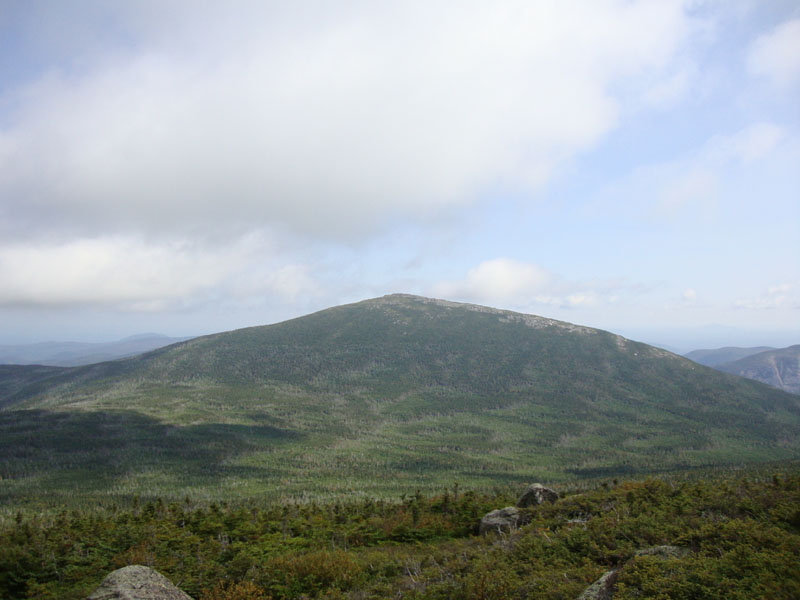
Looking at Doubletop from Mt. Coe

The grown in Mt. Coe Trail between Mt. Coe and South Brother

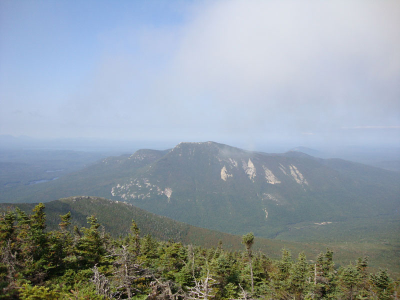
Looking at North Brother from South Brother

Looking down the eroded Marston Trail on the way to North Brother

Looking at Mt. Katahdin from North Brother

The grown in Mt. Coe Trail between Mt. Coe and South Brother

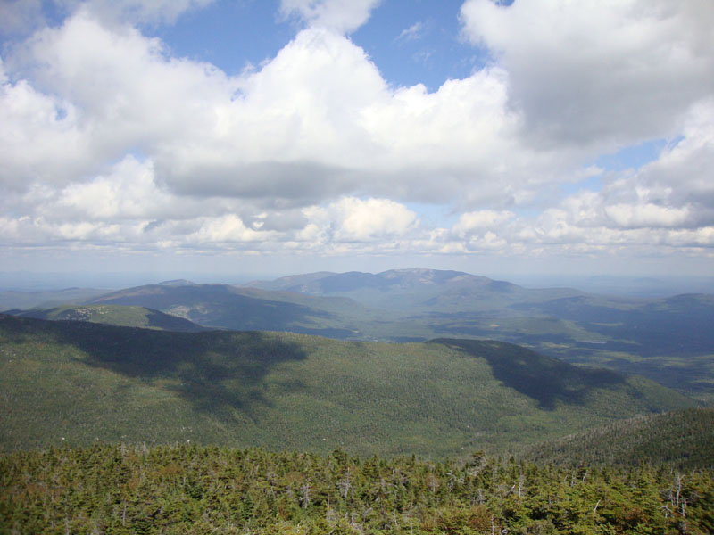
Looking at the Travelers from Fort Mountain


Directions to trailhead: From the Togue Pond Gate (Millinocket side), take the Tote Road past the Abol Campground and later, the Mt. OJI Trail. The Marston Trail trailhead and parking area will be on the right shortly thereafter.
Back to Mt. Coe Profile
Back to South Brother Profile
Back to North Brother Profile
Back to Fort Mountain Profile
|