Home
States
Colorado
Connecticut
Maine
Massachusetts
New Hampshire
New York
Rhode Island
Utah
Vermont
View All
Lists
NE 4,000 Footers
NE 100 Highest
NH 4,000 Footers
NH 100 Highest
NH 52 With A View
NH Belknap Range
NH Ossipee 10
Links
Trail Conditions
Trip Log
Sunrises
Sunsets
About
|
Randall Mountain
Parsonsfield, ME
Trailheads, measurements, times, distances, and maps are all approximate and relative to the hike(s) as shown below.
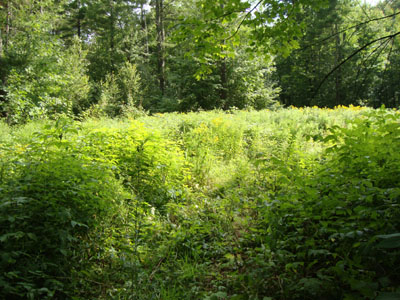
The grown in logging roads on the way to Randall Mountain
Route: Logging roads, bushwhack, herd path, (Randall Mountain), herd path, bushwhack, logging roads
With some thunderstorms approaching, I decided to head east and hike in the sunshine. Unfortunately, en route to finding a place to approach Randall Mountain, I ended up missing a turn or two due to missing road signs. I eventually made it to where I wanted to be - just in time for the rain.
Fortunately, the rain let up for a bit as I pushed through an overgrown logging road and up into open woods.
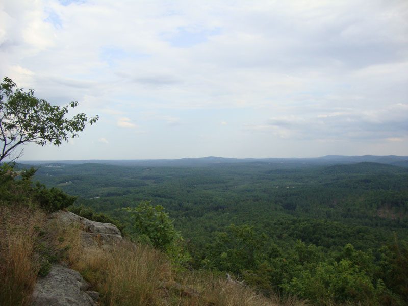
Just prior to reaching a subpeak, I found a nice herd path leading directly to the summit ledges. From the ledges, there were superb views to the south, ranging from points east of Ossipee Hill to some peaks in southwestern New Hampshire. While I also suspected I could find some views toward the White Mountains (perhaps better when the leaves are down), I opted to get moving, as I could hear thunder in the distance. After continuing east a bit to make sure I was indeed at the summit, I doubled back and followed the herd path until it disappeared at a steep area. From there, I cut back toward where I had ascended, taking a different grown in logging road back.
| Hike Ratings |
|
Getting To Trailhead: |
Difficult |
| Destination: |
Randall Mountain |
|
Length: |
Moderate |
|
Steepness: |
Difficult |
|
Navigation: |
Difficult |
|
Views: |
Excellent |
|
Crowds: |
Minimal |
|
| Hike Stats |
|
Date Hiked: |
Monday, August 9, 2010 |
| Hike Commenced: |
4:32 PM |
| Parking Elevation: |
680' |
| Destination: |
Randall Mountain |
| Ascent Commenced: |
4:32 PM |
| Summit Reached: |
4:53 PM |
| Time Elapsed: |
00:21 |
| Trailhead Elevation: |
685' |
| Summit Elevation: |
1,110' |
| Vertical Gain: |
430' |
|
|
| Hike Ended: |
5:32 PM |
| Hike Time Elapsed: |
01:00 |
| Hike Vertical Gain: |
440' |
|
The beginning of the logging road off Maplecrest Road
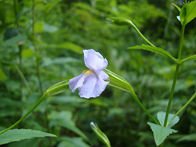
Allegheny Monkey-flower along a logging road

Looking at Ossipee Hill from Randall Mountain
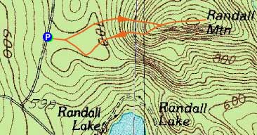

Directions to trailhead: From Effingham, NH, take Plantation Road southeast, which becomes Middle Road in Maine. Awhile later, bear left (straight) at the Hasty Road junction to remain on Middle Road. Awhile later, continue straight as Merrill Hill Road joins from the left. A few minutes thereafter, take a left to stay on Middle Road (no sign in August 2010) as the main drag (Moulton Hill Road) heads right. Eventually passing Cross Road on the right, Middle Road takes a sharp left turn uphill and becomes Maplecrest Road. The boulder-blocked logging road will be on the right shortly thereafter. There is limited room to park on the side of the road.
Back to Randall Mountain Profile
|