Home
States
Colorado
Connecticut
Maine
Massachusetts
New Hampshire
New York
Rhode Island
Utah
Vermont
View All
Lists
NE 4,000 Footers
NE 100 Highest
NH 4,000 Footers
NH 100 Highest
NH 52 With A View
NH Belknap Range
NH Ossipee 10
Links
Trail Conditions
Trip Log
Sunrises
Sunsets
About
|
Sabattus Mountain
Lovell, ME
Trailheads, measurements, times, distances, and maps are all approximate and relative to the hike(s) as shown below.

Looking up the trail
Route: Left loop of unknown trail, (Sabattus Mountain), Left loop of unknown trail
Though tempted to give it a try a few weeks back after hiking Big Bald Peak, I hadn't yet made it over to the somewhat popular Sabattus Mountain. With clouds overtaking the Sandwich Range area, I decided to head east and see if I could salvage a sunset hike.
Stuck behind some slow drivers, I still somehow made it to the parking lot by around 4 - I was the only one there. The trail starts on the back left of the parking lot and quickly splits. There's no mention of length or difficulty of either branch, so I decided to go opposite my political leanings by taking the left way.
The trail is rather level, before turning right and heading almost straight up the mountain for a bit, following what looks to be an old woods road (I actually was wondering if it was an old surface ski lift line, but I didn't see any other evidence of this).
After following this straight route for a bit, the trail branches off to the left again, then heads up to the rather level summit area. According to the topographic maps, the true summit appears to be near the first height of land this side of the trail passes. Whether or not this is higher than the former fire tower location is probably decided by less than 10 feet.
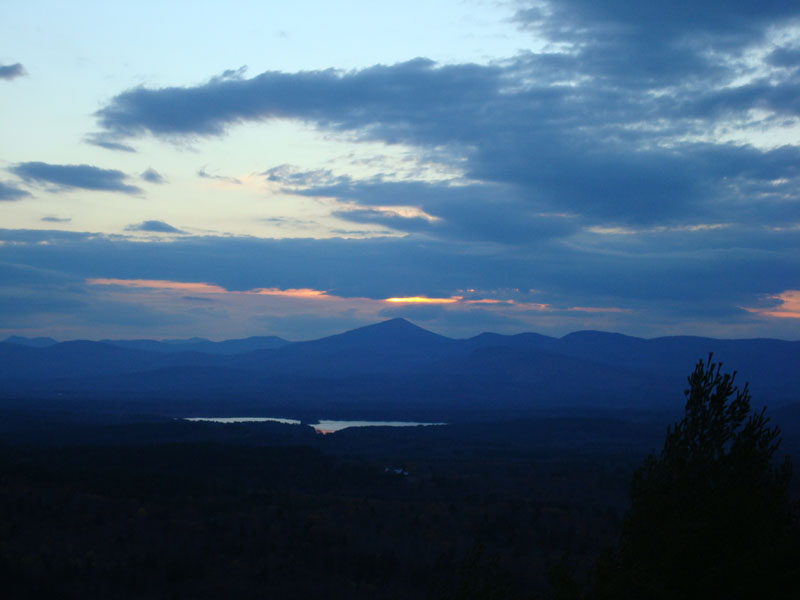
The trail continues along the summit ridge, heading southwest with progressively better views. Just after the firetower footings, the views open up with a very impressive open ledge. The views from here range from just about due east further into Maine, south to Pleasant Mountain, and somewhat northwest at Mt. Washington.
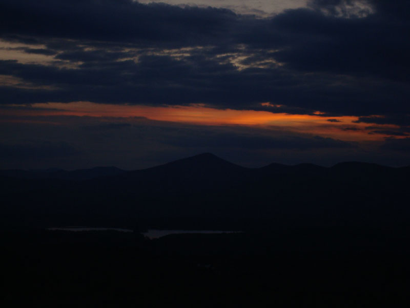
The clouds were very dense to the west, making for poor lighting. There was, however, a sliver of a sunset above Kearsarge North Mountain, making for at least some entertainment.
I couldn't seem to find any blazes to follow to continue the loop (there were a lot of herd paths near the footings/ledges), so I decided to go back from where thou cometh.
All in all a pretty neat little mountain - something I'll want to check out again in better lighting.
| Hike Ratings |
|
Getting To Trailhead: |
Easy |
| Destination: |
Sabattus Mountain |
|
Length: |
Moderate |
|
Steepness: |
Moderate |
|
Navigation: |
Easy |
|
Views: |
Excellent |
|
Crowds: |
Minimal |
|
| Hike Stats |
|
Date Hiked: |
Monday, November 5, 2007 |
| Hike Commenced: |
3:58 PM |
| Parking Elevation: |
755' |
| Destination: |
Sabattus Mountain |
| Ascent Commenced: |
3:58 PM |
| Summit Reached: |
4:12 PM |
| Time Elapsed: |
00:14 |
| Trailhead Elevation: |
760' |
| Summit Elevation: |
1,253' |
| Vertical Gain: |
498' |
|
|
| Hike Ended: |
4:52 PM |
| Hike Time Elapsed: |
00:54 |
| Hike Vertical Gain: |
578' |
|

The trailhead for the trails to the Sabattus Mountain summit

Looking at Kearsarge North Mountain from the Sabattus Mountain ledges

The sunset as seen from the ledges near the fire tower footings


Directions to trailhead: From US 302, take Route 5 North to Center Lovell. Take a right onto Sabattus Mountain Road. Head down this road a bit, then take a right onto a dirt Sabattus Trail road. The parking lot and trailhead will be down the road a bit on the right, marked with a big brown hiker sign.
Back to Sabattus Mountain Profile
|