Home
States
Colorado
Connecticut
Maine
Massachusetts
New Hampshire
New York
Rhode Island
Utah
Vermont
View All
Lists
NE 4,000 Footers
NE 100 Highest
NH 4,000 Footers
NH 100 Highest
NH 52 With A View
NH Belknap Range
NH Ossipee 10
Links
Trail Conditions
Trip Log
Sunrises
Sunsets
About
|
Snow Mountain
Alder Stream, ME
Trailheads, measurements, times, distances, and maps are all approximate and relative to the hike(s) as shown below.
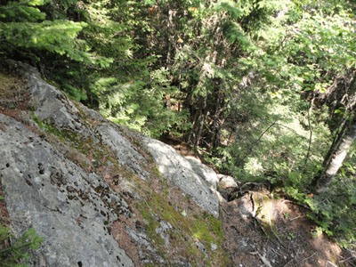
Looking down the scramble on the upper portion of the Snow Mountain Trail
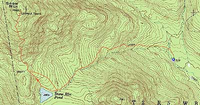
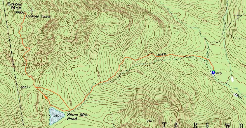
Route: Snow Mountain Trail, (Snow Mountain), Snow Mountain Trail, logging road, Snow Mountain Trail
After hiking Boundary Peak in the morning, I headed a bit south to Chain of Ponds Snow. Starting at the boulders at the end of the road, I followed the grassy road for a minute or two, then took a left and went over a bridge. From there, it was basically a snowmobile trail walk up, though there was a little bit of confusion in two places - one right turn had a small sign that helped. In the second case of confusion, though, there was a four way junction with a newish logging road and no signage. While I wanted to go right (and uphill), I turned back and headed straight, which brought me to Snow Mountain Pond.
While the pond looked nice, the mud and vast puddles (along with deer flies) made it less than pleasant. The turnoff for the trail was also a bit less than obvious, with the subsequent footbed grown in with grass.
Awhile later, I crossed another road (an obvious straight shot across, marked with a cairn) and took note of seeing the same types of tire marks in the mud as at the previous four way junction.
From there, the trail climbed gradually first, then steeply up a tricky little scramble (with a significant dropoff on one side - wouldn't be much fun if wet or icy).
From there, the trail had good footing but seemed to drag on (and had blowdowns and encroaching brush) forever. Nonetheless, shortly after passing the unmarked junction (on the left) of the old Big Island Pond Trail, I eventually reached the summit and the remains of the firetower. The tower cab had recently fallen off (fortunately onto the far side of the summit), however the substructure was still standing (complete with metal ladder), allowing for easy access to 360 views. I only climbed up about 15 feet, however, as the winds were gusting enough to make it a bit uncomfortable juggling a camera.
After signing in at the summit log near the collapsed cabin, I headed to the on-trail viewpoint, then back down. Upon reaching the upper logging road junction, I opted for the logging road and eventually found myself at the lower four way junction. Though the road was a bit muddy, it was much better walking than the Snow Mountain Pond area.
| Hike Ratings |
|
Getting To Trailhead: |
Moderate |
| Destination: |
Snow Mountain |
|
Length: |
Moderate |
|
Steepness: |
Very Difficult |
|
Navigation: |
Moderate |
|
Views: |
Excellent |
|
Crowds: |
Minimal |
|
| Hike Stats |
|
Date Hiked: |
Saturday, July 17, 2010 |
| Hike Commenced: |
12:51 PM |
| Parking Elevation: |
1,820' |
| Destination: |
Snow Mountain |
| Ascent Commenced: |
12:51 PM |
| Summit Reached: |
2:31 PM |
| Time Elapsed: |
01:40 |
| Trailhead Elevation: |
1,820' |
| Summit Elevation: |
3,960' |
| Vertical Gain: |
2,180' |
|
|
| Hike Ended: |
4:07 PM |
| Hike Time Elapsed: |
03:16 |
| Hike Vertical Gain: |
2,220' |
|
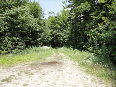
The Snow Mountain Trail trailhead
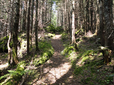
The upper portion of the Snow Mountain Trail
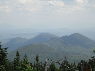
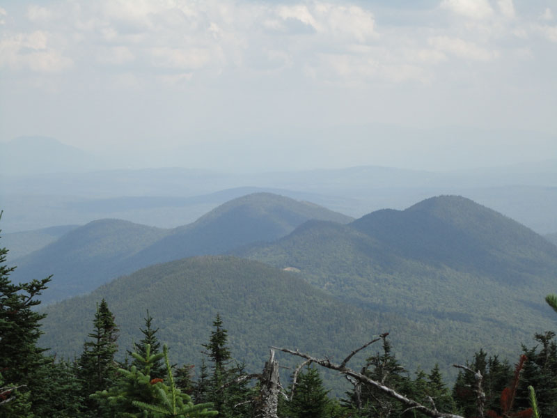
Round Pond Mountain as seen from the Snow Mountain viewpoint

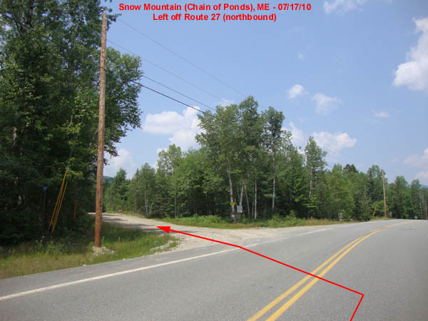
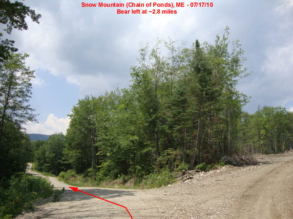
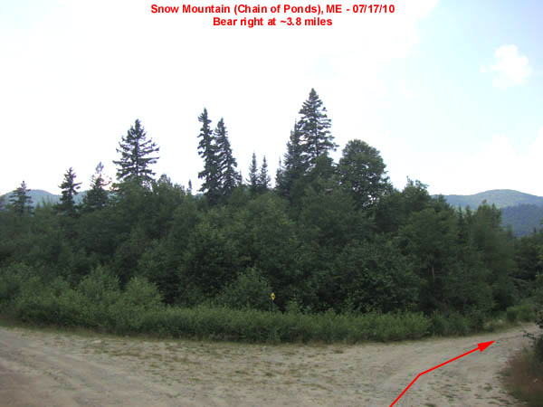
Directions to trailhead: Take Route 27 North from Stratton. Shortly after entering Alder Stream, take a left onto North Road (Penobscot Indian sign) (0.0 miles). At about 2.8 miles, bear left to stay on the main road. At about 3.8 miles, bear right. The road ends about a mile further, blocked by boulders. The trail starts at the boulders.
Back to Snow Mountain Profile
|
