Home
States
Colorado
Connecticut
Maine
Massachusetts
New Hampshire
New York
Rhode Island
Utah
Vermont
View All
Lists
NE 4,000 Footers
NE 100 Highest
NH 4,000 Footers
NH 100 Highest
NH 52 With A View
NH Belknap Range
NH Ossipee 10
Links
Trail Conditions
Trip Log
Sunrises
Sunsets
About
|
South Mountain
Mt. Katahdin, ME
Trailheads, measurements, times, distances, and maps are all approximate and relative to the hike(s) as shown below.
Looking down the South Turner Mountain Trail
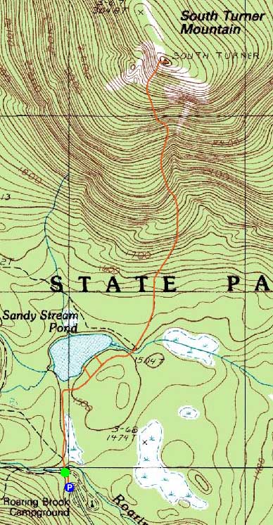
Route: Russell Pond Trail, Sandy Stream Pond Trail, South Turner Mountain Trail, (South Turner Mountain), South Turner Mountain Trail, Sandy Stream Pond Trail, Russell Pond Trail
It was pretty clear to me that, upon waking up, my ankle was still not strong enough to do a hike of any substance. Thus, I decided to do a shorter hike and hit the road a day early, rather than take a risk with a larger hike. Since I was so close to Roaring Brook, I decided South Turner Mountain would be perfect.
After a short stroll on Russell Pond Trail, I beared right onto the Sandy Stream Pond Trail. Checking out the viewpoints along this trail, I took my time watching a moose having breakfast on the other side of the pond.
Reaching the South Turner Mountain Trail junction, things remained pretty flat for awhile longer. Not long after crossing over a boulder field, the trail steepened up big time - it was essentially a rock stairway for much of the ascent to treeline.
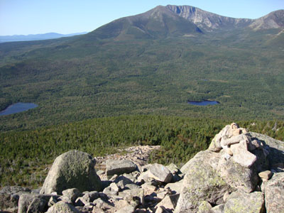
Reaching treeline, the trail was more of a rock/scree area with excellent views of Katahdin. The views from the summit were strong in all directions.
After taking some time at the summit, I limped my way back down to the trailhead, broke down my tent, and ended my first trip to Baxter.
| Hike Ratings |
|
Getting To Trailhead: |
Easy |
| Destination: |
South Turner Mountain |
|
Length: |
Moderate |
|
Steepness: |
Difficult |
|
Navigation: |
Easy |
|
Views: |
Excellent |
|
Crowds: |
Minimal |
|
| Hike Stats |
|
Date Hiked: |
Sunday, September 6, 2009 |
| Hike Commenced: |
7:20 AM |
| Parking Elevation: |
1,480' |
| Destination: |
South Turner Mountain |
| Ascent Commenced: |
7:24 AM |
| Summit Reached: |
8:43 AM |
| Time Elapsed: |
01:19 |
| Trailhead Elevation: |
1,490' |
| Summit Elevation: |
3,122' |
| Distance: |
2 miles |
| Vertical Gain: |
1,732' |
|
|
| Hike Ended: |
10:22 AM |
| Hike Time Elapsed: |
02:02 |
| Hike Vertical Gain: |
1,832' |
|
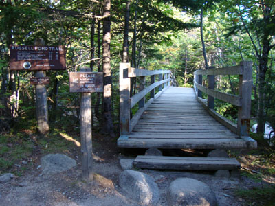
The Russell Pond Trail trailhead
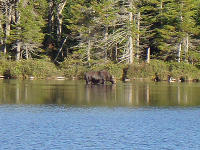
A moose in Sandy Stream Pond

Looking at Mt. Katahdin from South Turner Mountain


Directions to trailhead: From the Togue Pond Gate (Millinocket side), take Roaring Brook Road to its end. The Russell Pond Trail trailhead is beyond the sign-in shack. Crowd restrictions apply.
Back to South Mountain Profile
|