Home
States
Colorado
Connecticut
Maine
Massachusetts
New Hampshire
New York
Rhode Island
Utah
Vermont
View All
Lists
NE 4,000 Footers
NE 100 Highest
NH 4,000 Footers
NH 100 Highest
NH 52 With A View
NH Belknap Range
NH Ossipee 10
Links
Trail Conditions
Trip Log
Sunrises
Sunsets
About
|
Speckled Mountain
Stoneham, ME
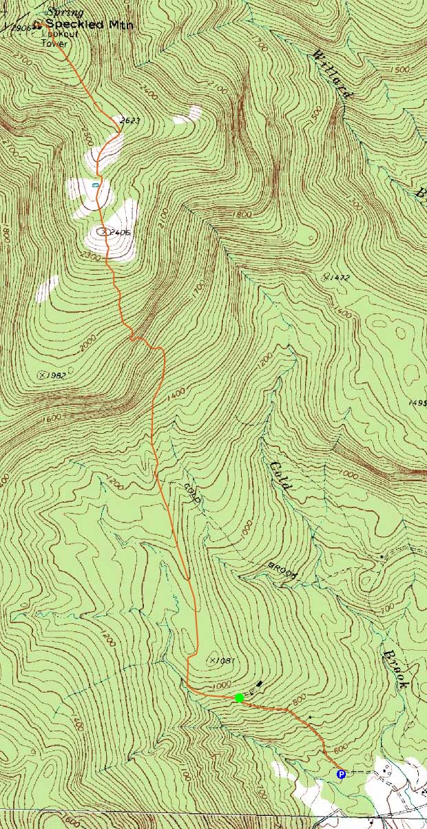
Trailheads, measurements, times, distances, and maps are all approximate and relative to the hike(s) as shown below.

Looking down the Cold Brook Trail
Route: Mountain Road, Evergreen Link, Cold Brook Trail, Bickford Brook Trail, (Speckled Mountain), Bickford Brook Trail, Cold Brook Trail, Evergreen Link, Mountain Road
After hearing much about the Cold Brook Trail for some time, I decided to check it out. Arriving near the base of the old Evergreen Valley ski area, I headed up Mountain Road, bearing right at the first fork onto a dirt road. After passing through a wire gate of sorts, I continued up the dirt road, bearing right at a junction (a yellow blaze was on tree, pointing left).
At this point, the mosquitoes determined I was going to be a blood donor. While the grassy road was lined with wildflowers, I had to put my head down and push forward, as to not get completely eaten alive. Taking a left at a Speckled Mountain sign, I soon reached the Cold Brook Trail. While the trail was somewhat bland for awhile, things improved dramatically after reaching the wilderness boundary - soon I was amongst vast ledges.
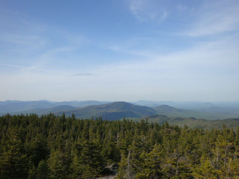
After passing through numerous wide open ledges, I ducked back into the woods, eventually merging at the Bickford Brook Trail junction and the Speckled Mountain summit. The views were quite good.
An absolutely amazing stretch of trail!
| Hike Ratings |
|
Getting To Trailhead: |
Moderate |
| Destination: |
Speckled Mountain |
|
Length: |
Moderate |
|
Steepness: |
Moderate |
|
Navigation: |
Moderate |
|
Views: |
Excellent |
|
Crowds: |
Minimal |
|
| Hike Stats |
|
Date Hiked: |
Wednesday, May 20, 2009 |
| Hike Commenced: |
4:13 PM |
| Parking Elevation: |
540' |
| Destination: |
Speckled Mountain |
| Ascent Commenced: |
4:23 PM |
| Summit Reached: |
5:44 PM |
| Time Elapsed: |
01:21 |
| Trailhead Elevation: |
920' |
| Summit Elevation: |
2,906' |
| Vertical Gain: |
2,116' |
|
|
| Hike Ended: |
7:31 PM |
| Hike Time Elapsed: |
03:18 |
| Hike Vertical Gain: |
2,626' |
|

The Evergreen Link Trail trailhead

A ladyslipper along the Cold Brook Trail

Looking at Caribou Mountain from Speckled Mountain


Directions to trailhead: Take Route 5 north from Lovell. Take a left onto West Stoneham Road. West Stoneham Road will become Adams Road. At one point, bear right to stay on Adams Road. After passing a pond (right) and set of abandoned tennis courts (left), take a right (still Adams Road), passing an old ski lodge (left). Almost immediately after passing the lodge and crossing a brook, there is a dirt parking lot on the left. After parking, continue walking down the paved road, then take a left and walk up the paved road, past the Evergreen Valley Inn. Take the next right onto a dirt road, continue past a cable gate. A few minutes later at a fork in the road, the Evergreen Link Trail will be the left option (a yellow blaze with an arrow is on a tree).
Back to Speckled Mountain Profile
|