Home
States
Colorado
Connecticut
Maine
Massachusetts
New Hampshire
New York
Rhode Island
Utah
Vermont
View All
Lists
NE 4,000 Footers
NE 100 Highest
NH 4,000 Footers
NH 100 Highest
NH 52 With A View
NH Belknap Range
NH Ossipee 10
Links
Trail Conditions
Trip Log
Sunrises
Sunsets
About
|
Todd Mountain
Adams Mountain
Rowe, MA
Trailheads, measurements, times, distances, and maps are all approximate and relative to the hike(s) as shown below.
Todd Mountain Trail
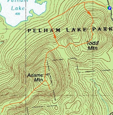
After months of thinking about hiking Todd Mountain (Rowe) and Adams Mountain, I was finally able to attain a map of the Pelham Lake Park trail system, with thanks to a local backcountry skier. On my way back from Spruce Hill the day before, I scouted out a trailhead on Davis Mine Road, which had room to park and a sign announcing the trail.
Despite the mid 40 degree weather and the apparently broken out trail, I decided to put on my snowshoes. A great choice, as the Todd Mountain Trail hadn't seen any traffic since possibly two storms ago.
The Todd Mountain Trail was short and moderately steep, ending at the viewless summit. From there, the trail continued southwest toward the Adams Mountain Trail intersection.
The Adams Mountain Trail started with a decent pitch, but then became increasingly gradual as the summit neared. The summit itself had no views, however there was an unbroken but signed trail to a vista on the east side of the mountain. Mt. Monadnock, Burnt Hill, Berkshire East Ski Area, and Mount Peak were all visible from here.
After seeing some peaks through the trees to the north and west, I decided to follow a sign to the "North West View Trail." After a half of a mile I encountered a sign telling me how far I had hiked, but with no reference to the North West View Trail, but rather Old Kings Highway, something I didn't want. Oh well.
Not wanting to hike back up Todd Mountain, I instead cut down to the Williams Trail (and noticed another reference to a northwestern view, only a fraction of a mile away) and back over to the Sabrina Rice Trail, following the well packed snowmobile tracks.
| Hike Ratings |
|
Getting To Trailhead: |
Easy |
| Destination: |
Todd Mountain |
|
Length: |
Easy |
|
Steepness: |
Moderate |
|
Navigation: |
Easy |
|
Views: |
Minimal |
|
Crowds: |
Minimal |
| Destination: |
Adams Mountain |
|
Length: |
Moderate |
|
Steepness: |
Moderate |
|
Navigation: |
Easy |
|
Views: |
Excellent |
|
Crowds: |
Minimal |
|
| Hike Stats |
|
Date Hiked: |
Monday, March 12, 2007 |
| Hike Commenced: |
3:40 PM |
| Parking Elevation: |
1,595' |
| Destination: |
Todd Mountain |
| Ascent Commenced: |
3:40 PM |
| Summit Reached: |
3:56 PM |
| Trailhead Elevation: |
1,595' |
| Summit Elevation: |
1,920' |
| Distance: |
.7 mile |
| Vertical Gain: |
330' |
| Destination: |
Adams Mountain |
| Ascent Commenced: |
3:56 PM |
| Summit Reached: |
4:32 PM |
| Trailhead Elevation: |
1,920' |
| Summit Elevation: |
2,110' |
| Distance: |
1 mile |
| Vertical Gain: |
460' |
| Hike Ended: |
6:03 PM |
| Hike Distance: |
4.7 miles |
| Hike Vertical Gain: |
1,085' |
|
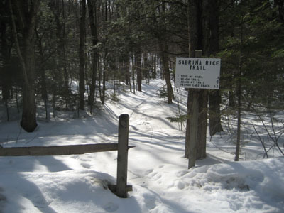
Sabrina Rice Trail trailhead
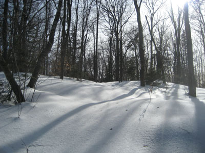
The viewless summit of Todd Mountain
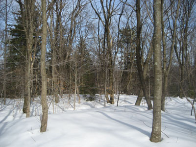
Adams Mountain Trail
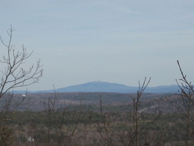
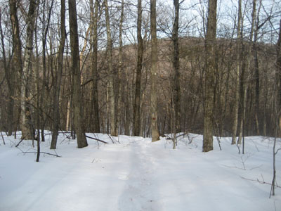
Looking northeast at Mt. Monadnock from the southeast lookout on Adams Mountain

Directions to trailhead: Take Davis Mine Road south from Cyrus Stage Road. The trailhead and a small parking area are both located on the right side of the road.
Back to Adams Mountain Profile
Back to Todd Mountain Profile
|

