Home
States
Colorado
Connecticut
Maine
Massachusetts
New Hampshire
New York
Rhode Island
Utah
Vermont
View All
Lists
NE 4,000 Footers
NE 100 Highest
NH 4,000 Footers
NH 100 Highest
NH 52 With A View
NH Belknap Range
NH Ossipee 10
Links
Trail Conditions
Trip Log
Sunrises
Sunsets
About
|
Crag Mountain
Northfield, MA
Trailheads, measurements, times, distances, and maps are all approximate and relative to the hike(s) as shown below.
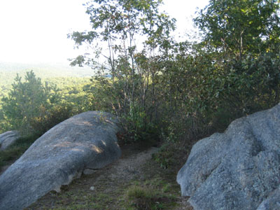
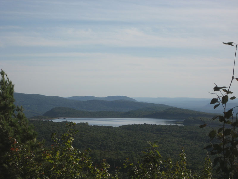
Heading southbound on the Metacomet-Monadnock trail near the Crag Mountain summit
Craig Mountain is a quick, easy hike just south of Northfield, Massachusetts. With the exception of one steep rocky area requiring minor climbing, it's a very easy ascent. The views on top are superb for such a short hike - Wachusett, Monadnock, Grace, Greylock, and Haystack are all visible on a decent day.
| Hike Ratings |
|
Getting To Trailhead: |
Easy |
| Destination: |
Crag Mountain |
|
Length: |
Easy |
|
Steepness: |
Difficult |
|
Navigation: |
Easy |
|
Views: |
Excellent |
|
Crowds: |
Minimal |
|
| Hike Stats |
|
Date Hiked: |
Tuesday, September 12, 2006 |
| Hike Commenced: |
5:15 PM |
| Parking Elevation: |
1,260' |
| Destination: |
Crag Mountain |
| Ascent Commenced: |
5:15 PM at Metacomet-Monadnock trailhead |
| Summit Reached: |
5:25 PM |
| Trailhead Elevation: |
1,260' |
| Summit Elevation: |
1,503' |
| Vertical Gain: |
243' |
| Hike Ended: |
5:42 PM |
| Hike Vertical Gain: |
258' |
|
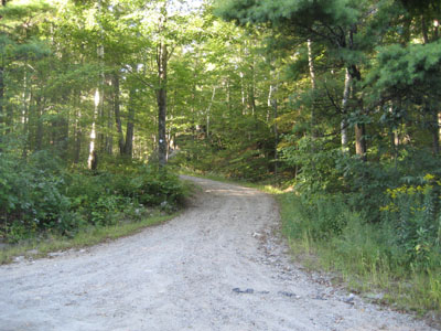
Metacomet-Monadnock trailhead south of Crag Mountain
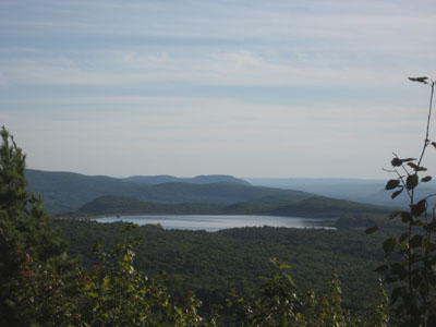
Looking south at Northfield Mountain from the Crag Mountain summit
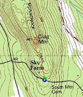

Directions to trailhead: From Route 63 in Northfield, take South Mountain Road past the high tension lines and Wendell Road intersection. The Metacomet-Monadnock trail will soon emerge on the right side of the road (blazes will be visible on trees and utility poles. There should be room to park on the side of the road on the top of the hill. The trail goes partway up a driveway on the left side of the road.
Back to Crag Mountain profile
|